
Leica Geosystems wins prestigious PRISM Award
2nd February 2017
Leica Geosystems wins prestigious PRISM Award
2nd February 2017
Leica Geosystems wins prestigious PRISM Award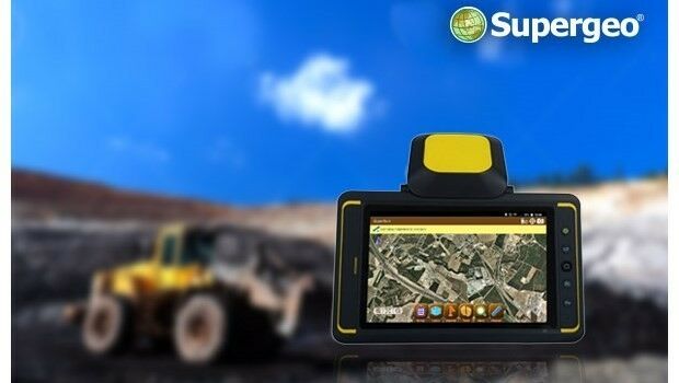
2nd February 2017
Indonesian Mining Company Adaro Selects SuperSurv
1st February 2017
Surrey Heath Council Explore the Versatility of the Arrow 100.
1st February 2017
Quartix announces the appointments of two new directors1st February 2017
The Getech Group Brings Greater Insight to Myanmar’s Geology
1st February 2017
East View Expands South China Sea Imaging Capabilities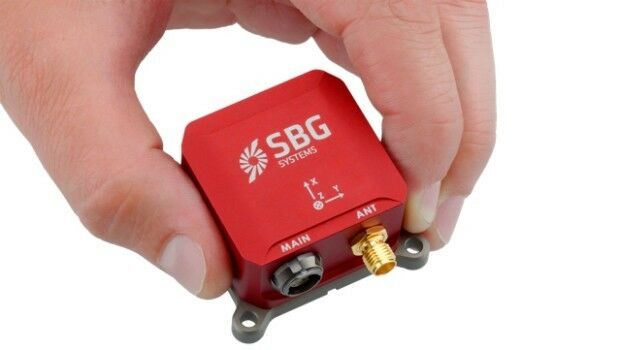
31st January 2017
Popular Line of Miniature Inertial Sensors from SBG Systems
31st January 2017
New supported devices, flight missions, and mission settings
31st January 2017
Diamond Aircraft introduces new Garmin G1000 NXi Flight Deck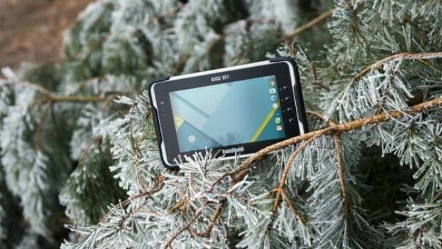
31st January 2017
ALGIZ RT7 ultra-rugged tablet now with Android 6.0 and 2 GB of RAM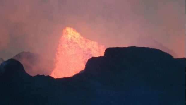
31st January 2017
Successful Ground Trials of Volcanic Ash Detection31st January 2017
Blue Marble Teams Up with Pointerra to Provide Cloud-Based LiDAR Data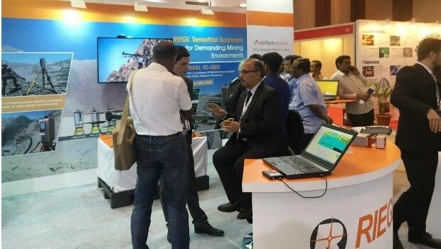
30th January 2017
RIEGL’s Notable Week at Geospatial World Forum 2017!

29th January 2017
Cyberbit to showcase hyper-realistic cybersecurity simulator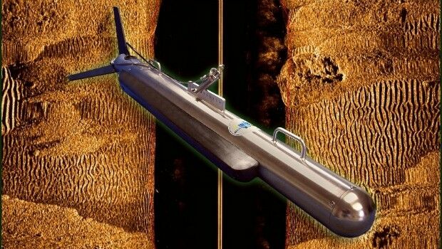
28th January 2017
New High Performance Chirp Side Scan Sonar System
27th January 2017
Terra Drone establish new branch in Australia, Brisbane.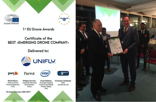
27th January 2017
UNIFLY Winner of Best Emerging EU Drone Company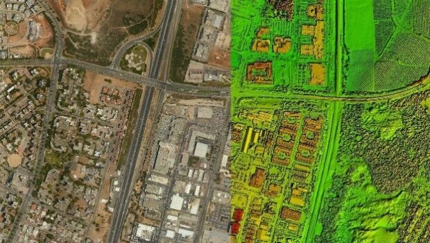
26th January 2017
New Trimble Technology Lab Gift to UMass Amherst26th January 2017
Orbit GT and Shanghai Topcon-Sokkia (STS), sign Reseller Agreement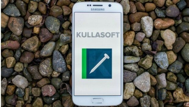
26th January 2017
Kullasoft release the Android version of the PGM Manager app25th January 2017
New measurement solution for optimization of LTE / 4G networks
25th January 2017
Pix4D speaks at UN Panel on Food Security
24th January 2017
Airport GIS | LiDAR, imagery and feature extraction for airport operations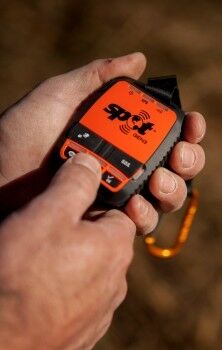
19th January 2017
Global Telesat Communications sold 10,000 SPOT Satellite Devices
19th January 2017
New CT5 Rugged Smartphone Launched from Cedar by Juniper Systems18th January 2017
OGC seeks public comment on OGC WaterML 2 - Part 318th January 2017
Elsevier Adds More Than One Million Figures and Tables to Geofacets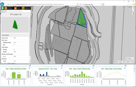
17th January 2017
Hexagon Mining acquires mine production management firm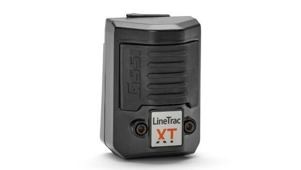
17th January 2017
GSSI LineTrac™ to Detect AC Power and RF Energy in Conduits
17th January 2017
The new FARO® FocusM 70 Laser Scanner Sets New Standards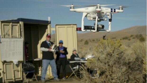
17th January 2017
FREQUENTIS’ location information supports NASA UAS test in Nevada
17th January 2017
GeoMax names Gottlieb Nestle GmbH master dealer17th January 2017
SimActive Used for Coastal Erosion Assessment with UAVs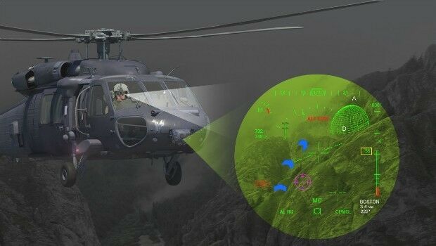
17th January 2017
Elbit to Supply BrightNite™ Systems to an Air Force in a NATO Country
17th January 2017
Fugro Attains Authorised Economic Operator Status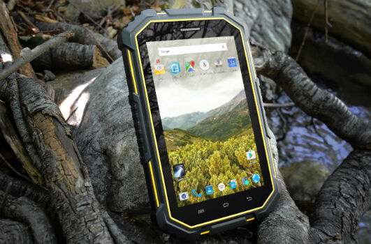
17th January 2017
Juniper Systems Launches New CT7G Rugged Tablet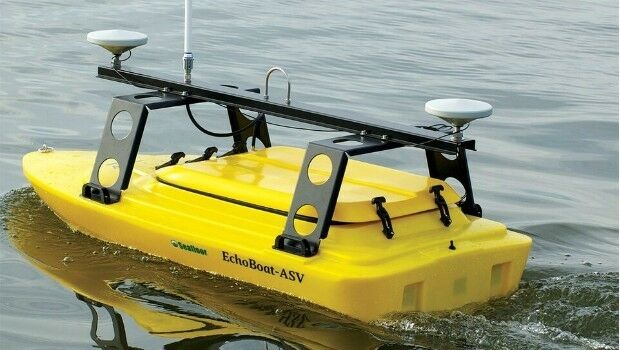
17th January 2017
Seafloor's Dockside Demo at Ocean Business '17, Southampton:16th January 2017
HERE supports rollout of Baidu Maps to rest of world
16th January 2017
Juniper Systems has a new rugged Android smartphone available
16th January 2017
Juniper Systems has a new rugged Android® tablet available
13th January 2017
ARBOR Wins 4 Taiwan Excellence Awards, that's a begin for 2017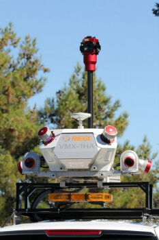
12th January 2017
Caltrans Takes Delivery of the RIEGL VMX-1HA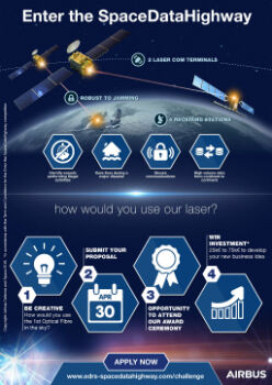
12th January 2017
Airbus Launches “Enter the SpaceDataHighway” Challenge