Share
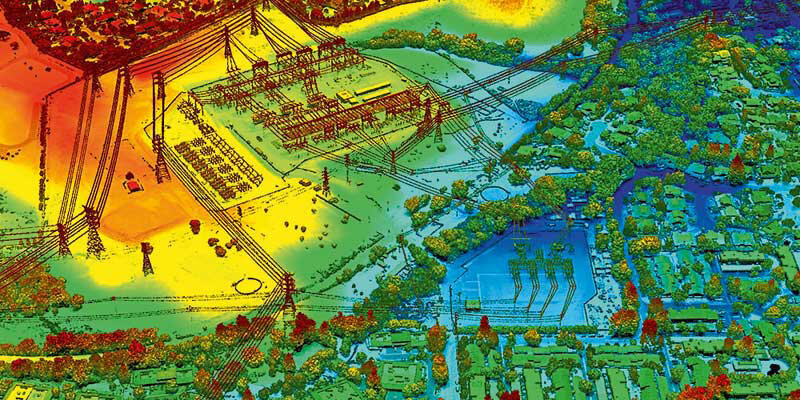
VeriDaaS announced that it has completed test flights necessary to begin its statewide California mapping project by acquiring high-density LiDAR elevation data on multiple areas of interest (AOIs). This data will be used for evaluation purposes by various state, federal and commercial stakeholders. In April 2021, VeriDaaS collected data at a minimum of 30 points per meter on a number of AOIs each with different terrain, vegetation and feature densities. These test flights will also be used to baseline sensor collection parameters to ensure the resulting data satisfies a wide range of use cases. The statewide California mapping project will support a wide range of use cases for both government and private enterprises. VeriDaaS continues to build out a coalition of private and public stakeholders to support funding of the project. This coalition will significantly lower the cost for all stakeholders while maximizing the return-on-investment and value of the data. www.veridaas.com


