Share
Using LiDAR to scan an area before entering it can help everyone from the military to the emergency services
Most surveyors don’t think of themselves as a life-saver. They may get called it from time to time by a grateful client, but literal life-savers?
Yet, thanks to LiDAR, more and more surveyors are doing just that. And they’re doing it by doing what they always do: giving accurate spatial information about an environment.
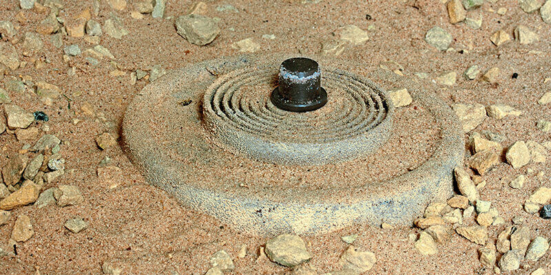
In this issue, we look at two such applications in two very different environments. On page 32, in the first of a two-part article, Emma Thomas looks at how surveyors are helping to clear landmines in the once-war torn country of Angola. Landmines can remain long after not just the people who placed them have gone, but after the conflict in which they were placed has passed. The enemies the mines were designed to kill are now not only unnecessary but a threat to the people left behind – perhaps even the people who placed them.
The job of clearing mines is very dangerous, since by their nature, landmines are designed to be hidden. But using UAVs, LiDAR and some very clever post-processing (which we’ll look at in more detail next issue), surveyors can now find those hidden mines without anyone’s life being put at risk.
Meanwhile, surveyors in the US are scanning buildings such as universities and sports grounds that seem perfectly peaceful. This isn’t because of a past threat such as a landline or even a current threat, but so that they hopefully can save lives in the future when those buildings are no longer as safe as they were and fast responses are needed. You can find out how they’re doing it on page 42, where Malgorzata Krol talks to the Fort Worth police department in Texas.
Rob Buckley
Editor
[email protected]