Share
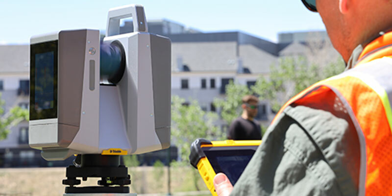
Trimble introduced the new Trimble X12 scanning system to the geospatial scanning portfolio. The X12 integrates intuitive Trimble software for precise data capture and in-field registration with state-of-the-art 3D laser scanning and imaging hardware technology from Zoller+Fröhlich (Z+F), combining the expertise of two providers into a single solution. The Trimble X12 can be operated by using Trimble Perspective field software installed on a Trimble T10x tablet to enable registration and refinement of scans in the field, ensuring project accuracy and completion before leaving the jobsite. Users can also leverage Trimble’s customized on-board software menu to configure and operate the scanner. Data is exported from the field and processed in the office with Trimble RealWorks software or third-party software. Final deliverables can be shared online with clients and stakeholders using Trimble Clarity, a browser-based data collaboration and visualization tool. www.trimble.com


