Share
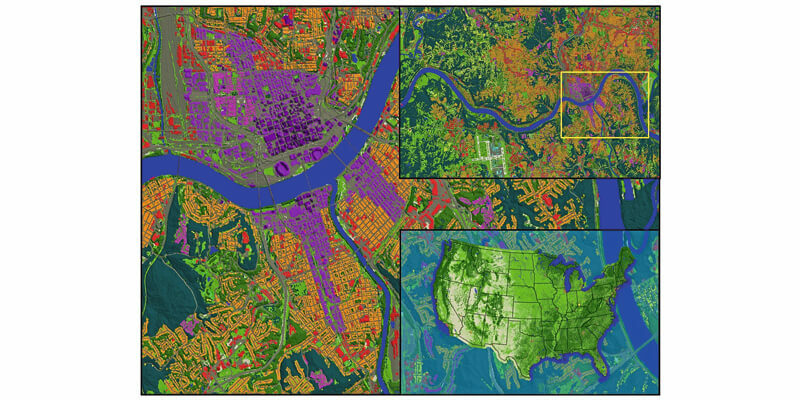
LAND INFO Worldwide Mapping LLC, the provider of mapping solutions for 5G wireless in North America, recently completed up-to-date 10m resolution thematic raster GIS data covering all 50 U.S. states. Optimized for low-band (broad-area coverage) 5G wireless planning, the dataset supports additional applications including utilities, insurance and government, and complements LAND INFO’s 1m resolution datasets that are used for mid-band and high-band 5G in more densely populated areas. The HxGN Content Program offers high-resolution, countrywide aerial imagery and elevation data of the contiguous United States and Western European countries. Hexagon continuously advances the program with higher resolution products for digital twin initiatives. www.landinfo.com


