Share
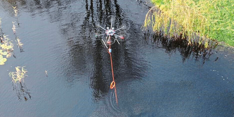
A cutting-edge new system for autonomous airborne hydrographic survey has been launched by THURN Group. The THURN QuickDip system of data collection uses aerial drones to carry Valeport sensors on pre-planned survey routes to deliver an efficient and repeatable method of gathering highly accurate survey data from inaccessible or dangerous waters. UK-based THURN Group developed the innovative QuickDip technology for inland and coastal waterways to offer a range of benefits including: rapid data collection from multiple sites of interest, repeatable map-based surveys to monitor change detection, the ability to safely collect data from difficult-to-access and dangerous waters as well as restricted-access waters, such as reservoirs. THURN QuickDip integrated drone-based system uses a Valeport sensor, a cable, a rotocopter drone and UgCS SkyHub/True Terraine Following (TTF) hardware – from software developer for unmanned aerial systems SPH Engineering. www.valeport.co.uk


