Share
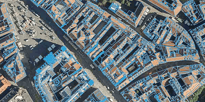
Eurosense has achieved outstanding results in creating high-quality watertight building models of Old Town Graz, Austria, at Level of Detail (LOD) 1 and 2, using Vexcel’s state-of-the-art UltraCam large-format aerial systems and UltraMap photogrammetric processing software in conjunction with RhinoTerrain and DAT/EM software solutions. The Vexcel and RhinoTerrain products have proven to be a perfect match for Eurosense, as they complement each other seamlessly. Eurosense has been utilizing Vexcel imagery with RhinoTerrain for several years to produce 3D city models, and the workflow has become a familiar and trusted production tool within the company. www.vexcel-imaging.com


