Share
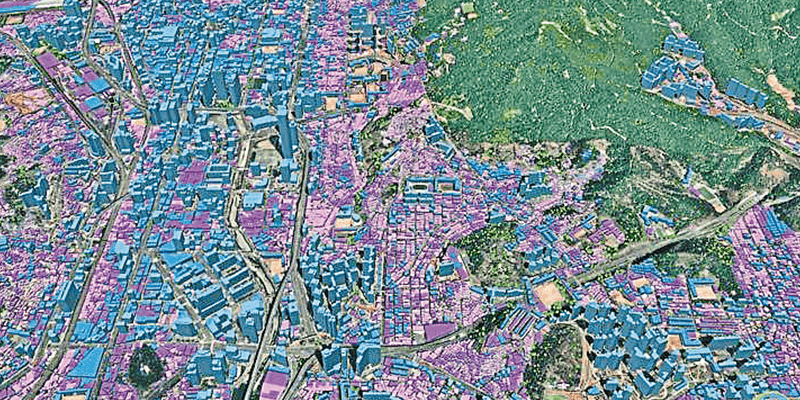
Ecopia AI announced the expansion of its partnership with Airbus, pairing Ecopia’s large-scale 3D vector mapping technology with Airbus’ global satellite imaging capability. This partnership will enable the creation of a high-precision three-dimensional vector representation of the real world, created and maintained with unprecedented speed. As part of this expanded relationship, Ecopia will also be joining Airbus’ certified reseller network - further providing the ability for Ecopia to resell Airbus imagery as part of their product suite. Through this continued partnership, Ecopia will leverage Airbus’ global very high-resolution 30cm imagery from Pléiades Neo and 50cm imagery from Pléiades, which will serve as an input for Ecopia’s AI-based 3D mapping systems. These 3D maps will offer a digital foundation for applications across sectors including government, insurance, telecommunications, and consumer applications. www.ecopiatech.com


