GMV Awarded UK Space Agency Contract to Deliver Satellite Launch Monitoring Algorithms Supporting NSpOC
5th March 2026
GMV Awarded UK Space Agency Contract to Deliver Satellite Launch Monitoring Algorithms Supporting NSpOCNews as it happens! Keep in touch with the latest developments in business and technology in the regions or worldwide.
5th March 2026
GMV Awarded UK Space Agency Contract to Deliver Satellite Launch Monitoring Algorithms Supporting NSpOC
4th March 2026
RDM Targets Fleet Improvements With Ctrack Telematics Solution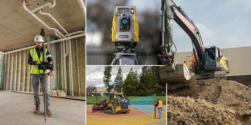
4th March 2026
Topcon unveils new machine control, safety, and geomatics innovations at CONEXPO 2026
3rd March 2026
Siemens Wins XenomatiX Free Lidar Contest, Expanding Collaboration on Autonomous and Smart Mobility Projects3rd March 2026
Octave Launches New Brand Built Around Unleashing Intelligence at Scale
1st March 2026
Ardent appoints Steven Manifold to newly created position of Director of Development Consultancy, broadening service offering1st March 2026
Synspective Joins Ministry of Defense Satellite Constellation Project Following SPC Establishment and Contract Execution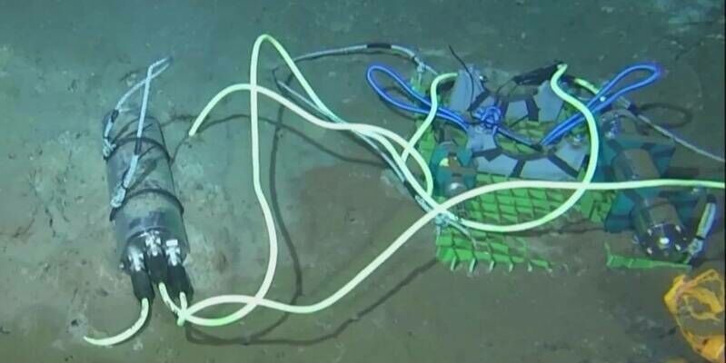
27th February 2026
First Universal SMART Cable Sensor System Successfully Deployed at Ocean Networks Canada NEPTUNE Observatory27th February 2026
The Netherlands Space Command relies on GMV to strengthen its Space Domain Awareness capabilities
26th February 2026
Hexagon recognized by Gartner as the “Company to Beat” in Earth intelligence solutions
26th February 2026
RIEGL UK Hosting the Heritage Geospatial Symposium in York
22nd February 2026
Echodyne to Open Major New Manufacturing Facility to Meet Rapidly Growing Global Demand
22nd February 2026
Topcon expands Capture Reality portfolio with introduction of new handheld scanning system
22nd February 2026
Emesent Launches the Emesent GX1, an All-in-One SLAM LiDAR, RTK and 360° Imagery Scanner
20th February 2026
Global Leaders Meet At Space-Comm Expo In London To Accelerate Future Of European Space Industry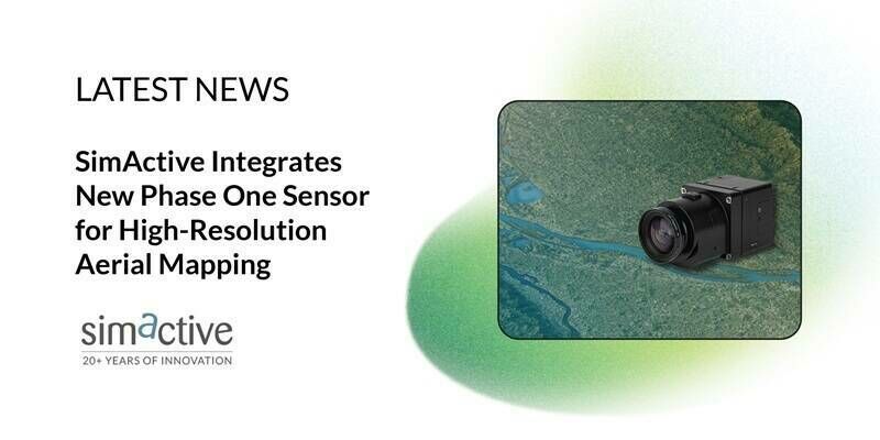
20th February 2026
SimActive Integrates New Phase One Sensor for High-Resolution Aerial Mapping
19th February 2026
Trimble Sponsors Global Design Challenge to Empower Future Engineers
19th February 2026
Safe Software Launches FME Flow Availability in AWS Marketplace
18th February 2026
Geo Week 2026 Opens Today with Record-Breaking Exhibit Hall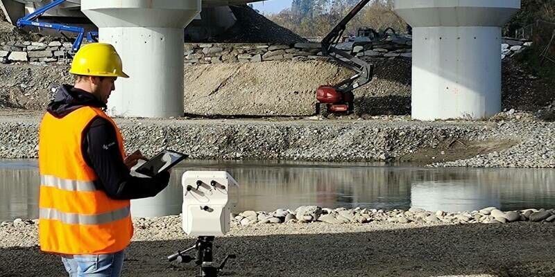
18th February 2026
IDS GeoRadar launches MyMO – a portable device for fast, non-contact monitoring
18th February 2026
New Leica MultiMapper brings portability and versatility to airborne mapping operations18th February 2026
Synspective and Airbus Defence and Space Announce Strategic Partnership to Expand SAR Satellite Data Access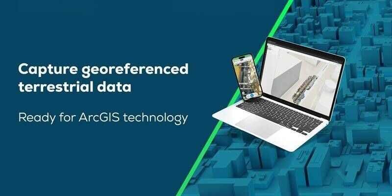
18th February 2026
Esri and Pix4D Launch Real-Time Terrestrial Mapping Workflow
13th February 2026
Association for Geographic Information Announces 2026 Council Changes