Skills gap could delay IoT innovation in the energy sector
3rd August 2017
Skills gap could delay IoT innovation in the energy sectorNews as it happens! Keep in touch with the latest developments in business and technology in the regions or worldwide.
3rd August 2017
Skills gap could delay IoT innovation in the energy sector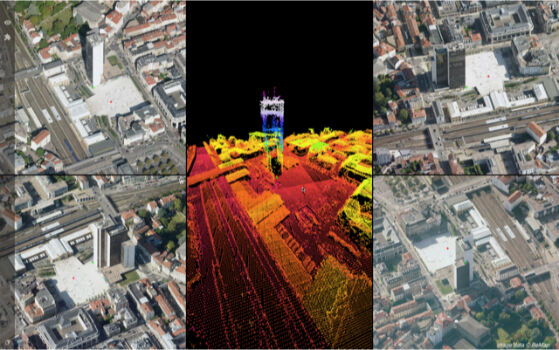
3rd August 2017
Orbit GT updates 3D Mapping Cloud with Oblique Imagery Support
3rd August 2017
Speakers to Highlight the 2017 National GIS in Transit Conference
2nd August 2017
Sharing Data with the Support for Cloud Storage in SuperPad 10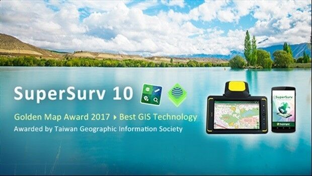
2nd August 2017
Brive City Uses SuperSurv to Update Topographic Maps2nd August 2017
Skyline Software Systems Releases Skylineglobe Server V7.02nd August 2017
TrackR Closes $50m in Series B Funding led by Revolution Growth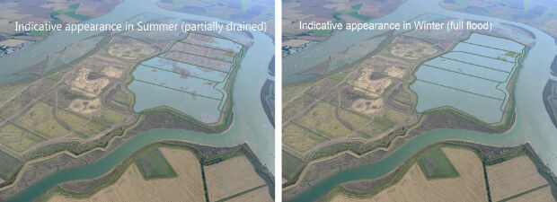
2nd August 2017
Unique designs on Wallasea Island have been approved
2nd August 2017
Astun Technology Announces Open Source Training Course Schedule2nd August 2017
Smarter building technlogy may help prompt construction sector growth
2nd August 2017
Nigeria, Africa’s largest economy, adopts 3 word addresses
2nd August 2017
The data behind the search for MH370: Phase One data released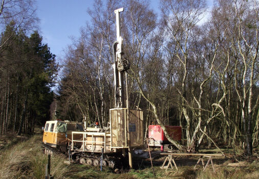
2nd August 2017
Fugro’s Integrated Capabilities Clinch Further Work For Sirius
2nd August 2017
GAF AG Signs Distribution Partnership with Planet
2nd August 2017
Elbit Space Imaging Systems, JUPITER and VENµS Were Launched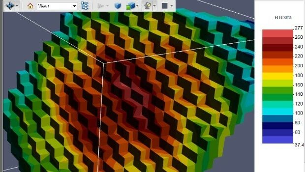
1st August 2017
PDF3D Release PV+ 5.4 Visualization & Publishing Update
1st August 2017
3D Repo Appoints Carmen Fan as Chief Technology Officer1st August 2017
Geovation Programme now open to location and land disruptors
1st August 2017
Manoeuvring the largest offshore floating facility ever built
31st July 2017
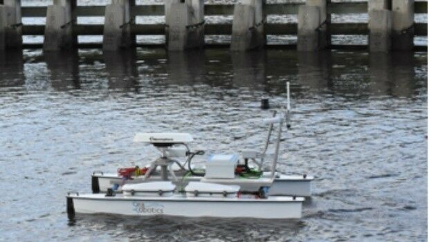
SeaRobotics Wins Contract for Autonomous Hydrographic Survey Vehicles31st July 2017
Skyline Software Systems Releases Terraexplorer for Web V7.0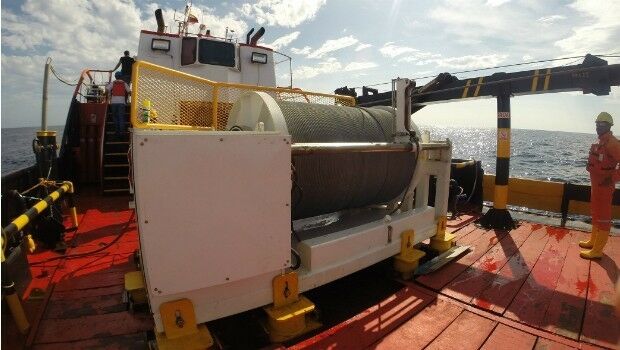
31st July 2017
Okeanus Science & Technology Acquires DT Marine Products