
News
News as it happens! Keep in touch with the latest developments in business and technology in the regions or worldwide.

Restore's Driver Behaviour Improvements With Ctrack Vehicle Tracking
18th April 2018
Restore's Driver Behaviour Improvements With Ctrack Vehicle Tracking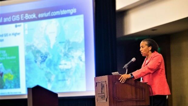
Dawn Wright Celebrates Earth Day by Speaking at EarthxOcean Conference
18th April 2018
Dawn Wright Celebrates Earth Day by Speaking at EarthxOcean Conference
Real-Time Mobile Data Collection with Boundless Anywhere
17th April 2018
Real-Time Mobile Data Collection with Boundless AnywhereVattenfall procure OceanWise Raster Charts XL
17th April 2018
Vattenfall procure OceanWise Raster Charts XL
Goonhilly Earth Station, SSTL and Astrobotic join forces
17th April 2018
Goonhilly Earth Station, SSTL and Astrobotic join forces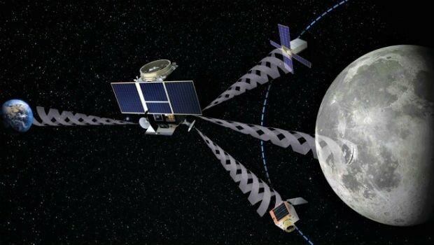
SSTL and Goonhilly Earth Station sign collaboration agreement with ESA
17th April 2018
SSTL and Goonhilly Earth Station sign collaboration agreement with ESA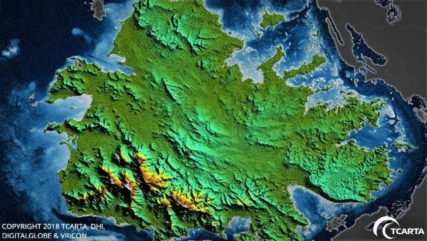
TCarta Delivers Satellite-Derived Land/Sea Floor Surface Models
17th April 2018
TCarta Delivers Satellite-Derived Land/Sea Floor Surface Models
LizardTech to Launch GeoExpress 10 with Expanded LiDAR Functionality
17th April 2018
LizardTech to Launch GeoExpress 10 with Expanded LiDAR Functionality
OGC announces the ESA’s upgrade to Strategic Member
17th April 2018
OGC announces the ESA’s upgrade to Strategic Member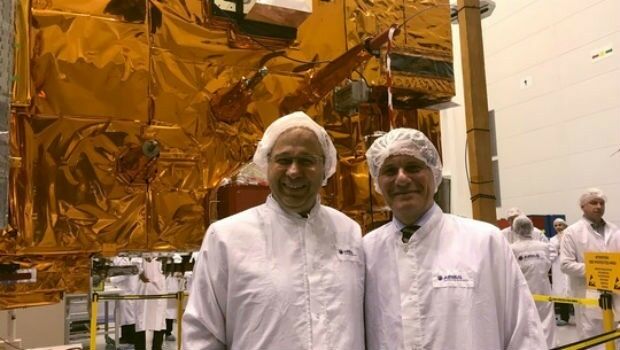
Crucial European weather satellite prepares for launch
17th April 2018
Crucial European weather satellite prepares for launch
Teledyne Optech to showcase Airborne and Terrestrial survey systems
17th April 2018
Teledyne Optech to showcase Airborne and Terrestrial survey systems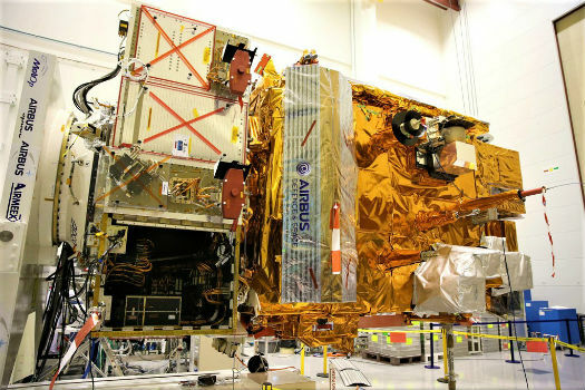
Airbus-built MetOp-C weather satellite gets ready for launch
17th April 2018
Airbus-built MetOp-C weather satellite gets ready for launch
Ownership rights over personal data - By GenerationLibre Think Tank
17th April 2018
Ownership rights over personal data - By GenerationLibre Think Tank
Copernicus App Lab’s Earth Observation Data Tools Ready for Developers
17th April 2018
Copernicus App Lab’s Earth Observation Data Tools Ready for Developers

Quickly Assess your UAV Data Quality in the field
17th April 2018
Quickly Assess your UAV Data Quality in the fieldIntelligent optimisation approach for strategic scheduling control
17th April 2018
Intelligent optimisation approach for strategic scheduling control

Story Maps Team Leader Recognized with AAG Award
17th April 2018
Story Maps Team Leader Recognized with AAG Award
Second Annual Commercial UAV Expo Europe a Huge Success
17th April 2018
Second Annual Commercial UAV Expo Europe a Huge Success
GIS4BUSINESS achieves Esri ArcGIS Online Specialty
17th April 2018
GIS4BUSINESS achieves Esri ArcGIS Online Specialty
GetRentr raises over £500k in seed funding round
16th April 2018
GetRentr raises over £500k in seed funding round