Share
A new study by the University of Göttingen in collaboration with the Czech Mendel University shows that previous methods of moisture measurement in forest soils are inadequate. Satellite data can help improve accuracy to give a better understanding of moisture dynamics
Forest soil stores water, carbon and nutrients for trees and also provides a habitat for living organisms. When managing forests, it is particularly important to work in a way that protects the soil and to correctly assess soil moisture for that purpose.
This latest research, published in the Journal of Hydrology: Regional Studies. has implications for best practice in forest management. The findings will help people adapt to a changing climate and to refine and inform prediction models.
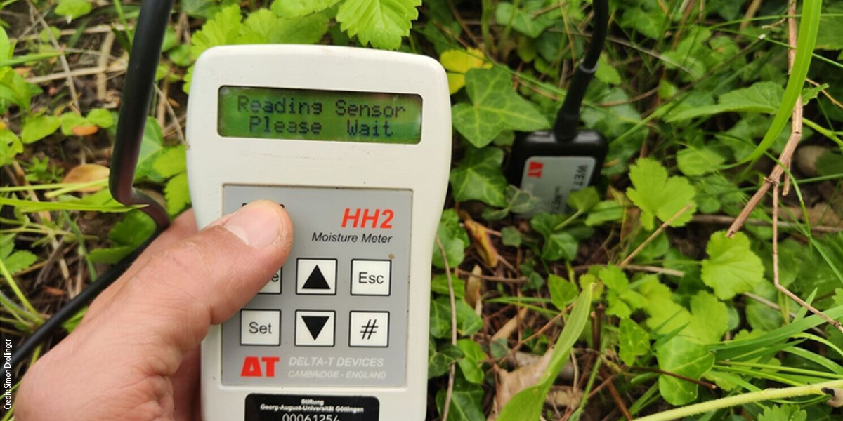
How moist is the forest floor? And how does this change over time? To find out, researchers systematically investigated soil moisture in a beech forest near Göttingen over the course of one year.
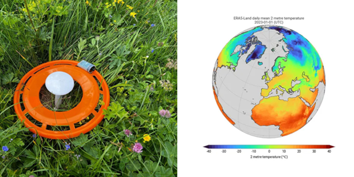
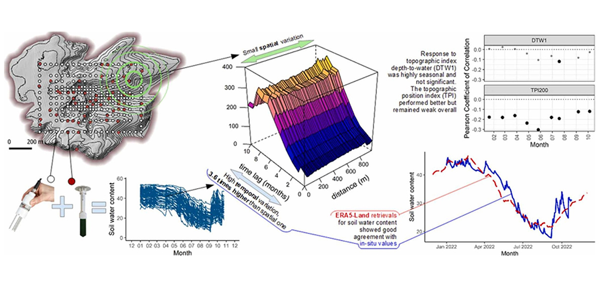
The study combined manual measurements at 236 different points, automatic sensors at 53 locations and ERA5-Land data—a model product fed by satellite, atmospheric, and station observations—across a 900 by 600 meter test field. This approach yielded a unique and richly detailed soil-moisture dataset for a typical Central European beech forest.
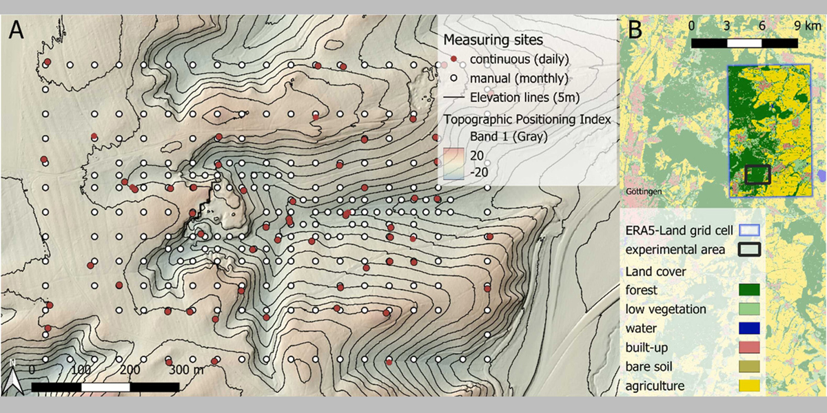
In the environment and forest, models and maps are often used to work out soil moisture based on factors such as slope, shape of the terrain or the pathways that water takes through the landscape. However, how well these approaches reflect actual soil moisture in German upland forests has not been systematically investigated in such detail until now.
The study demonstrates the limitations of such approaches and shows that free, satellite-observation-fed reanalysis products, such as ERA5-Land data, provide a useful addition to measurements taken on the ground. This approach opens up new opportunities for more effective forest management in a changing climate.
"Our results show that soil moisture is strongly influenced by the weather and the season—significantly more than by the exact location in the terrain," explains Dr. Simon Drollinger, a researcher in the Bioclimatology Group at the University of Göttingen and principal investigator of the study. "To better manage the forest, it turns out that looking at development over time is often more important than spatial distribution within the forest."
The ERA5 Land data, provided by the European Centre for Medium-Range Weather Forecasts (ECMWF) as part of the Copernicus Climate Change Service (C3S), corresponds very well to soil moisture values as measured on the ground. In fact, the model-based reanalyses informed by satellite observations can be adjusted with minimal calibration according to information on the ground to provide accurate results.
"The ERA5 Land data has once again shown that it can reliably map changes in soil moisture and temperature over time," says first author Dr. Marian Schönauer, Mendel University in Brno, Czech Republic. "Our research shows that this satellite data can provide reliable soil moisture values that are free to use and will always be available. These can and should be used in everyday practice.
"For a better understanding and effective management of water availability in climate change, we need more field data that is reliable, combined with information from satellites. This combination enables people to make the right decisions in forest management both now and for the future."
More information: Marian Schönauer et al, Topographic indices and ERA5-Land data to describe soil moisture variability in a Central European beech forest, Journal of Hydrology: Regional Studies (2025). DOI: 10.1016/j.ejrh.2025.102456
Journal information: Journal of Hydrology: Regional Studies
Story Source: University of Göttingen
Subscribe to our newsletter
Stay updated on the latest technology, innovation product arrivals and exciting offers to your inbox.
Newsletter

