Share
Trimble Applanix has launched POSPac Complete, a unified software and subscription offering designed to simplify and modernize high-accuracy positioning workflows across airborne, UAV, land and marine surveying applications. In this Q&A with GeoConnexion, Steve Woolven, President & General Manager at Trimble Applanix, explains why the company consolidated multiple solutions into one platform, how the integration of Trimble CenterPoint RTX and PP-RTX cloud corrections is reshaping post-processing workflows, and why base stations are increasingly becoming optional. He also discusses the growing influence of UAV operations on surveying requirements and highlights key technologies such as IN-Fusion+ and Trimble IonoGuard.
GeoConnexion: What drove Trimble Applanix to consolidate multiple technologies into POSPac Complete under one product and subscription model?
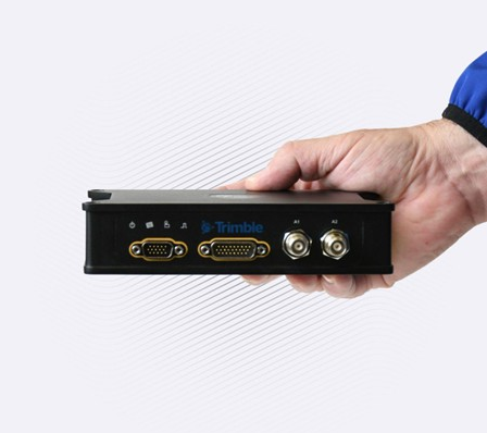
Steve Woolven: POSPac Complete was developed as a unified, next-generation workflow software to replace separate previous products like POSPac MMS and POSPac UAV. The core strategy behind this 'All-in-One License' subscription is to provide customers with a highly flexible, cost-effective, and financially predictable solution, moving away from steep upfront software investments. A key component is the seamless integration of the IN-Fusion+ Multi-Sensor Aided Inertial Engine, which automatically handles complex data fusion using Trimble ProPoint GNSS, Trimble Centerpoint RTX, and inertial measurements to ensure continuous, robust positioning even in challenging environments. This subscription model also includes the PP-RTX 2 (Post-Processed RTX version 2) cloud service, making the deployment of physical base stations an operational choice rather than a strict necessity, significantly enhancing accuracy, reliability and integrity and streamlining the entire workflow across air, land, and marine applications. Additionally, LiDAR QC tools and Camera QC tools can be added in to the POSPac Complete license.
GC: What is the “RTX factor” and why does it represent a major change in high-accuracy surveying workflows?
SW: The "RTX factor" signifies the paradigm shift created by deeply integrating the Trimble CenterPoint RTX and the PP-RTX worldwide cloud correction services into POSPac Complete. This combination significantly simplifies daily surveying by providing high integrity true centimeter-level accuracy globally without the traditional bottlenecks of base stations or Ground Control Points (GCPs), even for missions lacking local network services. When paired with the IN-Fusion+ engine, the system ensures exceptionally robust performance, boosting 3D accuracy by up to 115% in difficult GNSS-denied environments. The technology also features IonoGuard to protect survey data from solar-driven atmospheric interference, ultimately accelerating project turnaround as correction data is available minutes after completion.
GC: Does POSPac Complete make base stations optional for high-accuracy surveying, and what are the advantages of working without them?
SW: Physical base stations are no longer a strict necessity for high-accuracy surveying projects; with POSPac Complete, deploying a base station has truly become a choice. The PP-RTX cloud correction solution delivers centimeter-level accuracy globally, allowing surveyors to achieve comparable absolute accuracy to traditional single-base setups while eliminating major logistical and cost hurdles, which historically were the "bane of a surveyor's existence." Adopting this integrated software solution offers massive savings in overall productivity and efficiency, demonstrating that these modern methods now match or surpass the benefits of traditional base station deployments.
GC: How have UAVs changed surveying operations, and how does POSPac Complete support faster and simpler UAV workflows?
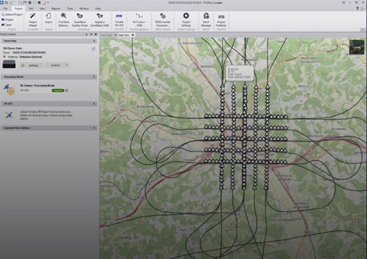
SW: The rapid adoption of Uncrewed Aerial Vehicles (UAVs) has transformed surveying with agile, smaller-scale operations, but it has highlighted the operational bottlenecks of traditional methods like setting up physical base stations. POSPac Complete addresses these unique UAV needs through its completely base station-free processing via PP-RTX, drastically reducing field labor time and cost. Crucially for short UAV flight windows, the system offers remarkably fast convergence times—under 3 minutes globally and as quickly as 1 to 2 minutes in fast regions. To further streamline the back-end, the software utilizes an intuitive, three-step Project Wizard (Import, Process, Export), ensuring high-accuracy results are achieved easily and rapidly, leveraging a globally accessible cloud infrastructure for continuous positioning.
GC: What is Trimble IonoGuard and what role does it play in maintaining survey accuracy?
SW: Trimble IonoGuard is an advanced technology seamlessly integrated into the IN-Fusion+ multi-sensor inertial engine. Its specific purpose is to detect and mitigate the effects of ionospheric scintillation—an atmospheric disturbance driven by the solar cycle that can severely degrade GNSS position performance. For POSPac Complete users, the main advantage is that IonoGuard protects survey data from degradation during these periods of peak solar activity, ensuring reliable, survey-grade accuracy is maintained, and it is supported across both Single Base and PP-RTX processing modes.
Subscribe to our newsletter
Stay updated on the latest technology, innovation product arrivals and exciting offers to your inbox.
Newsletter

