Share
The real value lies in how we make our geospatial data accessible, visual, and useful to everyone, not just specialists, writes KOREC’s John Cartledge.
“Surveying isn't just about surveyors, right?... it's about the power of spatial understanding for everyone.” Barry Bassnet, Owner and founder of RICHPiX - Spatial Imagery
That’s what Barry Bassnet published on LinkedIn recently in a post that attracted considerable comment. He suggested that we’ve become so laser-focused on CAD deliverables that we risk reducing rich, multi-dimensional data into flat lines on a page. Accurate lines, for sure -but certainly less accessible to the many people who could actually benefit from the data; a list that includes project managers, planners, environmental consultants, utility specialists and even the general public. These are the typical stakeholders who need to understand space and context so why not give them a format that makes sense, and why not ensure that the software that provides this information is truly visual with a user interface so intuitive that nobody needs expensive training on how to use it?
…there is a solution
In the move to democratise access to high-resolution geospatial data, something that has been restricted previously by cost or technical barriers, we have seen the development of several cloud data sharing platforms including one from KOREC’s sister company called Soarvo. Developed from the ground up, the Soarvo aim was to create something with exceptional functionality and security but with a user-friendly interface so straight forward, anyone can use it. In short, Soarvo is a revolutionary 3D geospatial data platform, which enables users to aggregate, illustrate and collaborate all in one place. Remember how Google Earth revolutionised map navigation…that’s what Soarvo can do for survey data.
And the best way to show how this software delivers is by visiting some from real world projects that look at a Soarvo highlight – the drone data workflow.
Drone project 1: Into the woods
This project demanded a dense forest survey to assess tree density and map the terrain for flood risk analysis. It was undertaken with a Wingtra Gen II fitted with a LiDAR sensor to penetrate through thick canopy and deliver multiple returns.
Once complete, the LiDAR was swiftly swapped out for Wingtra’s premium RGB61 camera and the site was re-flown at 100 metres (up from 80m). Same flight plan, fresh perspective.
Processing the Data
The processed data was seamlessly uploaded into Soarvo - a simple drag and drop - and instantly ready to be explored, analysed, and shared with a far wider audience, all with zero fuss.
Soarvo standouts on this project
1. See the forest and the ground: Once in Soarvo, the point cloud can be colourised by height and then a clipping plane used to show data just at ground level for better assessing flood risk.
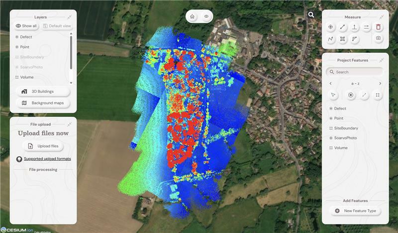
2. Focus only on what you need: Soarvo has the ability to read point cloud classifications and remove the ones not relevant to your application from view. In this case we created a purely ground level view to analyse the natural drainage within the forest and to examine where the ditches converge and assess what is happening in these vulnerable areas.
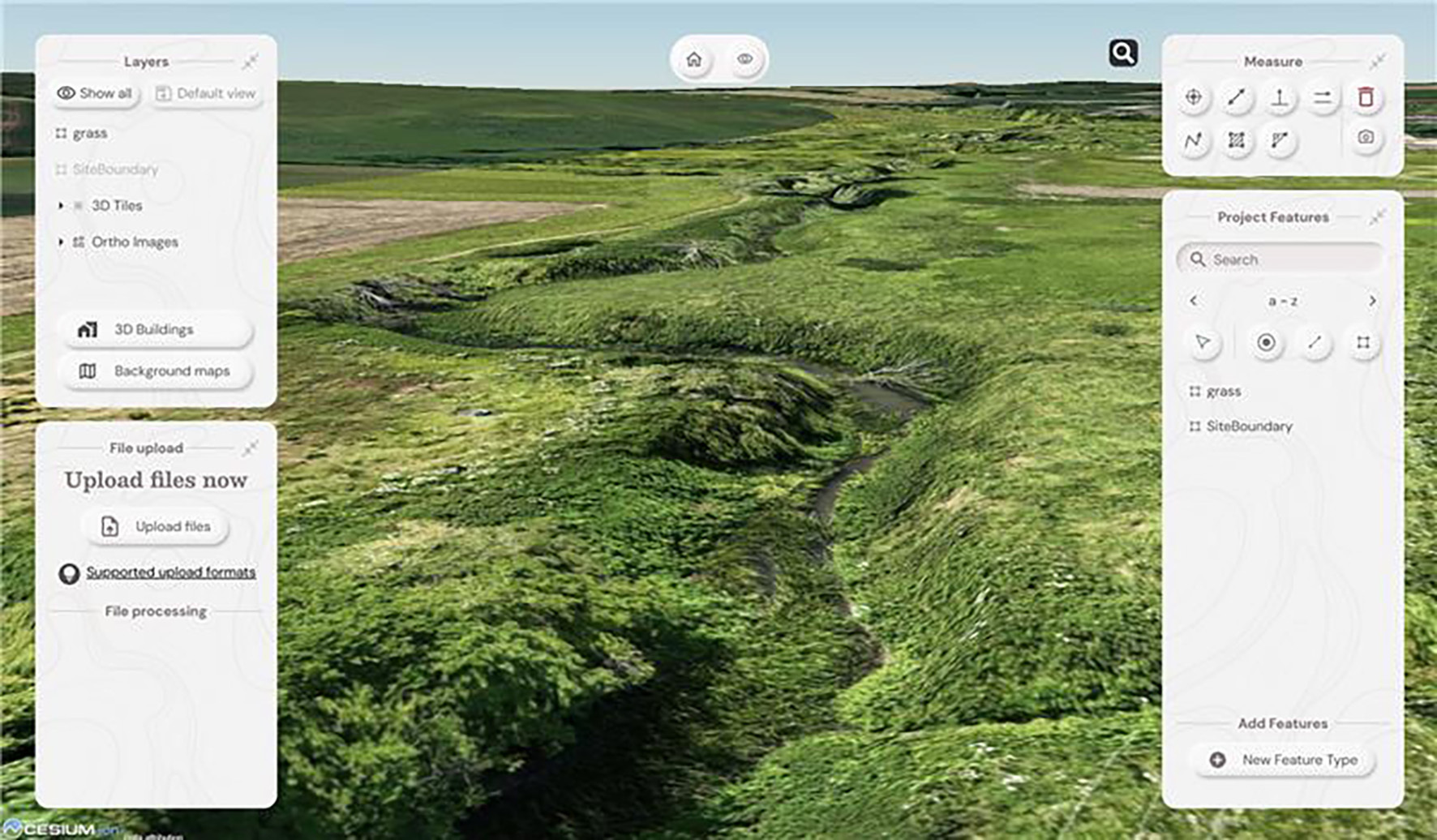
3. RGB data rendered in seconds: With the RGB61 sensor data, we produced an ultra-accurate 3D model of the forest that loads and renders impressively fast. Bonus: Soarvo allows you to drape the orthomosaic over the terrain, offering a rich, contextualised visual that’s miles ahead of a flat 2D map.
4. Snapshots with measurements: The ‘Snapshot’ tool came in handy for exporting JPEGs with embedded measurements.
5. Buit in GIS – done properly: Unlike most platforms, Soarvo includes full GIS functionality.
Permission to fly the forest kindly granted by Phillip Wilcox-Moore, Managing Director, Axter Ltd.
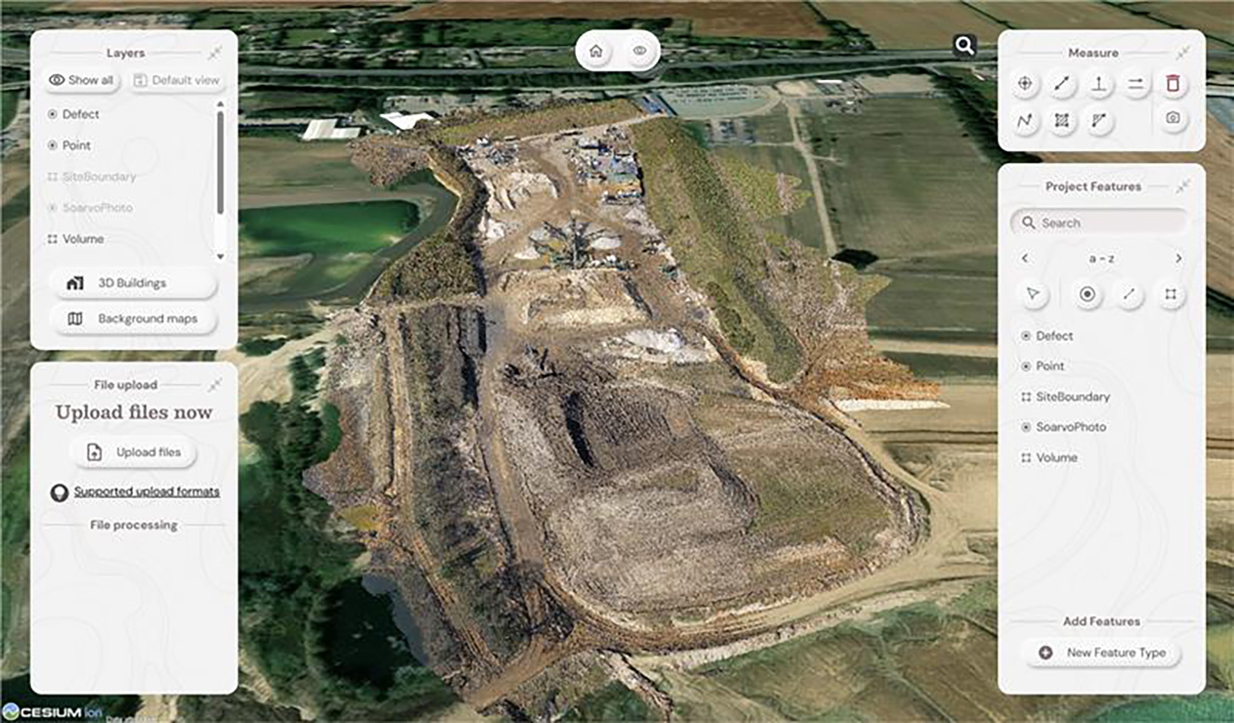
Drone Project 2: No stone unmeasured
Next up, a quarry stockpile survey.
Processing the drone data:
This data was processed in Soarvo by simply uploading the raw images in a zip file. Once loaded, Soarvo takes care of the rest generating an orthomosaic, 3D mesh and point cloud. No third-party software required, no CAD skills required and all processed and ready for sharing in typically, under an hour.
Soarvo standouts on this project:
1. Calculate volumes, fast! With Soarvo, it’s refreshingly easy, simply draw a polygon around the stockpile base, hit ‘calculate volume’, and you’re done. As accurate as traditional GPS-based surveys only faster, easier, safer and with the option for putting down more points for even higher accuracy, all completed from the desk.
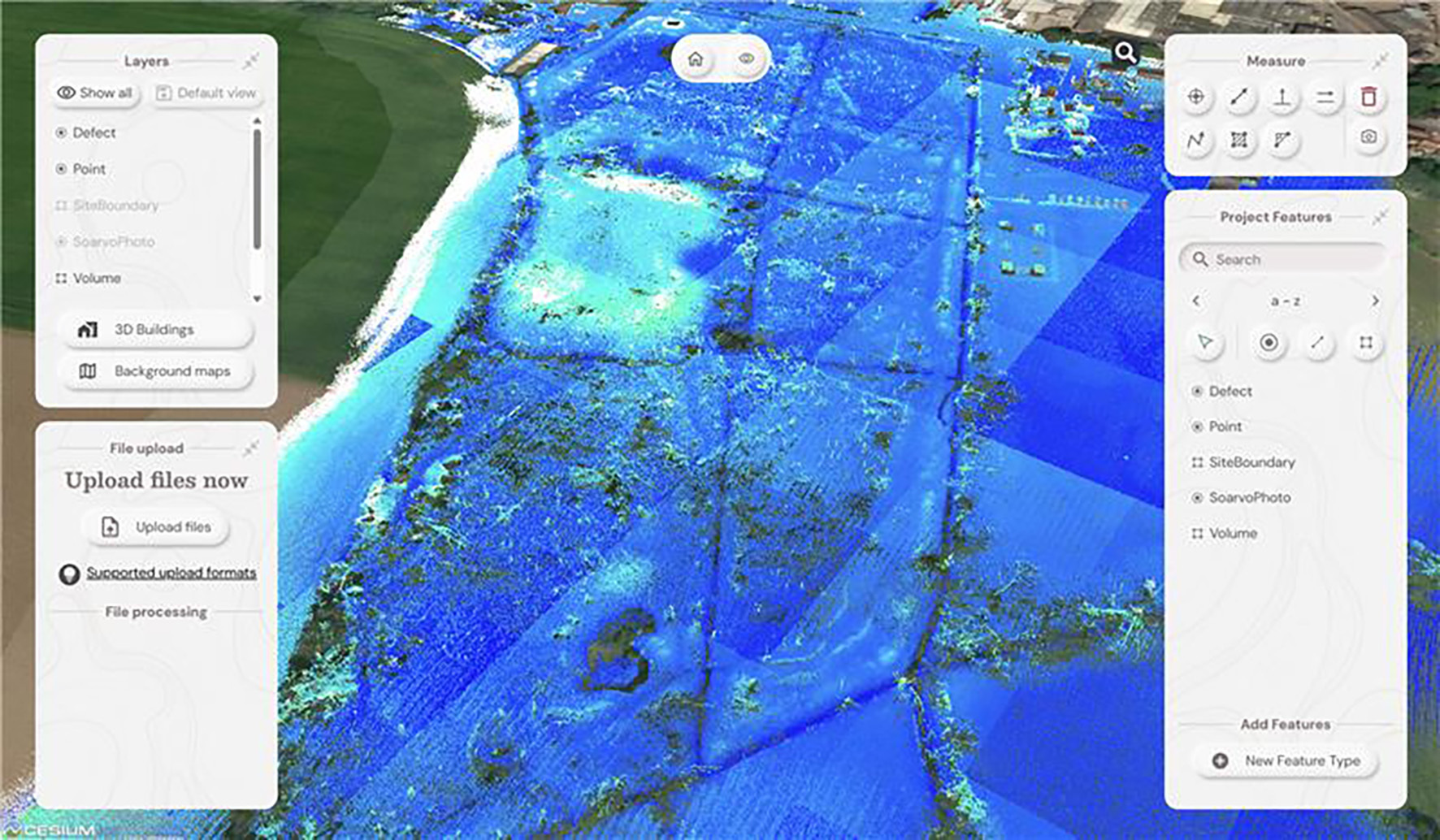
2. Context matters: Unlike many platforms, Soarvo shows your drone generated point cloud in full context - no black voids, just clean, continuous terrain on a choice of background mapping.
3. More ways for easy visualisation: Simply use the ‘snapshot’ function with added notes or measurements for easy insights without any technical expertise required.
And general to both projects – four more Soarvo benefits:
No limits on the number of people who have access to the data
It’s all about making spatial data more accessible to more stakeholders - securely and without limits.
Security is vital, so it’s named user access only
Importantly, by avoiding use of a hyperlink, security is increased and Soarvo users can share this data only through named user access.
Unique to Soarvo - merge and view ALL your data in one place
With Soarvo, you can bring together all your datasets - regardless of sensor type - into a single, cohesive view. But it doesn’t stop there. You can create layers of other key information too, like CAD-based topo surveys, GIS data with feature and attribute details (eg, boreholes), or even supporting documents like drainage reports. Just click to open with no digging around. It’s a genuinely useful feature, and a unique one that sets Soarvo apart.
Add context to your data – no black voids here
Soarvo provides context around your dataset and positions it in the real world rather than a giant black void. For example, your laser scan point cloud doesn’t sit in a black space, it’s positioned on to the background map of your choice from OS to Google to Bing. This opens up new doors with your clients who may need great data to check access to site etc.
And to sum up….
Undoubtedly CAD remains vital to our industry and is understandably widely popular, but as technology evolves, it becomes only part of a far richer story. The real value lies in how we make our geospatial data accessible, visual, and useful to everyone, not just specialists. And simply, that’s what makes Soarvo so exciting and relevant to an industry that needs its data to work harder and smarter – for us all.
John Cartledge, Mapping & GIS Business Area Manager at Soarvo
Subscribe to our newsletter
Stay updated on the latest technology, innovation product arrivals and exciting offers to your inbox.
Newsletter

