Share
What can mapped drainage systems on Mars teach scientists about the red planet's watery past? This is what a recent study published in the Proceedings of the National Academy of Sciences hopes to address as a team of scientists from the University of Texas at Austin (UT Austin) conducted a first-time mapping study involving Martian river basins

This study has the potential to not only gain insight into ancient Mars and how much water existed there long ago, but also develop new methods for mapping ancient river basins on Mars and potentially other worlds.
How scientists mapped Martian rivers
For the study, the researchers inspected images obtained from the Mars Orbiter Laser Altimeter (MOLA) dataset and Context Camera (CTX). MOLA was one of the primary instruments onboard NASA's Mars Global Surveyor during its missions from 1997 to 2006, and CTX is currently orbiting Mars onboard the Mars Reconnaissance Orbiter, with CTX having the distinction of complete coverage of the entire red planet.
To identify and label the river systems, the researchers used ArcGIS Pro, which is a well-known mapping software designed for Earth and planetary datasets.
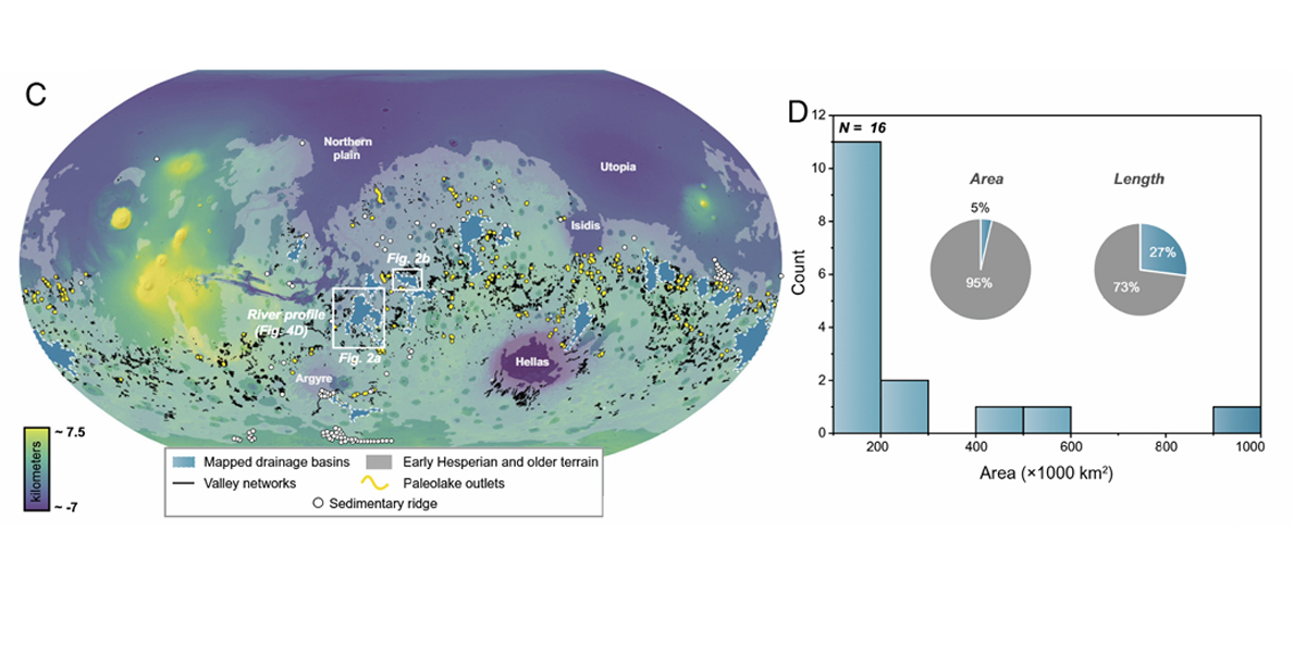
The goal of the study was to identify and map various river systems to see where they converge, including water deposit systems, outlet canyons, lakes, and valley networks. The researchers only mapped drainage systems that exceeded 105 km2, which the researchers note is a common baseline area for large drainage systems on Earth.
In the end, the researchers successfully mapped 16 drainage systems they estimate produced a volume of approximately 28,000 km3 of sediment, which they estimate comprises approximately 42% of the total flowing sediment volume across ancient Mars. Additionally, they discovered that outlet canyons contributed approximately 24% of the global river sediment amount on ancient Mars.
"We've known for a long time that there were rivers on Mars," said Dr. Timothy A. Goudge, who is an assistant professor in the Department of Earth and Planetary Sciences at UT Austin and a co-author on the study. "But we really didn't know the extent to which the rivers were organized in large drainage systems at the global scale."
Mars is estimated to have formed around the formation of the solar system, approximately 4.5 billion years ago. While the amount of time Mars is estimated to have had surface liquid water varies within the scientific community, with some arguing it had episodic periods as opposed to one lone period, a 2022 study estimated that Mars had liquid water as recently as 2 billion years ago.
Evidence of water and its disappearance
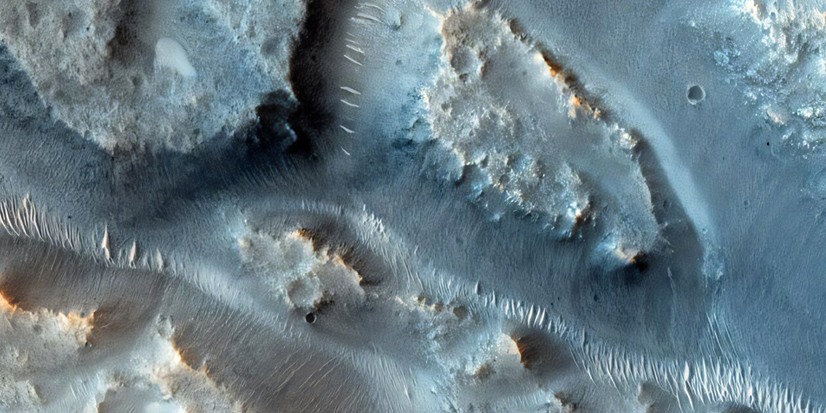
Along with the water deposit systems, outlet canyons, lakes, and valley networks discussed in this most recent study, other geomorphological landforms that indicate evidence of past liquid water on Mars include deltas, outflow channels, gullies, and coastal-like terraces. Additionally, mineralogical evidence includes clays, sulfate minerals, carbonates, and hematite ("blueberries"), the last of which was found by NASA's Opportunity rover in 2004.
Scientists hypothesize there are several reasons for Mars losing all its liquid water, including loss of magnetic field, climate collapse, and geological burial. Like Earth, Mars's magnetic field was driven by its core. Unlike Earth, Mars's core is much smaller, resulting in it cooling far sooner than Earth's will cool. This resulted in slow dissipation of its magnetic field, exposing the surface to intense solar and cosmic radiation, stripping the surface and atmosphere of its water. While some of the water escaped to space, scientists hypothesize that some of the water might have become buried, becoming groundwater, based on modeling and potentially stored in the poles.
More information: Abdallah S. Zaki et al, Large drainage systems produced half of Mars' ancient river sediment, Proceedings of the National Academy of Sciences (2025). DOI: 10.1073/pnas.2514527122
Journal information: Proceedings of the National Academy of Sciences
Story Source: Laurence Tognetti, Universe Today
Subscribe to our newsletter
Stay updated on the latest technology, innovation product arrivals and exciting offers to your inbox.
Newsletter

