Share
With global food security posing a major challenge in the face of population growth and climate change, a new resource from the European Space Agency will provide seasonally updated cropland and crop type maps at global scale
One of the first steps in achieving food security for all is to know which crops are growing where and how – each season. Launched in April of this year, the WorldCereal database from the European Space Agency (ESA) is the world’s first dynamic system capable of providing seasonally updated crop information to help monitor agricultural production across the globe.
According to the 2022 report on the State of Food Security and Nutrition in the World, the number of people facing chronic hunger, jumped from around 618 million in 2019 to 769 million in 2021. The impacts of climate change and recent crises, such as the COVID-19 pandemic and extreme weather events, have a profound impact on food systems around the world.
With the increasing likelihood that we will exceed the 1.5˚C limit and even surpass the 2˚C limit, climate-related disasters will continue to exacerbate an already critical food situation.
A global scale resource
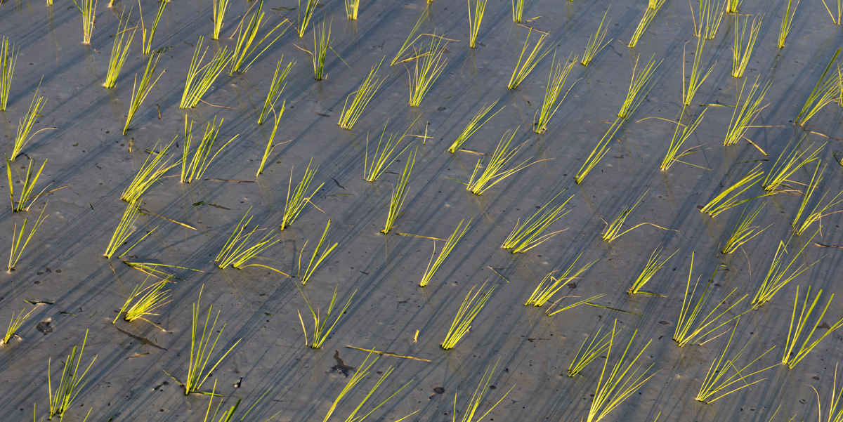
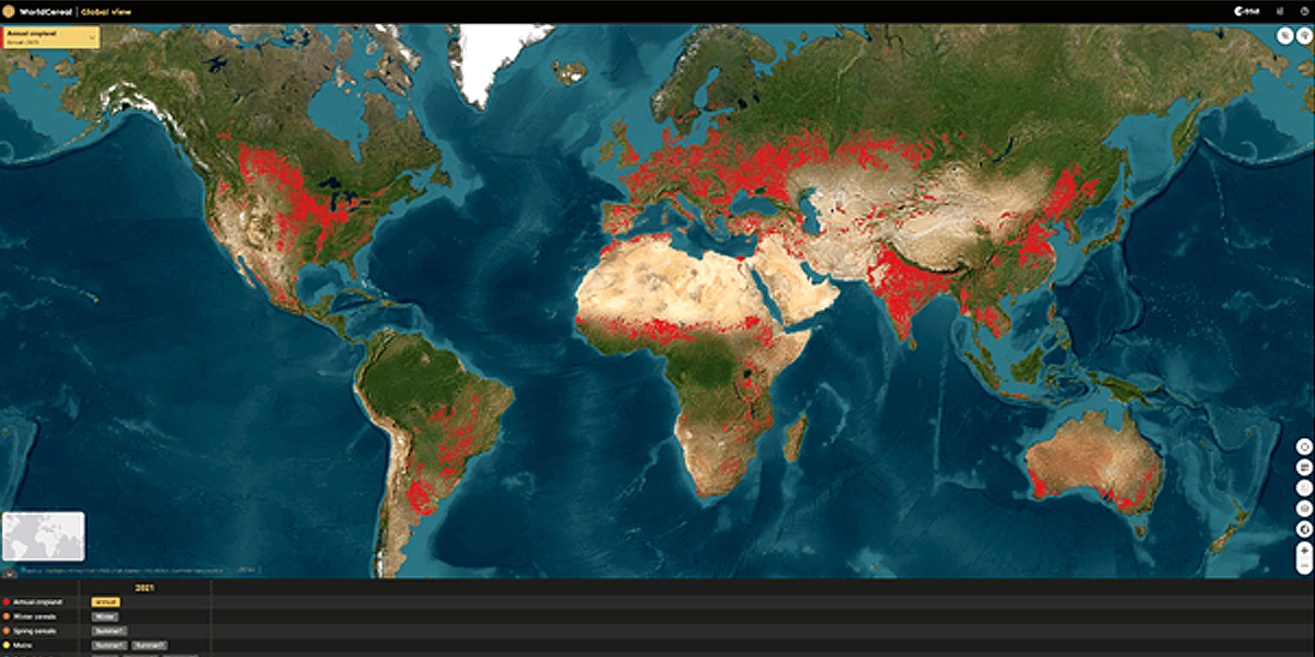
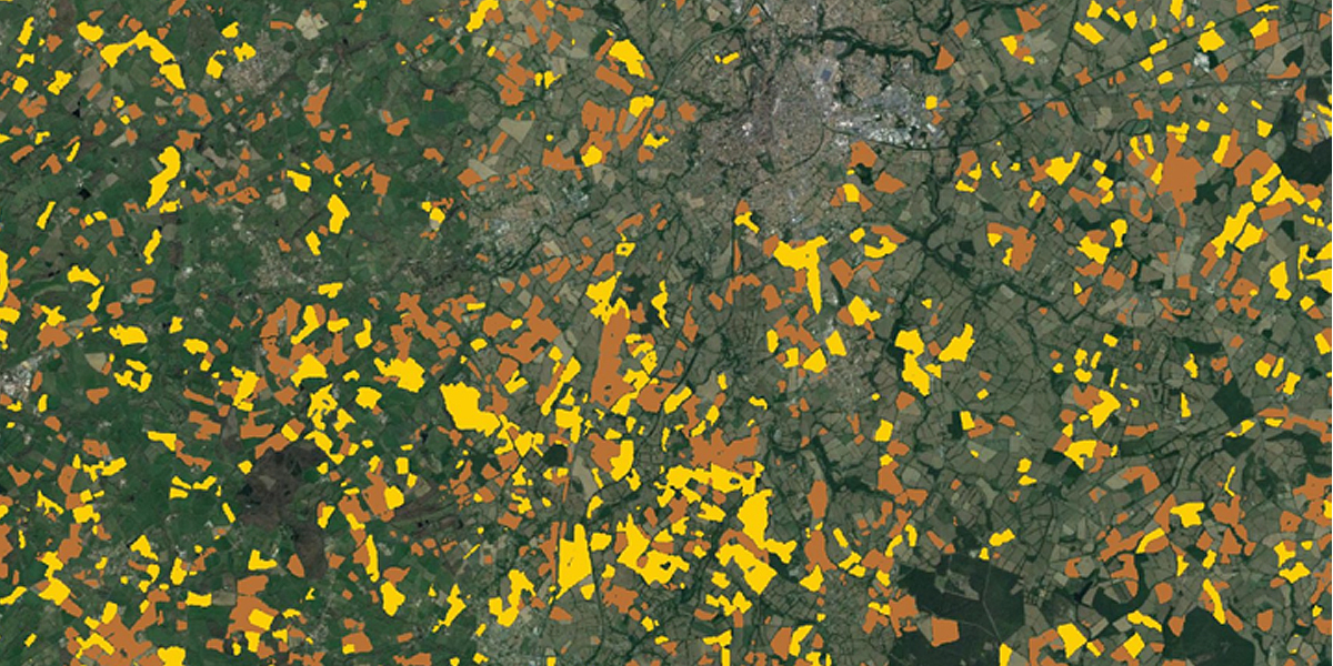
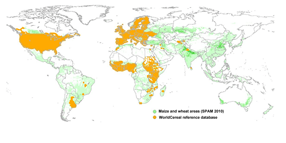
This is where WorldCereal, a global and seasonal crop and irrigation mapping system, comes in. WorldCereal provides highly accurate seasonally updated cropland and crop-type maps at 10-metre spatial resolution at a global scale.
Simonetta Cheli, ESA’s Director of Earth Observation Programmes, comments, “As the first worldwide platform of its kind, WorldCereal is another powerful example of space delivering smart solutions to some of the biggest challenges we face today. With our data and applications, we are moving more and more from measuring and monitoring to managing and mitigating global risks.”
The system can generate a range of seasonal products, including global temporary crop extent, seasonal maize and cereal maps, seasonal irrigation maps and seasonal active cropland maps.
Focusing on maize and cereals, this detailed view of agriculture – made freely available – will help monitor agricultural production around the world.
A tool for all
WorldCereal provides a vital tool for policymakers, international organisations and researchers to better understand global crop and irrigation patterns, as well as inform decision-making related to food security and sustainable agriculture.
It can be used by entities such as the UN Food and Agriculture Organisation (FAO), who will be able to access the crop-specific information to fill gaps in their agricultural statistics. The data can show countries where the areas of maize and cereal have been estimated and to aid country reporting activities.
José Rosero Moncayo, Director of the Statistics Division at FAO, comments, “In a world where we still have data gaps at country level in fundamental areas of agricultural statistics such as area planted and agricultural production, FAO see the products generated by the WorldCereal project with great excitement.
Data quality and timeliness are crucial to foster evidence-based decision-making. We look forward to integrate this innovative, dynamic system in support of country reporting processes on crops, irrigation and land use statistics alike.”
Other users of the system would include global, regional and national agricultural monitoring bodies, national entities involved in SDG reporting, other UN organisations such as the World Food Programme, insurance companies and the private sector, among others.
Open and free
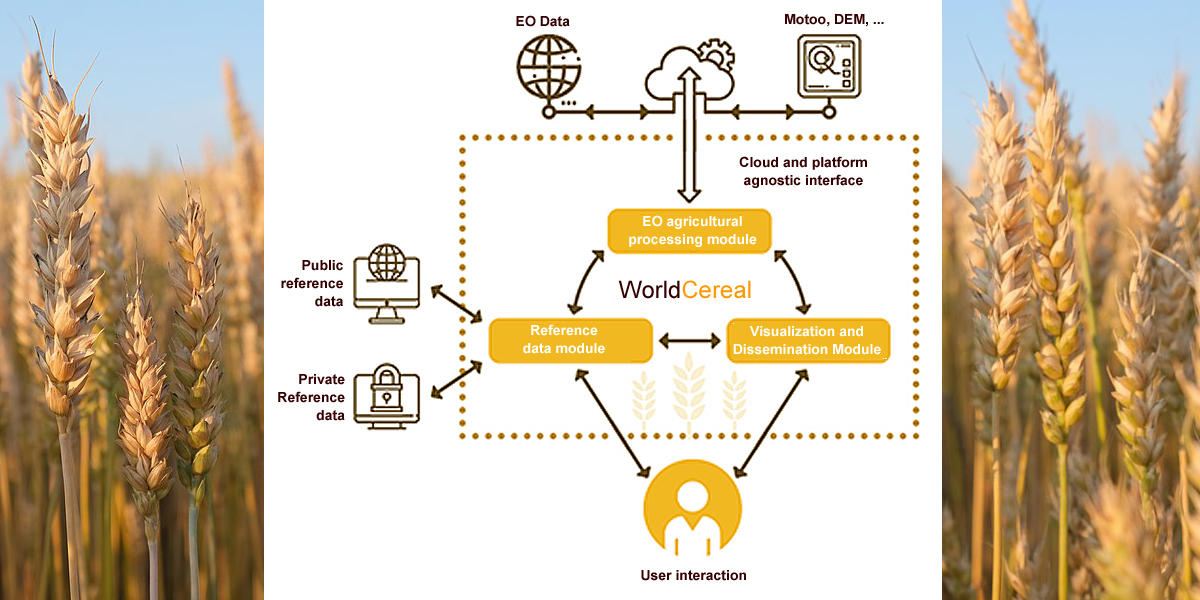
The WorldCereal system utilises open and free data from the Copernicus Sentinel satellites, including Sentinel-1 and Sentinel-2, as well as data from the USGS’ Landsat satellites, combined with meteorological and in situ data.
The system takes advantage of the high-spatial and temporal resolution of satellite imagery and demonstrates how open-source Earth observation data can help to achieve food security.
Zoltan Szantoi, Land Application Scientist at ESA, explains: “The WorldCereal system is not just a demonstration of the power of integrating remote sensing, machine learning and large amounts of data. Rather, it represents a step towards realising the timely provision of agricultural production and yield estimates, critical for food security planning.”
WorldCereal will not only provide a system which offers accurate, global and seasonally updated cropland extent, crop type and irrigation maps, it will also provide the community with the necessary tools and technology to create these maps themselves for their own regions of interest and, if available, using their own reference data
The WorldCeral Team
The WorldCereal consortium consist off a team of experts in the domains of optical and radar crop type mapping, open source developments, cloud agnostic implementation, independent validation, user engagement and production of EO products at global scale.
VITO (Belgium) is the prime contractor of the WorldCereal consortium together with CS SI (France), eLeaf (The Netherlands), GISAT (CZech Republic), International Institute for Applied Systems Analysis (Austria), University of Strasbourg (France), University of Valencia (Spain) and Wageningen Applied Research (The Netherlands).
The WorldCereal partners have all been involved in mapping and monitoring projects for the past decades, ensuring the fact that the system and algorithms to be developed within WorldCereal will build upon existing tools.
Source: The European Space Agency. More information at: esa-worldcereal.org
Subscribe to our newsletter
Stay updated on the latest technology, innovation product arrivals and exciting offers to your inbox.
Newsletter

