Share
As cornfields suffer crop damage caused by weather, corn producers can use geospatial and remote sensing technologies to get a more accurate measurement of the damage and estimate potential economic loss, according to a recent study from the United States Department of Agriculture and published in Frontiers in Agronomy.
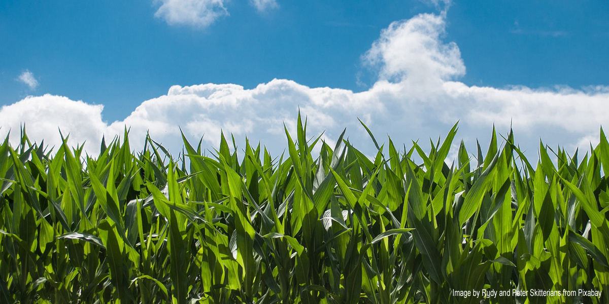
The United States is the largest producer of corn in the world, and Mississippi alone produced more than 28 million tons of corn in 2021. As the Mississippi Delta is one of Mississippi's major corn-growing regions, crop damage from natural disasters like flooding, hailstorms, and wind can pose major threats to production.
In the study from the United States Department of Agriculture's (USDA), Agricultural Research Service (ARS), researchers from the Crop Production System Research Unit used a GPS-mounted yield monitoring system to assess green snap or "brittle snap"—a condition caused when corn stalks break from wind damage—in cornfields located in Stoneville, Mississippi, after severe winds affected the Delta region in May and June 2022.
"A corn producer may not be able to see the extent of wind damage just by driving along the edges of the corn field," said ARS Research Agronomist Ammar Bhandari. "A corn producer may mistakenly believe their fields did not suffer damage when in reality may have occurred deep inside the fields."
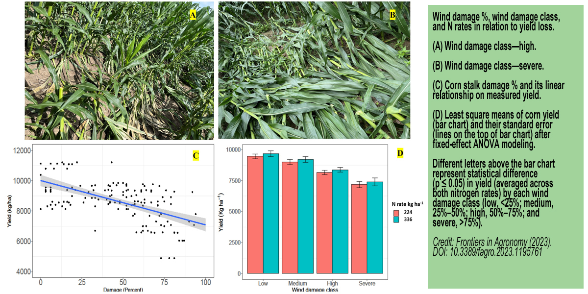
Researchers collected the yield maps from multiple cornfields and analyzed them to assess yield loss due to wind damage. Results indicated an average yield loss of approximately 26 pounds per acre per 1% of total wind damage. The potential loss was estimated to vary from approximately $76 per acre for areas with less than 25% of wind damage to approximately $232 per acre for areas with more than 75% of wind damage.
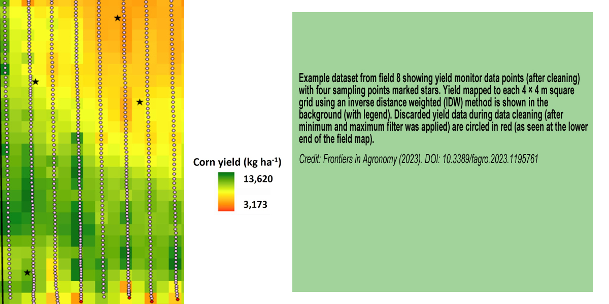
By getting accurate GPS coordinates of the damage locations and combining them with yield monitor data to estimate yield loss through geospatial technologies, producers can have a more reliable reference tool for assessing site-specific wind damage over large areas.
"The research results could help predict potential yield loss (approximately 26 pounds per acre per 1% of total wind damage) and economic loss to assist producers and other stakeholders in decision-making to prepare for changing weather patterns and unprecedented severe windstorms in the future," said Bhandari.
More information: Ammar B. Bhandari et al, Assessing wind damage and potential yield loss in mid-season corn using a geospatial approach, Frontiers in Agronomy (2023). DOI: 10.3389/fagro.2023.1195761
Article source: Jessica Ryan, United States Department of Agriculture
Subscribe to our newsletter
Stay updated on the latest technology, innovation product arrivals and exciting offers to your inbox.
Newsletter

