Share
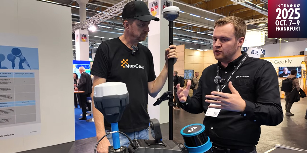
As Emesent began the journey from Brisbane to Frankfurt for this year’s INTERGEO Expo, we caught up with company co-founder and CSO, Dr Stefan Hrabar (pictured ), to explore the latest additions to its autonomous SLAM-based LiDAR mapping portfolio
GeoConnexion (GEO). Towards the end of last year, Emesent introduced a backpack RTK solution for its Hovermap SLAM-based mapping solution. Can you outline how it helps speed-up the data capture process and give an idea of the time that can be saved using this combo?
Stefan Hrabar (SH): One of its biggest advantages is how much time it saves in the field. It delivers high-accuracy positioning without the need to set up or georeference ground control targets, which can be a major hassle - especially on busy sites or in rough terrain. You just strap on the backpack with Hovermap and the RTK receiver, and you're ready to scan - no delays, no complex setup.
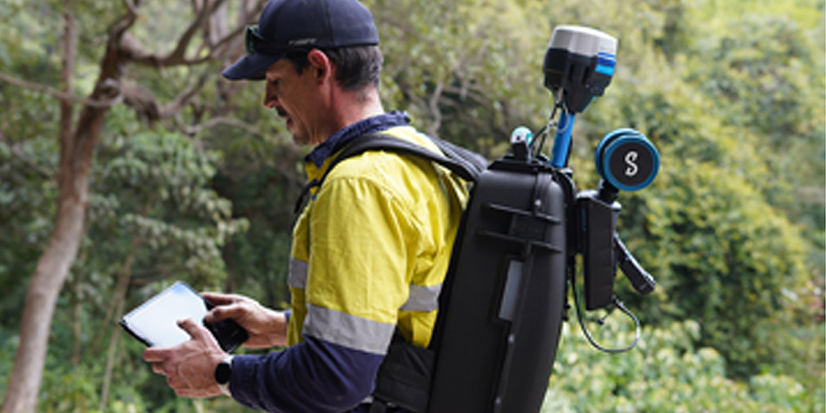
As you move between outdoor and indoor environments, it intelligently combines SLAM and GPS, so there’s no need to pause and set up Total Stations or additional control points. That continuous workflow means fewer interruptions and more efficient data capture. Plus, the same scan can be used for 360° image capture and colorization, making your workflow even more streamlined and helping you get more done in less time. We recently put Backpack RTK to the test against traditional terrestrial laser scanning (TLS) on a culvert project - and the difference was striking. What took 90 minutes with TLS was completed in just 5 minutes using Backpack RTK.
GEO: Last year’s release of AURA, Emesent’s flagship software platform, saw the addition of enhancements for data processing and visualisation, including features such as automated point cloud cleaning and true-to-life colorisation. Can you say what users can anticipate in the next release?
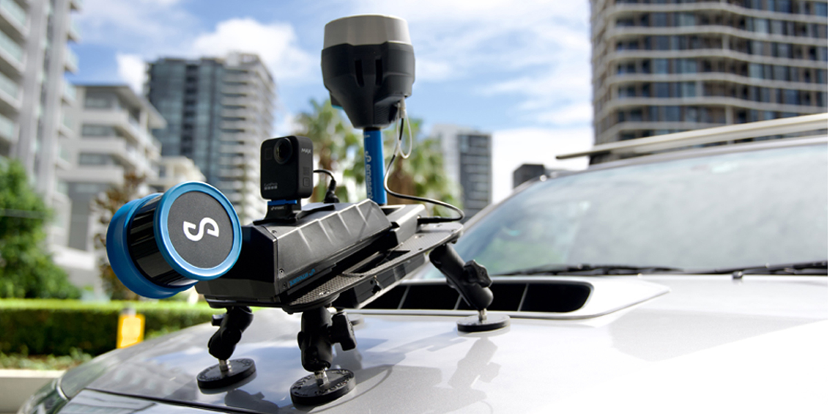
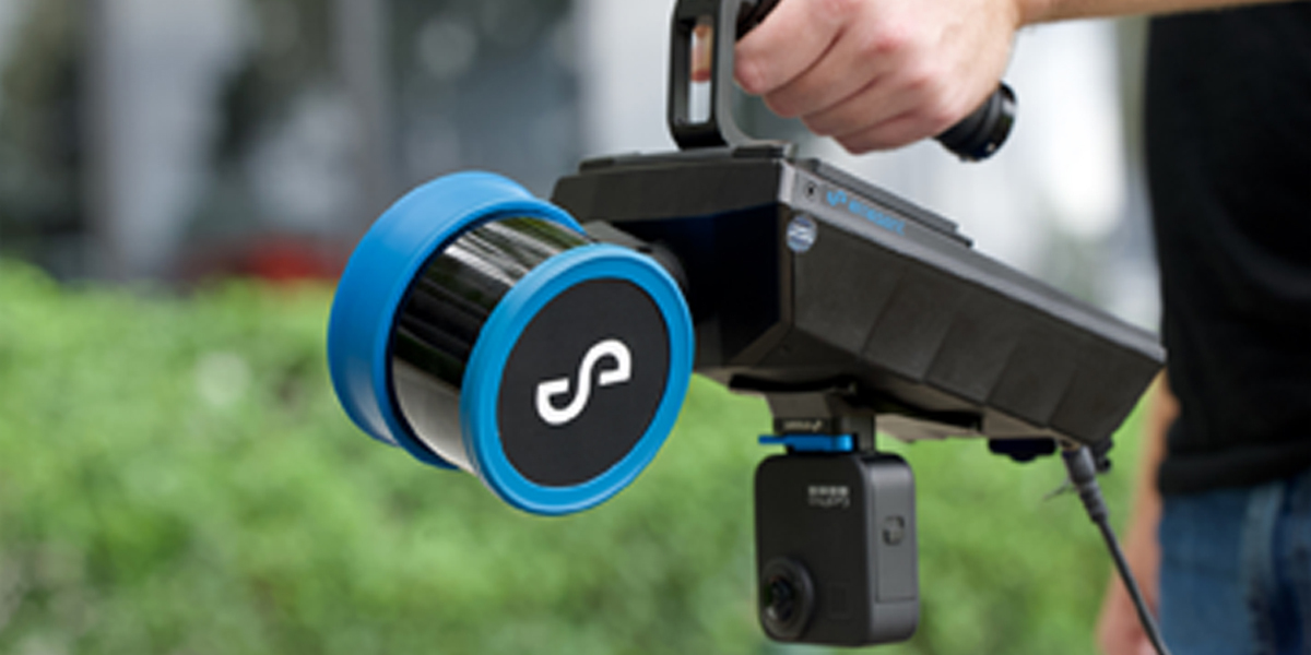
SH: Hovermap is known for its versatility and flexibility. With the next release of Aura users can benefit from that same level of versatility and flexibility when it comes to georeferencing and correction with GCPs, no matter how they capture their scan - handheld, backpack, drone or vehicle (as pictured below). You will have the flexibility to choose any targets which can be identified in the point cloud, accelerating your workflow - or you can augment them with Emesent’s retroreflective targets which are detected automatically. And we’ll be introducing several enhancements to streamline the GCP workflow - including checks to help identify potential errors before processing, check points to measure scan accuracy and more detailed reporting - so you can trust every result, without the hassle.
GEO: Most recently, Emesent announced a significant upgrade of the autonomous navigation and obstacle avoidance software for its Hovermap scanner. Can you outline the new capabilities on offer with this latest upgrade?
SH: Our recent updates to Cortex, our AI-powered autonomy engine, and Commander, our tablet-based control interface, significantly boost Hovermap’s capabilities – particularly in underground mining, where conditions are unpredictable and often dangerous. In short, the enhanced functionality delivers more reliable, safe and efficient results.
The most significant new feature for Cortex is the addition of autonomous exploration. Instead of using waypoints to define an autonomous mission, the user simply draws a bounding box in the Commander app to define a volume to be mapped. The mission is launched with the push of a button and Hovermap does the rest. It flies the drone to explore the designated volume autonomously ensuring it completely maps the area before returning and landing.
Even for experienced pilots, autonomous exploration delivers greater confidence in executing complex missions. With rapid mission setup, reliable navigation in GPS-denied or low-light environments, and true set-and-forget mapping, Hovermap makes advanced mapping accessible to the whole team, regardless of drone experience.
With the new autonomy enhancements, Hovermap can also navigate even tighter spaces than before, adjusting in real time to avoid obstacles. This means there’s no need to switch to pilot assist mode in narrower spaces - it’s fully autonomous. So now you can safely access areas that were once off-limits, with confidence in your coverage and safety.
And with onboard processing, you get immediate, actionable data - right there on site. No PC-based post-mission processing needed. Hovermap automatically generates .laz files, ready to drop into your mine planning software, enabling stope reconciliation up to 50% faster.
These updates are all about empowering teams to push the boundaries of what's possible and making the workflow from capture to insights as seamless as possible.
GEO: Businesses operating in the minerals and mining sector, not least in Australia, face increased ESG compliance and reporting requirements. How can Emesent solutions help them regard this as less of a cost or risk and more as an opportunity?
SH: Integrating Hovermap into mining operations supports ESG goals by enabling safer, smarter, and more sustainable data capture. Its autonomous LiDAR mapping reduces the need for extensive personnel or equipment on site, lowering both environmental disruption and carbon emissions. From a social and governance perspective, Emesent’s solutions enhance worker safety by reducing the need to enter hazardous or confined spaces, such as underground mines or unstable structures.
With high-precision 3D data, Hovermap makes it easier to monitor land use, vegetation, and environmental changes - supporting better decisions and stronger regulatory compliance. It also provides transparent, time-stamped spatial data that strengthens ESG reporting and helps meet growing accountability demands.
As ESG reporting requirements grow more rigorous, Hovermap data capture provides a reliable foundation for tracking progress, demonstrating accountability, and continuously improving environmental and operational performance. While there’s an initial investment, Hovermap delivers long-term value by cutting downtime, reducing manual fieldwork, and improving productivity. These efficiency gains translate into tangible cost savings over time. More importantly, it turns ESG compliance into a competitive advantage - building stakeholder trust, attracting investment, and positioning companies as leaders in responsible innovation.
GEO: On the industrial front, Emesent has partnered with Cintoo to deliver a cloud-based, end-to-end 3D reality capture solution for asset monitoring and maintenance in manufacturing plants. What was the response to this development following its announcement at last year’s INTERGEO Expo in Stuttgart and what is the current status of this joint development?
SH: Thanks to this collaboration, clients are benefitting from a more streamlined and user-friendly reality capture experience for monitoring and maintaining critical assets. Teams can now consolidate all their reality capture data in one place, so instead of managing large files or switching between tools, they now access a single source of truth - improving collaboration, accelerating decisions, and enhancing outcomes across multiple sites.
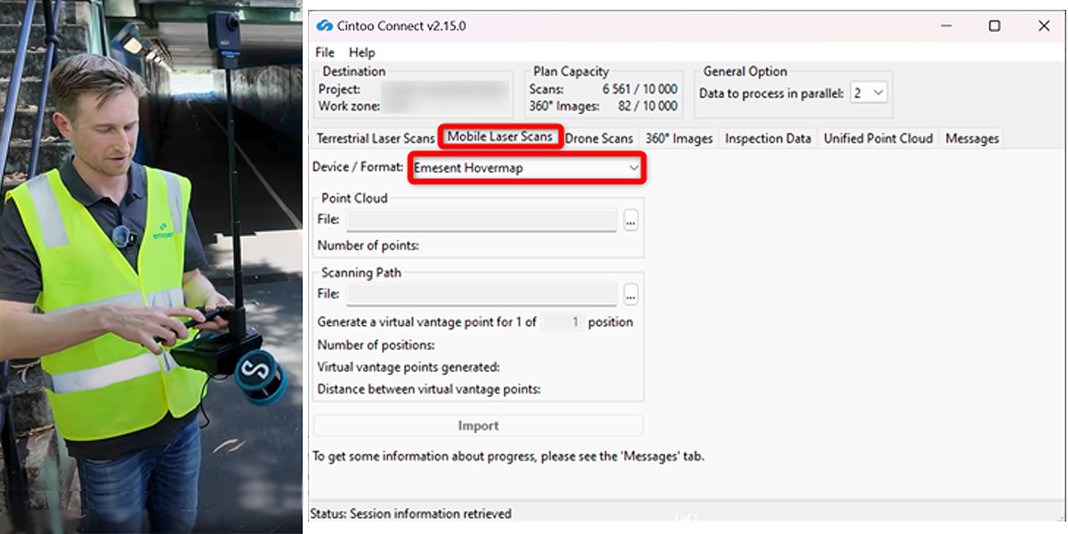
With support for mobile, terrestrial, and drone-based scans - including Hovermap - Cintoo lets teams merge and compare data from any hardware vendor. This flexibility simplifies workflows and enables faster, more coordinated action. Overlaying BIM or CAD models onto scan data allows users to detect issues early and take corrective steps before they impact timelines or quality. The platform also integrates into broader Digital Twin and IoT ecosystems, offering rich contextual insights by linking scan data to real-world asset tags and conditions.
Looking ahead, Emesent and Cintoo are excited to extend this powerful solution to the automotive and manufacturing sectors.
GEO: Several other partnerships have been announced by Emesent in recent months, Would you like to sketch-in the background and progress of these?
SH: At Emesent, versatility is one of our key drivers - especially when it comes to helping clients find new ways to navigate challenging or inaccessible environments. To this end, we actively pursue technology partnerships and collaborations with a variety of payload delivery platforms.
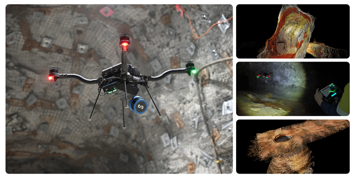
Our recent project with KBR is a great example, where we collaborated on a narrow tunnel inspection solution for utilities and city councils. By deploying the Hovermap ST-X scanner (pictured below) on a custom-built, remote-controlled vehicle, and combining SLAM-based LiDAR with 360-degree HD imagery, we’ve developed a safer, faster way to inspect very confined underground pipes and tunnels. Crews remain safely above ground while capturing detailed data, real time, in environments too risky or cramped for people to enter. The resulting 3D digital maps allow maintenance teams to pinpoint exactly where repairs are needed, minimising the cost and disruption caused by tunneling or excavation work.
This easy-to-deploy solution has already halved planning and inspection time in a 640m sewer scan and is set to enhance safety, reduce disruption, and support better planning for a number of infrastructure maintenance scenarios.
GEO: Do the imposition of new and volatile global trade tariffs make it a more challenging business climate for companies such as Emesent and its customers?
SH: Emesent’s operations are built on a strong, resilient foundation, allowing us to remain agile and ready to adapt as global tariff changes evolve; while the impacts to date have been less significant than anticipated, we continue to monitor the situation closely and will adapt our strategy as needed to ensure ongoing stability and growth.
More information on Emesent products and services can be found at https://emesent.com/
Subscribe to our newsletter
Stay updated on the latest technology, innovation product arrivals and exciting offers to your inbox.
Newsletter

