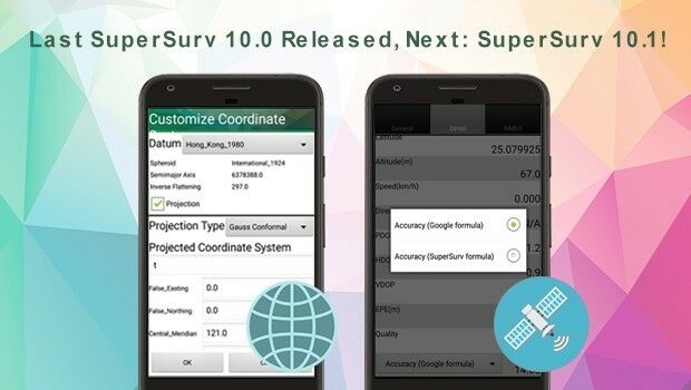
Last SuperSurv 10.0 Update Released, Next: SuperSurv 10.1!
18th October 2017
Last SuperSurv 10.0 Update Released, Next: SuperSurv 10.1!
18th October 2017
Last SuperSurv 10.0 Update Released, Next: SuperSurv 10.1!17th October 2017
OceanWise Offers Continuity for Marine Mapping Users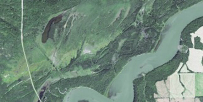
17th October 2017
Earth-i’s satellite imagery chosen to monitor tree logging in Canada17th October 2017
Get Outside for National Map Reading Week
16th October 2017
Topcon launches three new technology updates for the built environment16th October 2017
PDF3D work with Forensics to Bring 3D PDF into the Court Room14th October 2017
NavVis partners with PrecisionPoint to bring American indoors online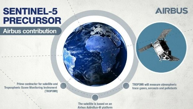
14th October 2017
Sentinel-5P successfully launched to monitor world’s pollution13th October 2017
International Conference on Cultural Heritage and New Technologies13th October 2017
GSDI Webinar on Open Geospatial Data on 16 November 2017
13th October 2017
Maptek Announces New Montréal and Vancouver Offices
13th October 2017
Airborne LiDAR production fully integrated with Leica HxMap workflow.jpg)
13th October 2017
Luciad Announces Winners of Geospatial Excellence Awards
11th October 2017
EUTELSAT 172B satellite reaches geostationary orbit in record time
11th October 2017
When shipping becomes a matter of life or death
11th October 2017
UAV exhibition opens doors to businesses across Europe
11th October 2017
First Lockheed Martin GPS III Satellite “Available for Launch

10th October 2017
UAV exhibition opens doors to businesses across Europe10th October 2017
Topcon Leadership at Bentley Year in Infrastructure Conference10th October 2017
Garmin® Head-up Display (GHD) system for integrated flight decks
9th October 2017
Collaboration for Constructioneering Academy initiative
9th October 2017
Bureau Veritas releases new rules for FSRUs meeting industry needs

6th October 2017
European Consortium Demonstrates new Internet-of-Things Platform
6th October 2017
Col-East Taps Extensive Image Archive to Create Multi-Function Maps
5th October 2017
Geosoft and AcornSI move UXO classification to the cloud
5th October 2017
Intelligent Telematics Makes Senior Management Appointment
5th October 2017
Martin Truex Jr.’s Beechjet 400A is equipped with Garmin® G5000
5th October 2017
Commercial UAV Expo to include Workshops/Demos/Training5th October 2017
OGC Announces New 3D Portrayal Service Standard5th October 2017
Turn your great idea into a great business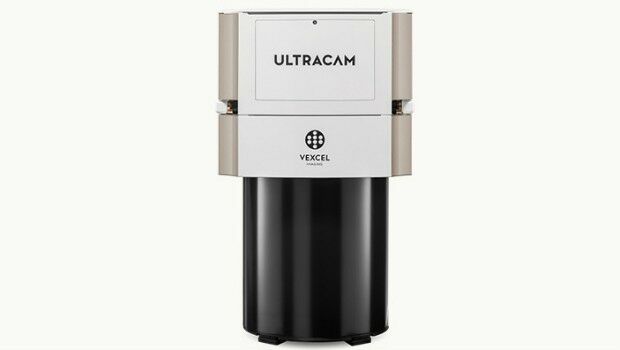
4th October 2017
Vexcel Imaging introduces the new UltraCam Eagle Mark 3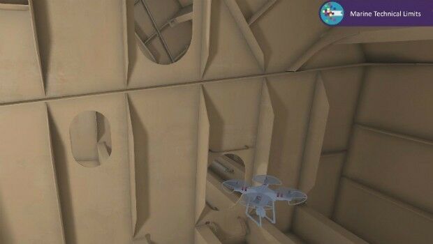
4th October 2017
Bureau Veritas joins the RECOMMS drones project
3rd October 2017
Satellite Images show Europe's diversity in new book
2nd October 2017
Frequentis and Hexagon for Nationwide Integrated Command Centers
2nd October 2017
Approaches and solutions for tomorrow’s transport
2nd October 2017
Drone Major Group - launches today to provide global connectivity

2nd October 2017
LAStools Win Big at INTERGEO Taking Home Two Innovation Awards
30th September 2017
Fugro Wins Highway Data Collection Contract for The State Of Alaska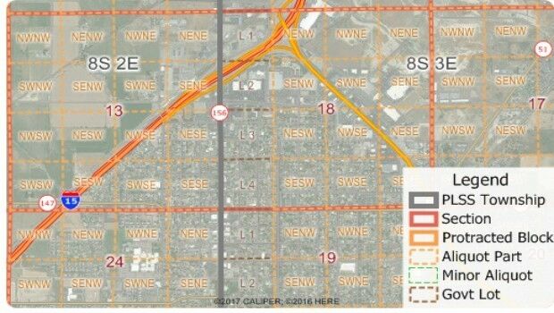
30th September 2017
Free Public Land Survey System (PLSS) Data for Use with Maptitude