
UrtheCast and Beijing Space View Technology sign Strategic Agreement
4th December 2017
UrtheCast and Beijing Space View Technology sign Strategic Agreement
4th December 2017
UrtheCast and Beijing Space View Technology sign Strategic Agreement2nd December 2017
Landmark hosts digital mapping and data workshops
1st December 2017
Fugro Wins Ørsted Contracts For Site Investigations
1st December 2017
Esri Signs Global Enterprise Agreement with Airbus Defence and Space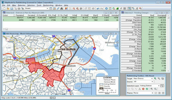
1st December 2017
Learn More About Maptitude for Redistricting
30th November 2017
Approval of additional G5 electronic flight instrument capabilities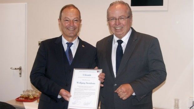
30th November 2017
Dr Wolfgang Steinborn Awarded DDGI’s Golden Badge of Honor30th November 2017
Data Model Development advances OGC’s Underground Pilot Project
30th November 2017
RIMS BV: external specialist for use of drones during surveys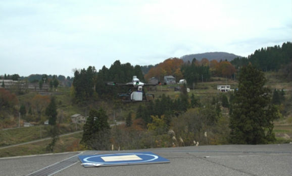
30th November 2017
World's First fully Autonomous Flight of "Smart Drone"30th November 2017
Esri Will Donate Software Licenses to URISA GISCorps Volunteers30th November 2017
Cityworks Announces Release of Performance Budgeting 1.030th November 2017
OGC seeks public comment on CDB Multi-spectral Imagery Extension
29th November 2017
Improve Road Safety with Connected Vehicle Cameras29th November 2017
Global Mapper Available with Photogrammetric Point Cloud Generation29th November 2017
Scientific-grade GNSS with Real Time Kinematic Satellite Navigation28th November 2017
Lido/mPilot 3.0: First step towards fully dynamic navigation maps28th November 2017
HERE to acquire ATS to power highly secure software updates_The_Hon_Minister_Pyne_Nathan_Habermehl_(Program_Director_Tranche_2_a%20_Elbit)_The_Hon_Senator_Zed_Seselja.jpg)
28th November 2017
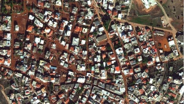
Satellite Images of West Attica Flood Help Government Response28th November 2017
SimActive Introduces New Technology for True Orthos
27th November 2017
Lockheed Martin Assembles Third U.S. Air Force GPS III Satellite27th November 2017
Frequentis TETRA Gateway for integration of various control centres
27th November 2017
Terra Drone And LG U+ Put UTM System Into South Korea27th November 2017
ABB selects Digpro’s dpPower for a large SCADA ADMS project in Turkey
27th November 2017
SSTL confirms Sarah Parker’s appointment as MD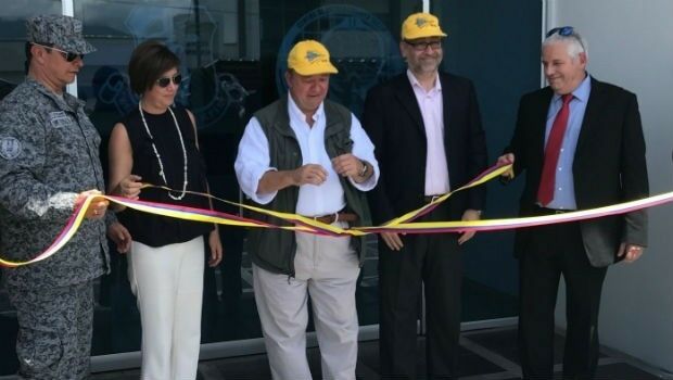
27th November 2017
Elbit Systems Fighter Mission Training Center Inaugurated in Colombia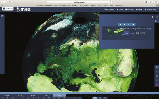
25th November 2017
EarthServer: 1+ Petabyte Analysis-Ready Datacubes24th November 2017
Landmark Solutions launches ‘Points of Interest – Northern Ireland’24th November 2017
Munkfors Metro Network in Sweden chooses Digpro
23rd November 2017
Airbus SmarTWISP app developer programme moves on to the next stage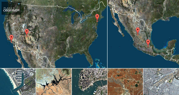
23rd November 2017
PlanetObserver presents new PlanetSAT Updates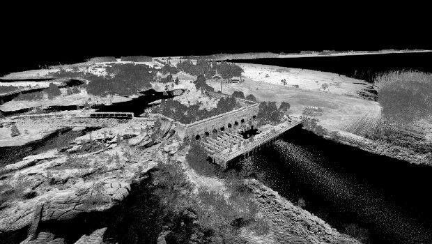
23rd November 2017
3D Laser Mapping launches campaign to release open-source LiDAR data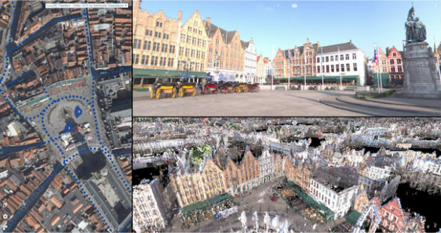
23rd November 2017
Orbit GT releases 3D Mapping Publisher v18
23rd November 2017
Swiss pilot Dario Neuenschwander wins the FAI Drone Racing World Cup
23rd November 2017
SSTL ships CARBONITE-2 and Telesat’s LEO-1 for PSLV launch
22nd November 2017
The world is on the brink of a technological revolution22nd November 2017
OGC's 105th Technical & Planning Committee Meeting
22nd November 2017
Martek Establish Dedicated Maritime Unmanned Aviation Division
22nd November 2017
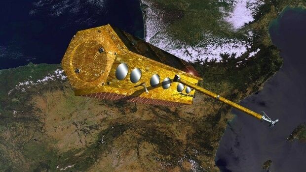
The PAZ satellite heads towards its launch base22nd November 2017
Active digital map for French Armed Forces
22nd November 2017
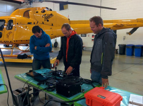
geoDVR for SAR - North Shore Rescue & Talon Helicopters
22nd November 2017
Garmin® celebrates a milestone in aviation