
GeoPlace launches new service to help councils with business rates
28th February 2018
GeoPlace launches new service to help councils with business rates
28th February 2018
GeoPlace launches new service to help councils with business rates
27th February 2018
Wingtra launches a drone that sets a new benchmark in photogrammetry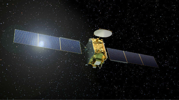
27th February 2018
British ESA astronaut Tim Peake visits Airbus Portsmouth_Port1.jpg)
26th February 2018
Changes to the FREQUENTIS AG Executive Board

26th February 2018
ERM Advanced Telematics set to expand its offering26th February 2018
TEOCO launches UAV Service Enablement Platform for Drones26th February 2018
Esri Acquires ClearTerra Location Data Extraction Technology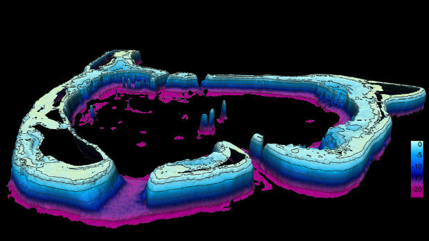
23rd February 2018
EOMAP wins UK Hydrographic Office contract23rd February 2018
Geovation Conference 2018 winning start ups announced
22nd February 2018
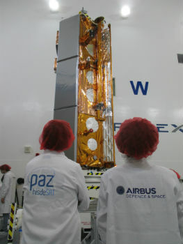
Airbus-built PAZ radar satellite successfully launched
22nd February 2018
ATrack Integrates Mobileye ADAS to Enhance Driving Safety
22nd February 2018
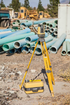
Topcon To Showcase The Latest Automated Workflows
20th February 2018
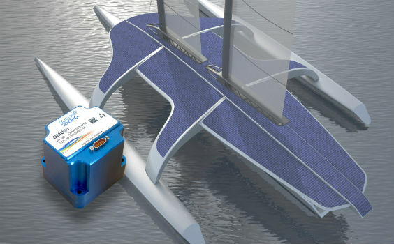
Autopilot for the Mayflower Autonomous Ship equiped
20th February 2018
Class approval for Drone inspection of confined spaces for RIMS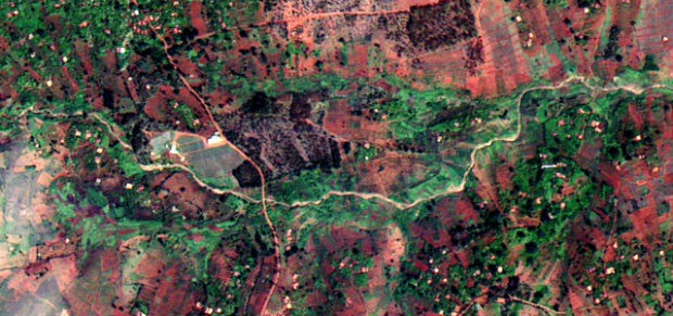
20th February 2018
Earth-i receives £2.7 million from UK Government to improve crop yield
16th February 2018
BARTHAUER and the city of Sousse: joined by shared roots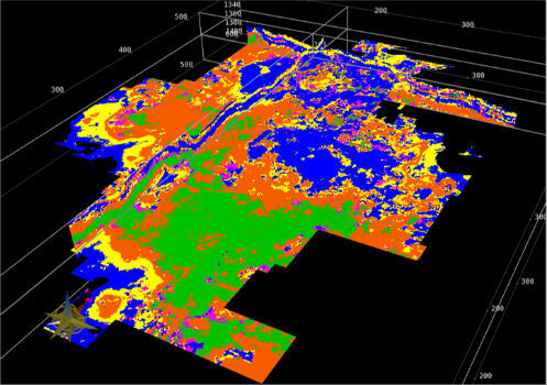
16th February 2018
New CGG GeoSoftware Technology Drives Greater E&P Efficiency16th February 2018
OGC seeks public comment on Web Coverage Service (WCS)
16th February 2018
Leading an Earth Observation project to predict dengue fever outbreaks16th February 2018
AND signs map license agreement with Mapbox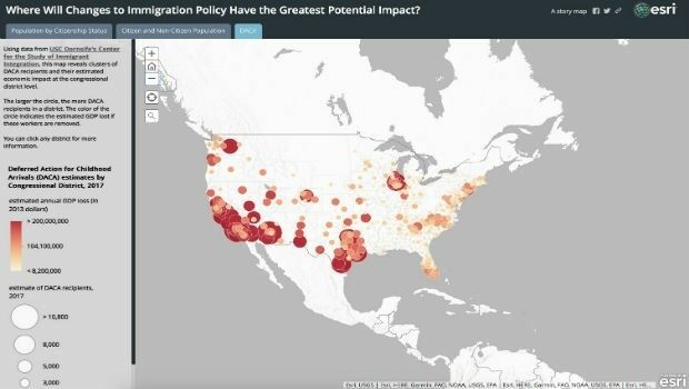
15th February 2018
Esri Story Map Explores Communities Impacted by Immigration Changes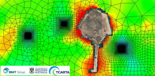
15th February 2018
Satellite Derived Bathymetry from TCarta Plays Key Role in Aquaculture
15th February 2018
United States Air Force selects Garmin® D2 Charlie aviator watch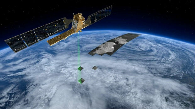
14th February 2018
Rezatec announces completion of £2m financing14th February 2018
Microsoft and Ordnance Survey join forces14th February 2018
Global Mapper v19.1 Now Available with New Features

14th February 2018
OGC Announces Earth Observation Exploitation Platform Hackathon 201813th February 2018
A Turkish Point of View on the Gallipoli Campaign13th February 2018
RegioGraph: 2018 update available end of March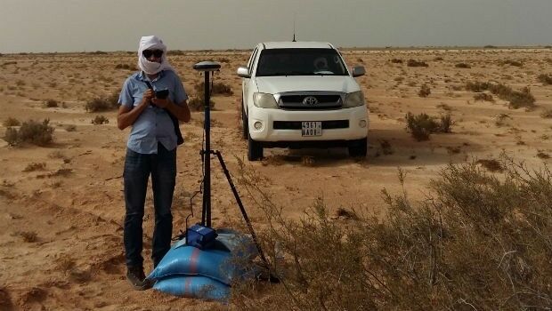
13th February 2018
Mauritanian HV Electric Transmission Corridor to be Surveyed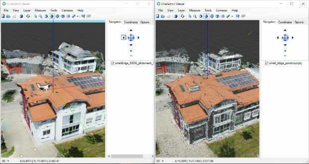
13th February 2018
ICAROS Uses TatukGIS SDK to Develop New Aerial Geospatial Data Viewer13th February 2018
AirGon LLC Appointed North American Distributor for YellowScan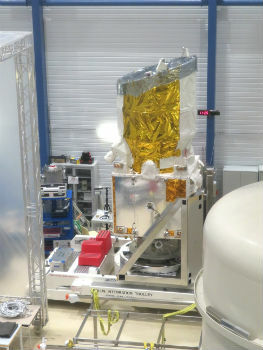
12th February 2018
Airbus-built Aeolus successfully passes all tests in Liège (Belgium)
9th February 2018
GEOINT 2018 Registration and Housing Now Open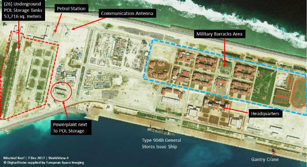
9th February 2018
Satellite images unveil Chinese military fortresses in Spratly Islands
9th February 2018
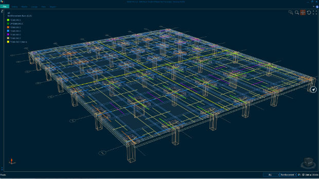
Bentley Systems Expands Concrete Building Design and Documentation8th February 2018
GSSI Proudly Announce Launch of New Website