Satellite Positioning, Navigation & Timing (PNT)
Don't miss a beat, sign up to our newsletter
PCI Geomatics Releases Geomatica Software Update
8th February 2018
PCI Geomatics Releases Geomatica Software Update
CyArk and Phase One Partner to Preserve the World’s Cultural Heritage
8th February 2018
CyArk and Phase One Partner to Preserve the World’s Cultural Heritage
Esri Releases Operations Dashboard for ArcGIS
8th February 2018
Esri Releases Operations Dashboard for ArcGIS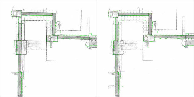
NavVis sets new standard in SLAM precision
8th February 2018
NavVis sets new standard in SLAM precision
OGC Requesting Responses to its Portrayal Concept Development Study
8th February 2018
OGC Requesting Responses to its Portrayal Concept Development Study
ESA and Airbus Sign Partnership Agreement
8th February 2018
ESA and Airbus Sign Partnership Agreement
Airbus and human spaceflight: from Spacelab to Orion
8th February 2018
Airbus and human spaceflight: from Spacelab to Orion
3DUserNet To Power Texodrone Online 3D Data Platform
7th February 2018
3DUserNet To Power Texodrone Online 3D Data Platform
Dubai and HERE with data infrastructure for driverless transportation
7th February 2018
Dubai and HERE with data infrastructure for driverless transportation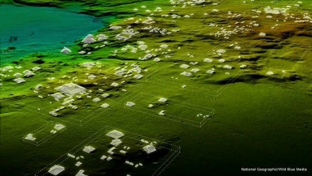
Teledyne Optech Titan lidar enables discovery of extended Mayan ruins
7th February 2018
Teledyne Optech Titan lidar enables discovery of extended Mayan ruins
Cepton and May Mobility Accelerate the Delivery of Autonomous Vehicles
7th February 2018
Cepton and May Mobility Accelerate the Delivery of Autonomous Vehicles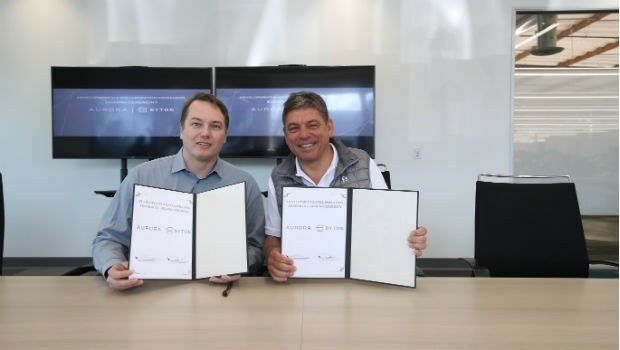
BYTON Partners with Leading Self-Driving Technology Company Aurora
6th February 2018
BYTON Partners with Leading Self-Driving Technology Company Aurora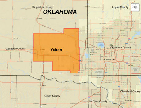
CGG Extends Oklahoma Coverage with Yukon Multi-Client Survey
6th February 2018
CGG Extends Oklahoma Coverage with Yukon Multi-Client Survey
Category Winners Announced at the Inaugural LIDAR Leader Awards Ceremony
6th February 2018
Category Winners Announced at the Inaugural LIDAR Leader Awards Ceremony
Trimble Announces New MX9 Mobile Mapping System
6th February 2018
Trimble Announces New MX9 Mobile Mapping System
YellowScan unveils its new UAV-LiDAR System
6th February 2018
YellowScan unveils its new UAV-LiDAR System
A partnership to integrate LiDAR and Photogrammetric technologies
6th February 2018
A partnership to integrate LiDAR and Photogrammetric technologies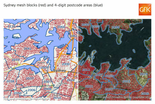
GfK releases new digital maps for Australia
6th February 2018
GfK releases new digital maps for Australia
Announcement at the International LiDAR Mapping Forum Symposium
6th February 2018
Announcement at the International LiDAR Mapping Forum Symposium
Sundbybergs Stadsnät increases the control of the fiber network
5th February 2018
Sundbybergs Stadsnät increases the control of the fiber network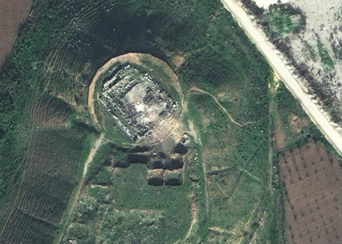
Satellite Images of Afrin Identifies Massive Damage to Ancient Temple
5th February 2018
Satellite Images of Afrin Identifies Massive Damage to Ancient Temple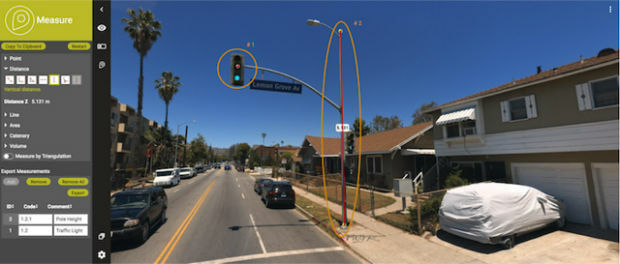
Orbit GT releases major update of 3D Mapping Cloud
4th February 2018
Orbit GT releases major update of 3D Mapping Cloud
Fugro’s Rig Positioning Services Reduce Mobilisation Time For Statoil
3rd February 2018
Fugro’s Rig Positioning Services Reduce Mobilisation Time For Statoil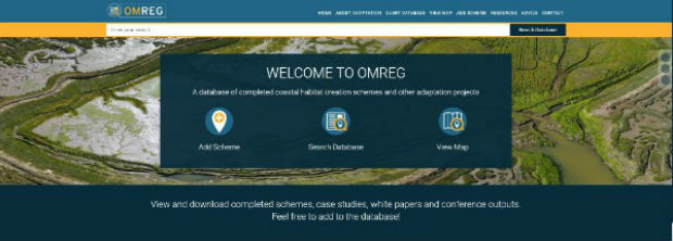
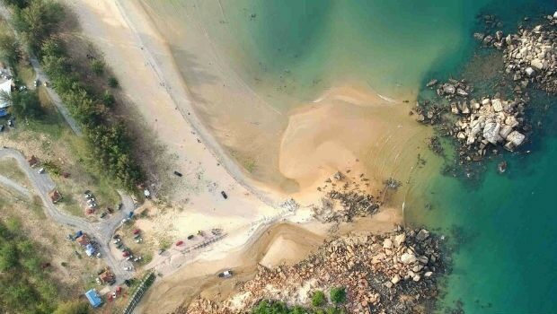
ABPmer launches redesigned coastal and marine habitat creation website
2nd February 2018
ABPmer launches redesigned coastal and marine habitat creation website
PCI Geomatics Releases GXL 2017, Service Pack 1
2nd February 2018
PCI Geomatics Releases GXL 2017, Service Pack 1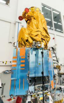
SSTL and 21AT announce new Earth Observation Capacity Contract
2nd February 2018
SSTL and 21AT announce new Earth Observation Capacity Contract
3D Laser Mapping releases real-time automated mine monitoring solutions
2nd February 2018
3D Laser Mapping releases real-time automated mine monitoring solutions
Blue Marble to Showcase Global Mapper's Pixels-to-Points™ Tool
2nd February 2018
Blue Marble to Showcase Global Mapper's Pixels-to-Points™ Tool
URISA Announces 2018-2019 Vanguard Cabinet of Young Professionals
2nd February 2018
URISA Announces 2018-2019 Vanguard Cabinet of Young Professionals.jpg)
3D at Depth Completes 300 Offshore LiDAR Metrologies
2nd February 2018
3D at Depth Completes 300 Offshore LiDAR Metrologies
U.S. Customs and Border Protection Certifies Elbit Systems of America
2nd February 2018
U.S. Customs and Border Protection Certifies Elbit Systems of America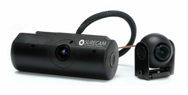
Intelligent Telematics Opens New European Headquarters In Reading
1st February 2018
Intelligent Telematics Opens New European Headquarters In Reading
RIEGL Wins a Prestigious MAPPS Geospatial Excellence Award
1st February 2018
RIEGL Wins a Prestigious MAPPS Geospatial Excellence Award
Alloy ushers in the future of GNSS reference receivers
1st February 2018
Alloy ushers in the future of GNSS reference receivers
Reach for the stars with Drone Major Group
1st February 2018
Reach for the stars with Drone Major Group
National flood map provides future climate change flood scenarios
1st February 2018
National flood map provides future climate change flood scenarios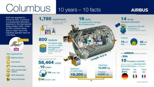
Columbus: 10 years in Space, close to 60,000 Earth orbits
31st January 2018
Columbus: 10 years in Space, close to 60,000 Earth orbits
New noise maps created for the German Federal Railway Authority
31st January 2018
New noise maps created for the German Federal Railway Authority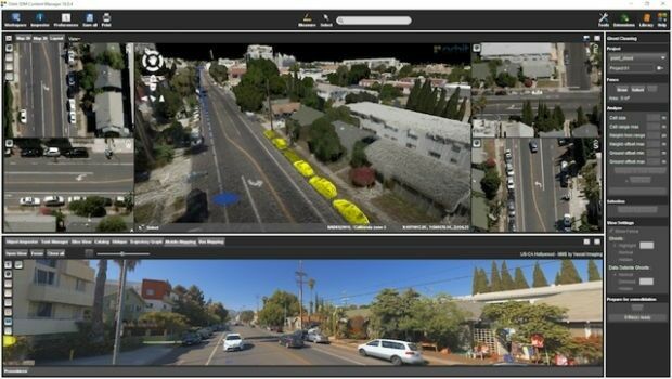
Orbit GT releases 3D Mapping Content Manager v18
31st January 2018
Orbit GT releases 3D Mapping Content Manager v18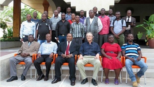
GDMIS System for Ministry of Natural Resources in Malawi
31st January 2018
GDMIS System for Ministry of Natural Resources in Malawi
Boundless Launches Scalable Geospatial Server for the Enterprise
31st January 2018
Boundless Launches Scalable Geospatial Server for the Enterprise
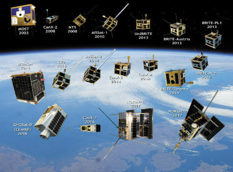
Space Flight Laboratory Highlights 20 Years of Microspace Achievements
31st January 2018
Space Flight Laboratory Highlights 20 Years of Microspace Achievements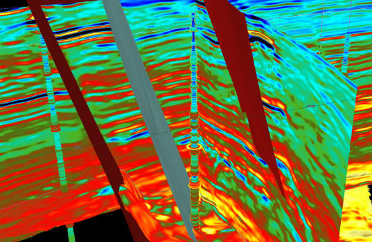
CGG GeoSoftware Donates Jason Reservoir Characterization Software
31st January 2018
CGG GeoSoftware Donates Jason Reservoir Characterization Software
L&M Surveys (UK) purchase 22 HDR Camera Systems for VR Capturing
30th January 2018
L&M Surveys (UK) purchase 22 HDR Camera Systems for VR Capturing
Airbus to provide near real-time access to its satellite data
30th January 2018
Airbus to provide near real-time access to its satellite data