
European Space Imaging announces new partnership with Vricon
12th August 2016
European Space Imaging announces new partnership with Vricon12th August 2016
European Space Imaging announces new partnership with Vricon12th August 2016
PCI Geomatics Releases Geomatica 2016 Service Pack 1
10th August 2016
Barrow Upon Soar Rail Closure Prompts Monitoring Calls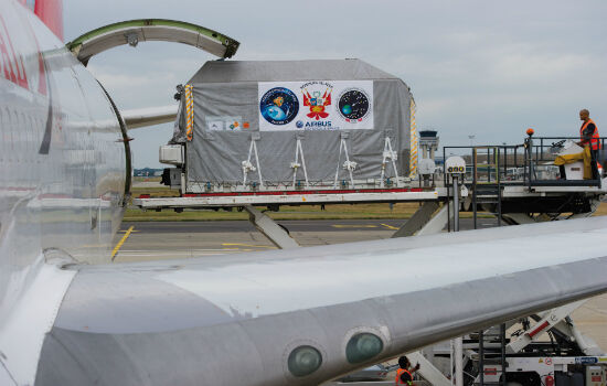
6th August 2016
PerúSAT-1 satellite is now on its way to Kourou launch site
5th August 2016
160 Commercial Drone Companies Showcase UAV Technology at InterDrone2nd August 2016
New senseFly financing and insurance packages for Drone operators2nd August 2016
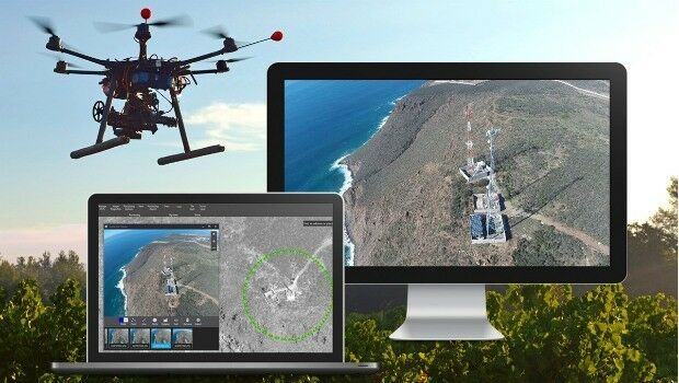
AirGon LLC Revolutionizes Drone Data Extraction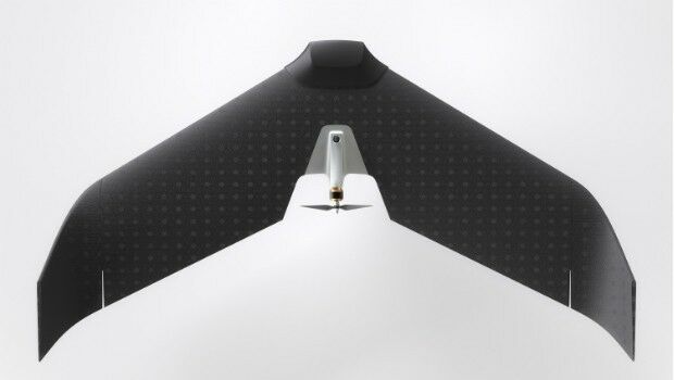
27th July 2016
Lehmann Aviation redefines mapping drones with brand-new L-A Series27th July 2016
Future of drone use within business set to change_(1).jpg)
27th July 2016
Airbus Defence and Space Launches “One Tasking”20th July 2016
Airbus Defence and Space Launches “One Tasking”
19th July 2016
SSTL expands LEO platform capability with VESTA nanosatellite
18th July 2016
QuestUAV Provides Own PPK Solution For Q-200 Surveyor UAV
14th July 2016
25 years ago – Europe’s first Earth observation satellite was launched
12th July 2016
Leica Geosystems completes CAA qualifications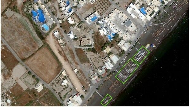
12th July 2016
Shelter from the summer sun under legal umbrellas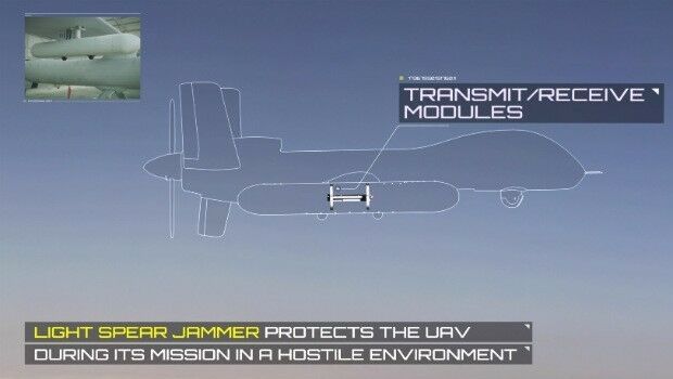
11th July 2016
Elbit Systems Launches Light SPEAR™ UAS Jamming System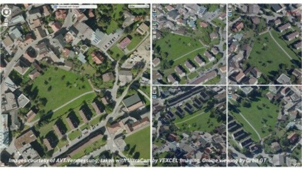
8th July 2016
Orbit GT and Vexcel Imaging, Austria sign Reseller Agreement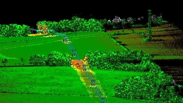
8th July 2016
Patrol+® a flying success with survey completed for National Grid
8th July 2016
The Truth About Drones in Construction and Infrastructure Inspection8th July 2016
Vexcel Imaging and Orbit GT sign Reseller Agreement
5th July 2016
European Commission Launches Copernicus Accelerator
30th June 2016
Twenty questions challenge for Earth Observation

30th June 2016
EUMETSAT approves new Strategy of Meteosat-8 over the Indian Ocean28th June 2016
DigitalGlobe and Esri Announce New Long-Term Partnership
27th June 2016
Extreme Runners to be Protected by Globalstar’s SPOT Gen3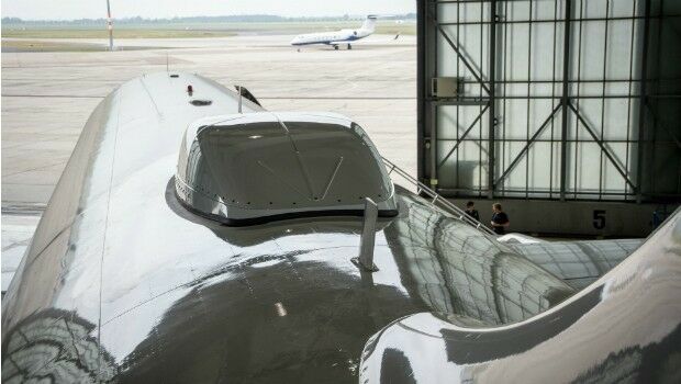
27th June 2016
Inmarsat solution certified for Airbus A320 aircraft family
24th June 2016
Airbus Defense and Space Partners with AMREL23rd June 2016
CompassDrone™ Your One-Stop-Shop for Drone Based Remote Sensing22nd June 2016
Airbus Defense and Space and 3v Geomatics Partner for TerraSARX"
21st June 2016
Fugro Deploys Q1400 Trenchers at Three North Sea Oil and Gas Projects21st June 2016
GSDI 15 Workshop Opportunities in Taiwan, 29 November to 2 December21st June 2016
Small Vessel Tracking Trials, a Success in South Africa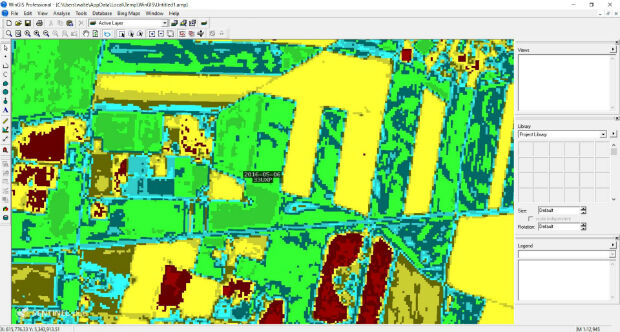
21st June 2016
WinGIS & EC-Sentinel II Images introduced at AgriFuturedays 2016
20th June 2016
Shell Selects Globalstar Satellite Asset Tracking Solution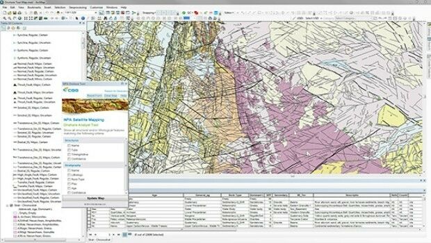
20th June 2016
CGG GeoConsulting introduces EARS BasinMap
17th June 2016
Press conference with ESA astronaut Tim Peake after return to Earth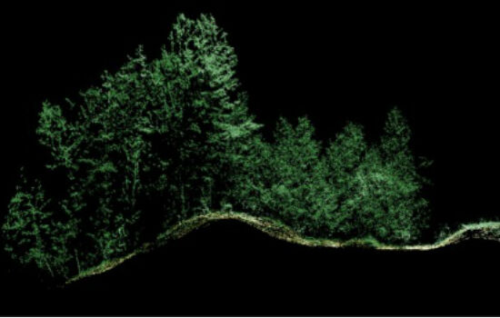
16th June 2016
Leica Geosystems expands LiDAR capabilities in ALS80 airborne sensor16th June 2016
UAVAir calls businesses to take note of growing use of drones