Share
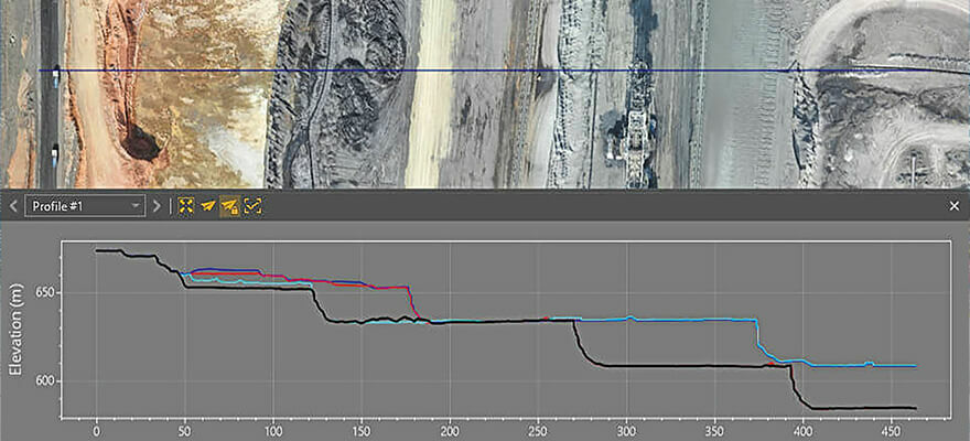
With the goal of giving surveyors a better understanding of the topographic data captured by drone mapping sensors, Virtual Surveyor has unveiled Profile View functionality in Version 8.4 of its popular surveying software. Profile View enables users to generate an elevation profile simply by drawing an onscreen traverse across any part of the data set created from drone imagery or LiDAR point clouds. Virtual Surveyor is a robust surveying software that bridges the gap between drone photogrammetric processing applications and engineering design packages, enabling surveyors to derive topographic information from drone data needed by engineers for construction, mining, and excavation projects. The software presents an interactive onscreen environment with drone orthophotos, digital surface models (DSMs), and/or LiDAR point clouds where users generate CAD models, create cut-and-fill maps, and calculate volume reports. www.virtual-surveyor.com


