Share
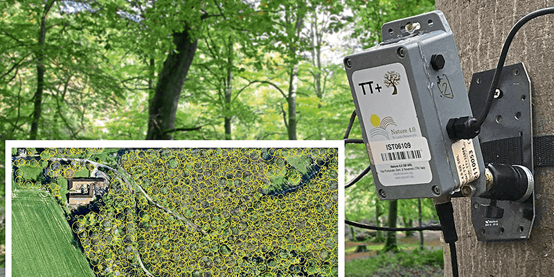
A system to provide early warning of pest or disease attacks on the UK treescape is being developed by Fera Science Ltd. Funded by Natural Environment Research Council (NERC) and using tree location data from aerial mapping company Bluesky, a network of wireless sensors is being deployed at three trial sites in Norfolk. These sensors monitor the condition of tree canopies, movement of water, tree growth and the motion of the trunk. Combined with visual observations by voluntary ‘citizen scientists’, and images from drones and satellites, these measurements will identify a ‘sentinel’ system of changes in tree health. Fera are using data from Bluesky’s National Tree Map (NTM) which is a unique database of height and crown spread for trees 3m and over. The NTM is updated on a rolling three-year programme to ensure it is accurate and up to date and allows for tracking of tree canopy cover over time. www.bluesky-world.com


