Share
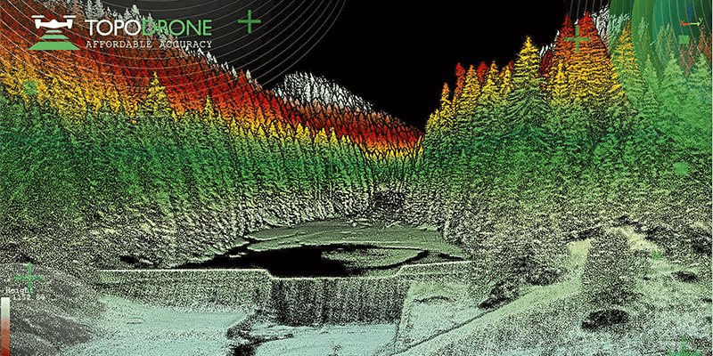
Topodrone, a Swiss-based designer and manufacturer of high-precision surveying equipment, releases a new lightweight 360° LiDAR model range with advanced features and capabilities: LiDAR 100 & 100+ with a 100 m working flight altitude and LiDAR 200+ with a 200 m working flight altitude. All of them can be used as a single payload for different carriers and installed on a drone, car and backpack. Topodrone LiDAR 200+ has successfully passed field tests and has been implemented in a test mode by two European customers. BDS Topografie conducted a surveying project in Romania to study a dam and mountain river with a very difficult terrain structure. Atyges and Gonzalo Malvarez from the Coastal Environments research group of the Universidad Pablo de Olavide de Sevilla experimented with the combination of bathymetry, LiDAR and photogrammetry approaches to survey a reservoir in Spain. www.topodrone.com


