Share
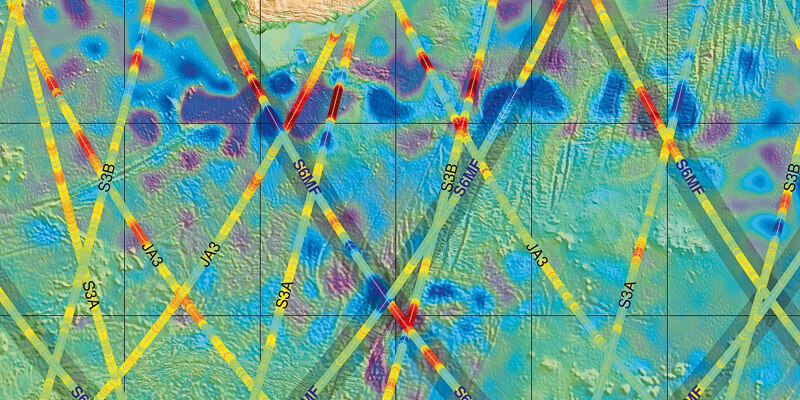
The first data from the European-US ocean-monitoring satellite Copernicus Sentinel-6 Michael Freilich, launched on 21 November, show the spacecraft’s altimeter is on track to provide highly accurate measurements of sea level, sea state and ocean surface wind speed. Sea level products extracted from the first nineteen hours’ worth of altimeter data received on 4 December, overlaid on a map showing the similar products from all of the Copernicus altimetry missions – Jason-3, Sentinel-3A and -3B - confirm Copernicus Sentinel-6 Michael Freilich is “seeing the same scene” in a dynamic area of the ocean south of South Africa. The products reflect highs and lows in the ocean surface topography that, like high and low pressure in the atmosphere, regulate ocean currents. www.eumetsat.int


