Share
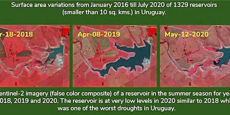
Terra Cover announces the release of a new surface water monitoring service, ReaLSAT (Reservoir and Lake Surface Area Timeseries), for freshwater analysis and research. The ReaLSAT service provides global surface area monitoring for water bodies with sizes greater than 0.01 square kilometres. The insights derived from robust tracking of these water bodies enables customers in insurance, water resource management, and infrastructure development industries to incorporate the impact of changes in freshwater availability in business operations. In a recent case study, Terra Cover analysed 1329 reservoirs (built for hydropower or irrigation) in Uruguay. In 2018, which witnessed one of the worst regional droughts in history, total surface area decreased by almost 40 % across the country. According to Terra Cover analysis, current 2020 figures also show alarming reductions in surface areas. www.terracover.ai


