Share
In a disaster, optical data can be used to monitor damage and reconstruction over large areas. SAR data makes it possible to ‘sense’ the ground’s motion. Vincenzo Massimi explains how the two can be combined – and are being used in the reconstruction of Indonesia, following the recent tsunami
Around the globe, many types of natural disasters can affect humanity: earthquakes, tsunamis, volcanic eruptions, floods, hurricanes or wildfires. These disasters harm lives and the economy, especially for developing countries, where the mortality is higher and there are usually longer-term consequences for economic growth, development, and poverty reduction. Governments need appropriate risk management strategies to respond to disasters quickly and to minimise human suffering, environmental harm and economic loss.
Earth observation can contribute to mitigating the impact of disasters by providing hazard mapping, supporting services for the assessment of exposure, vulnerability, and risk and reconstruction monitoring. In particular, synthetic aperture radar (SAR) data can acquire images in any weather condition and independently of the light from the sun.
SAR interferometry (inSAR) takes advantage of a series of images acquired over time, allowing users to follow the evolution of deformations of the ground, so they can monitor instabilities. It allows for millimetre-scale measurements of changes in ground deformation.
Persistent scatterer interferometry (PSI) uses SAR satellite images to generate ground motion maps. A detailed map of buildings in the areas affected by the disaster makes it possible to fuse data from ground motion and the terrain, thus generating a “building motion” map. This provides the level of concern of each monitored element, which can be updated monthly using the SAR data acquired periodically by satellite constellations such as Sentinel-1.
Optical images, on the other hand, are an excellent aid for monitoring changes in vast areas. Whether they are acquired from satellite or airborne platforms, it is quite intuitive that optical data can be useful for analysing the effects of extreme events, comparing the images acquired immediately after an event with the historical ones.
What is less widespread is the use of optical data to monitor reconstruction activities in areas affected by disasters. It is in this area that the extraction of geo-analytics from images serves to obtain quantitative measures and indicators: for example, to monitor the state of reconstruction compared to what is planned, to better support land management.
Using optical and SAR data, continuously acquired for areas affected by disasters, enables the creation of indicators and metrics, which can be an essential resource for local authorities. The Earth observation data helps to better understand the hazards associated with seismic activity, flooding, and landslides, so users can make more informed decisions in the redevelopment master plan. Afterwards, monitoring the reconstruction and extracting analytics about the progress of the works enables users to monitor the implementation of the plan in extensive areas, highlighting delays and critical issues while controlling any risks related to a territory in continuous transformation.
Supporting reconstruction
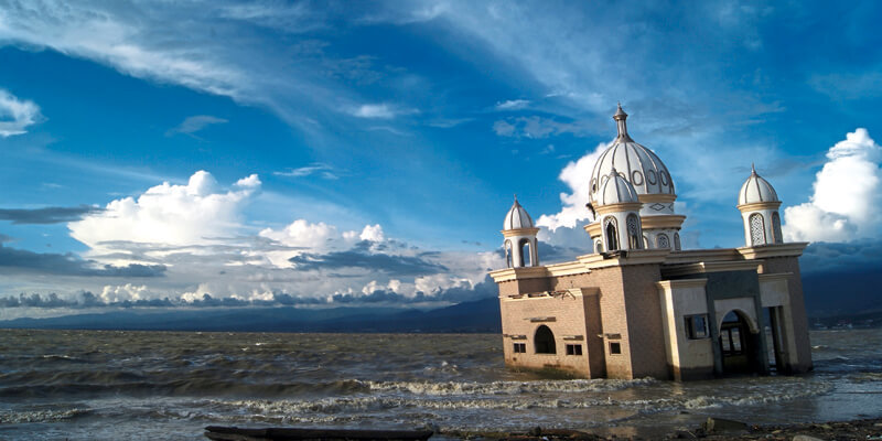
On 28 September 2018, a 7.5 magnitude earthquake struck the island of Sulawesi, Indonesia (see GeoConnexion International September 2019). The epicentre was Palu, the provincial capital located on a bay on the island’s northwest coast. The quake triggered a tsunami that swamped the city with 10-metre waves. The combination of the earthquake, tsunami, soil liquefaction, and landslides claimed well over 2,000 lives, destroyed homes, buildings, infrastructures, and farmland in several districts.
Recognising the need to relocate settlements from the liquefaction-prone areas, the Indonesian government developed a master plan for recovery and reconstruction. Indra and Planetek Italia contributed to the implementation of this plan with a batch of Earth observation-based services. The primary information provided was related to terrain deformation mapping (before the earthquake) followed by the update of terrain information mapping (after the quake) and reconstruction monitoring with VHR images. The main purpose was to help the local authorities better understand the hazards, so they can make more informed decisions in elaborating a redevelopment master plan.
Indra and Planetek delivered regular monitoring of the reconstruction status based on the VHR optical satellite images and the classes of motion of every single monitored element based on the measurements of the displacement of the monitored elements and their nearby areas. The integrated information delivered allowed for the characterisation of the movements of the wide areas and of each single building, based on the PSI ground motion map, and to retrieve reconstruction and rehabilitation statistics based on the interpretation of the VHR satellite images.
Pre- and post-event maps were delivered through the business intelligence visualisation tools of our Rheticus platform, to support those involved in reconstruction. The ground motion maps delivered covered the liquefaction and landslides areas. The web app demystifies the complexity of PSI by simplifying the analysis of the movements – even as small as few millimetres – of each measured point located on buildings and infrastructure elements in the urban and peri-urban zones. For each measured point, the web interface provided a pop-up window that shows detailed information about the ground motion.
Meanwhile, the ‘building motion’ dashboard provides the level of concern for each monitored element every month, based on the ground motion map. This enables users to watch over the reconstruction and keep under control and mitigate the risks related to the instability of reconstruction areas, which still have to settle after the earthquake and the subsequent tsunami.
Vincenzo Massimi is Rheticus technical specialist at Planetek Italia (www.planetek.it). Various other colleagues contributed to the article


