Share
13 years ago, Paul Reichardt surveyed a California cliff-face from a boat using a total station. When asked to capture a precise orthomosaic and topographic map of its structure this year, he approached Robert Lafica for a less precarious method. Together, they developed a new photogrammetric technique for cliff surveys. Mary Jo Wagner reports
When surveyor Paul Reichardt approached Robert Lafica, owner of Central Coast Aerial Mapping (CCAM), about acquiring a cliff-face survey, he was frank in his response: “I’ll try, but I’m not sure it will work.”
As a specialist in photogrammetry, Lafica is skilled in producing detailed 3D stereo-based topographic maps, orthophotos and orthomosaics and surface models – CCAM has been providing such products since 1977. And he’s provided photogrammetric services many times for traditional cliff surveys using fixed-wing aircraft that collect nadir images.
This survey, however, was unique. It required imaging the side of the cliff to produce a precise orthomosaic and topographic map of its structure and integrity. Lafica was confident he could capture the 250m-long bluff with his UAV; the challenging unknown was the ability to accurately triangulate oblique images and map them in stereo.
“A drone would allow me to capture the caves and pockets along the cliff face, which you can’t get with a traditional nadir angle,” says Lafica. “My photogrammetry software is top-notch at triangulating nadir images, but I’d never tried oblique drone images. With oblique images, the land that’s closer to the camera is quite clear but it’s less clear the further away it is. I wasn’t sure if the software could calculate those odd angles to properly triangulate. That was a big question mark because without accurate triangulation, I couldn’t properly map or mosaic the cliff.”
No more crazy, please
The bluff in question sits just off the famed Pacific Coast Highway 1 in Cayucos, California. Perched precariously on top of the nearly 12m-high bluff is a sweeping residence that Reichardt knew well – 13 years earlier, he performed the same coastal cliff survey with a total station.
“Because of the length and steepness of the bluff, you have to be about a quarter of a mile (250m) offshore to get the full face,” says Reichardt, a professional land surveyor and photogrammetrist with Terrain Group. “We took a boat out to a rock, set the instrument up, established vertical and horizontal parameters, and captured measurements to the house and the lot and as much of the edge face of the cliff that we could. It was precarious and crazy, but it worked.”
However, when he was requested to capture the bluff again, Reichardt tapped into his long working relationship with Lafica and approached him for a safer, more efficient and more accurate technique.
Reichardt needed a 1.2cm orthomosaic of the entire area of interest (AOI), a 3cm 3D topographic contour map of the cliff face and top-of-bluff surface and a vector-based (digital terrain model (DTM) accurate to 3cm. The topographic map needed to have 30cm contours and also clearly show the mean high water (MHW) line, which delineates private and public foreshore boundaries.
Given the small AOI, the ability to tilt the UAV’s camera for oblique imaging, and Lafica’s willingness to push his photogrammetry technology, the conditions were favourable for testing and potentially proving a new photogrammetric mapping concept.
From all angles
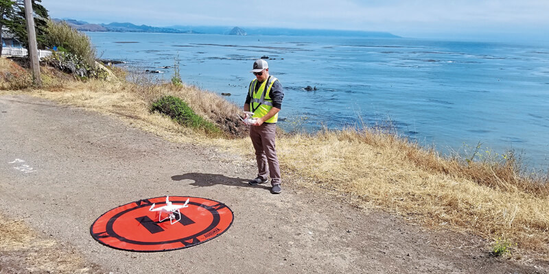
Lafica and Reichardt went to the bluff in February to survey the site, timing their arrival with the lowest tide window. While Lafica prepared the UAV, Reichardt set out six black and white ground control point (GCP) targets around the property and along the beach and then used his Trimble R8 GNSS receiver to measure their positions to within 1.2cm. They also established four checkpoints, or photo ID points, around the AOI as quality control points for the photo triangulation process.
After setting ground control, Lafica immediately launched the UAV before the tide washed away the GCP targets on the beach. Flying at an altitude of 40m, the UAV covered the site from both nadir and oblique camera angles in nine passes, collecting 158 photos at an average ground sample distance of 1.3cm. To capture the cliff side, Lafica flew the UAV about 27m away from its face and angled the camera at 40º.
While Lafica was capturing the aerial survey, Reichardt used the Trimble R8 and a 5600 total station to collect the property corners and some top-of-surface elevations to integrate into the 3D topographic map.
In less than two hours, they were packing up to go home.
“It took me 2.5 days to complete this cliff survey 13 years ago with my conventional methods,” says Reichardt. “Robert and I did it in one evening. That’s a huge time savings, but even more amazing is the end result.”
Full frontal mapping in 3D
To begin the mapping process, Lafica first needed to tie photos together to orientate the project. Because he captured both nadir and oblique images, he processed the two image sets separately, beginning with the nadir imagery.
Lafica loaded the 127 nadir photos, the UAV GNSS data and the GCP positions into Trimble’s Inpho UASMaster photogrammetric software to automatically triangulate the images. Processing the images in batches, it automatically pinpointed 6,368 common features or tie points (TPs) with multiple connections across the images to match images to each other. After the initial triangulation, Lafica then zoomed into each photo to locate the control point targets and attached precise coordinates to each target in the image.
With that additional georeferencing, UASMaster then performed the final triangulation, connecting all the imagery to the ground control and setting the images in the correct positional accuracy for orthorectifying and mapping.
The true test of the software’s triangulation capabilities came next, when Lafica loaded the 80 oblique images into UASMaster for aerial triangulation. To his surprise, the software automatically deciphered the unique characteristics of off-nadir imaging and processed them just as well as traditional UAV photos – all in 45 minutes.
“To accurately tie the oblique images together, the software needed to use different routines and algorithms to figure out puzzles like the camera lens distortion values. And it did,” says Lafica.
After the final triangulations were finished, Lafica moved all the photos to his photogrammetric workstation to produce a DTM and view the imagery in stereo and create the precise 3D topographic map. He compiled terrain break lines across the entire cliff face – from the rocky base of the bluff to the top – that were accurate to 0.3cm and symbolised planimetric features such as dense trees and brush, structures, fencing and scattered rocks and boulders. He also delineated the MHW contour line along the shore as well as the water surface elevation line to precisely illustrate the position of the tide line at the time of data acquisition in relation to the MHW line – a critical map element for Reichardt’s customer.
“With conventional surveying, it’s difficult to scale the face of a cliff to get equal elevation for the survey to the MHW line,” says Reichardt. “And it’s challenging to acquire the detail of a rocky bluff. But Robert nailed it. The map had a perfect MHW line, the water surface elevation line, the exactness of the break lines and all the rocks and structures. It’s an incredible amount of detail that I think only a photogrammetrist can provide.”
Lafica also created orthophotos and then used Inpho’s OrthoVista module, the photogrammetry tool for creating seamless orthomosaics, to stitch each orthorectified image together. In about two hours, the software mosaicked the orthophotos into one seamless, colour-balanced and geometrically correct orthomosaic of the entire AOI at a 2D accuracy of 3cm.
About one week after the field survey, Lafica delivered the 3D topographic map, the orthomosaic and a vector-based DTM to Reichardt. “We proved that we can map in stereo from nadir drone imagery about three years ago,” says Lafica, “but this is beyond what I thought I could achieve in stereo mapping. Most importantly, this success gives us the opportunity to offer a unique service and build new business.”
If Reichardt approaches Lafica about acquiring a cliff-face survey again, his response may still be frank, but he’ll likely answer with a much more assured, “I can do that.”
Mary Jo Wagner is a freelance writer who has been specialising in the geospatial industry for 27 years. She can be reached at [email protected]


