Share
Two tailing dams collapsed in Brazil in 2015 and 2019. Brazilian mining companies are now using monitoring tools to protect workers, communities and the environment – and ensure such disasters never happen again
The future of the mining industry is becoming increasingly entwined with one particular area of technological innovation: monitoring. The collapse of two tailings dams at mines in Brazil in 2015 and 2019 illustrated that the relationship between mining and monitoring is no longer just one of convenience, but necessity. Torrents of liquefied waste destroyed local communities, contaminated water supplies and caused many deaths.
As of 2020, Brazil legislation requires mining companies to monitor the structural stability of their tailing dams, which are full of mine waste. However, it’s not just Brazil where the future of mining is becoming increasingly entwined with monitoring innovation. Worldwide, companies in the mineral sector have increased their investment into monitoring solutions so that they can evaluate the stability of cut slopes and tailings dams. This information enables them to take appropriate preventative actions and issue timely warnings ahead of events.
Tailings dams store mining waste from processed rock. They are formed by earthwork structures that grow over time as mining operations generate waste. Since these dams may also contain harmful materials, they must be monitored for deformations that could threaten collapse. Legislative changes in Brazil enforced monitoring of these structures as a safety requirement for mining companies. Based on the type of construction, tailings dams present different levels of risk. These risk levels determine how frequently measurements are required by law and which type of monitoring
is needed – continuous, automated monitoring or campaign monitoring.
Cepemar, an environmental solutions company with specialisation in mining applications, helps mining companies to comply with regulations. As Brazil’s largest environmental survey and monitoring services provider, Cepemar collects geophysical and geospatial data to perform impact studies and evaluate risks at tailings dams. They perform campaign monitoring throughout the country, collecting measurements daily, weekly, or monthly using surface landmarks in dams, dikes, pits, and mining cliffs. Prior to investing in new instrumentation, Cepemar used simple total stations to gather data manually, meaning technicians located and measured every prism in a time-consuming process compromised by human error. To enable higher accuracy alongside more efficient, faster data collection, Cepemar decided to invest in state-of-the-art monitoring technology with integrated automation. Cepemar project manager Frilson Mateus V Netto explained: “The goal was to provide the end customer with greater accuracy, data quality and assurance in our campaign monitoring processes”.
The latest monitoring technology
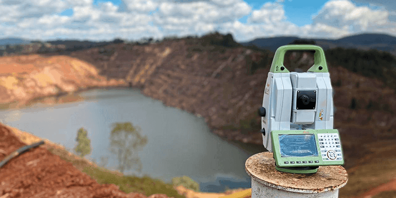
Cepemar selected total stations designed with specific features for monitoring from Leica Geosystems. The features of the Leica TM60 total station, including the world’s farthest ATRplus range, half-second automatic aiming accuracy, advanced imaging, and the longest continuous operation, were crucial for Cepemar’s transition toward automated data acquisition. These features improved measurement workflows from setup, through data collection and on to analysis. All these features are important for semi-automation of campaign monitoring and critical should the total station be used for automated monitoring in combination with Leica GeoMoS Monitor software.
TORRENTS OF LIQUEFIED WASTE DESTROYED LOCAL COMMUNITIES, CONTAMINATED WATER SUPPLIES AND CAUSED MANY DEATHS
The total station’s ATRplus’s self-learning technology adapts to environmental conditions like fog and rain by adjusting parameters, increasing measurement rate success. Further streamlining the process, the total station takes automated measurements of the learnt targets, enabling faster collection of data, reducing the probability of error by automatically setting parameters for each measurement, and increasing the quality of successful measurements with automated blunder checking.
For campaign monitoring, TM60 features a specific TPS Monitoring application that enables enhanced workflows and automation in the field for data capture, increasing QA and reducing the workload of the operator, whilst delivering results that can be reviewed manually in the field or uploaded for later analysis. Connecting this TM60 to Leica GeoMoS Monitor software enables 24/7 automation of measurements with scheduling, movement analysis, threshold detection, reporting, and alerting in addition to system operation telemetry. These features diminish the rework required for Cepemar technicians and ensure a complete data set from which to build analyses.
This allows Cepemar to acquire relevant data to conduct time-comparative analysis to determine whether an object has moved. The movement indicates deformation and Cepemar provides tables, charts, and visualisations to the clients to show surface movements along the monitored zones, providing information about structural integrity that enhances safety, enables informed decision-making when interventions are necessary, and helps their clients meet federal regulations.
Not just one but two dams
Mineração Morro do Ipê (MMI), a mining company, has implemented a comprehensive monitoring solution at the Ipê and Tico-Tico mines’ tailings dams in the Serra Azul region of Brazil. MMI needed a comprehensive system that combined geodetic, geotechnical and radar measurements to ensure continuous deformation monitoring to provide alerts in the case of sudden events as a “Total Monitoring” solution.
To achieve this, MMI acquired and installed monitoring systems, designed in consultation with Hexagon. At each site, a Leica TM60 observes precise measurements of multiple points located along each tailing dam embankment, managed fully automatically and remotely via GeoMoS as it intelligently controls the total stations and processes the measurements. The software operates continuously, capturing and analysing data. Then, if an event occurs, it generates automated alerts issued to MMI when measurements exceed their defined thresholds. Easy to use yet powerful data analysis and visualisation tools for generating graphs, tables and maps with automatic reports from predefined templates, enables MMI to easily distribute data, and aids the review processes.
OUR GOAL WAS TO MAKE GEODETIC SURVEYS AND FIELD INSPECTIONS FASTER AND SAFER
To complement geodetic monitoring and enhance hazard mitigation at the dams, MMI also installed RockSpot, the interferometric and Doppler radar from IDS GeoRadar adding to the Hexagon portfolio of products. The RockSpot is a real time device used to detect rockfalls and activate sirens in urgent cases. Comprised of a camera, GNSS antenna and radar module, the device detects sudden-surface deformations and records line of sight velocity, travel path, rockfall surface size, and other data. MMI technicians review the RockSpot detection data live via a web portal and cross reference with streamed images of the dam. The radar system operates continuously across the wide area, creating a full rockfall database to perform data analysis and so supports an efficient rockfall risk zone identification, with analysis to reduce operational and geotechnical risks.
As a result of the data analysis from these combined solutions and other geotechnical instrumentation, MMI gets comprehensive information of displacements and instant detection of sudden movements, improving safety
and efficiency.
“Our goal was to make geodetic surveys and field inspections faster and safer, with more information to meet internal standards with high quality in less time,” explained Rodrigo Oliveira, Geotechnical Manager at MMI.
To further support this objective, MMI installed a GNSS reference base station that enables 24/7 corrections to any GNSS survey grade rover receiver operating at the mine. For example, MMI uses a GNSS for cadastral surveys of boreholes, marking mining plans and site measurements, with positions corrected by the base. For aerial surveys, they use a UAV, which uses the base station corrections that eliminate the need for ground control points. GNSS monitoring points can also use this base station to deliver accurate real time deformation data.
The collected geodetic and topographic data is processed and centralised using Leica Infinity surveying office software. This enables post-processing tasks, including volume calculations of material piles, with data from a variety of sensors. MMI also uses point cloud modelling software Cyclone 3DR Survey Edition to enable surface comparisons and inspections of small area movements to generate and update contour lines, enabling up-to-date records and visualisations. By implementing these technologies, MMI can achieve high-quality standards in less time while ensuring safety and efficiency in their operations.
Monitoring is the future of safe and sustainable mining
MMI’s investment in these Hexagon technologies has enabled comprehensive monitoring of the tailings dams at Ipê and Tico-Tico along with land and aerial surveys to track operations and movements across the site. The combination of Total Monitoring solution data provides valuable information about movements and helps with operational organisation and informed decision-making. Investments in an automated mine monitoring portfolio enable preventative actions and rapid responses as part of a responsible, future-focused approach.


