Share
It sounded almost inconceivable – map 70km of a vital rail route to 1cm accuracy without shutting down traffic or putting lives at risk. Yet one Danish firm was able to do it in record time. Jodie Hartnell finds out how
Anders Nygaard Møller is rarely intimidated by technical challenges. But when he saw the specifications for the Odense-Nyborg railway mapping project, he was sceptical: survey 70km of one of the world’s most vital rail corridors, do so without shutting down rail traffic, keep the survey crew out of harm’s way, and deliver 1cm precision on all observed points.
“I was not sure we could meet the requirements,” says Møller, the business manager for engineering surveying at surveying firm LE34. “If we were to meet them all, we would need to do something that we had never done before – and as far as we could tell, no one had done this before.”
Møller was referring to the use of mobile mapping systems – integrated scanning and imaging instruments that move at road or rail speeds to collect rich imaging and/or point cloud data. But Møller was being asked to survey at precisions previously thought unobtainable with such systems.
His initial scepticism was with just cause. While mobile mapping has been proven for more than a decade as an effective solution for asset inventory where 2cm-5cm can suffice, conventional wisdom in the surveying community is that 1cm with mobile mapping is a practical barrier.
The rail project Møller was contemplating required engineering-grade survey for the entire corridor, but the additional constraints made conventional survey impractical. Could it be done with mobile mapping? 1cm mobile mapping has been a long-sought holy grail. After presenting the challenges to his team, Møller and his colleagues set out to make it happen.
A critical link
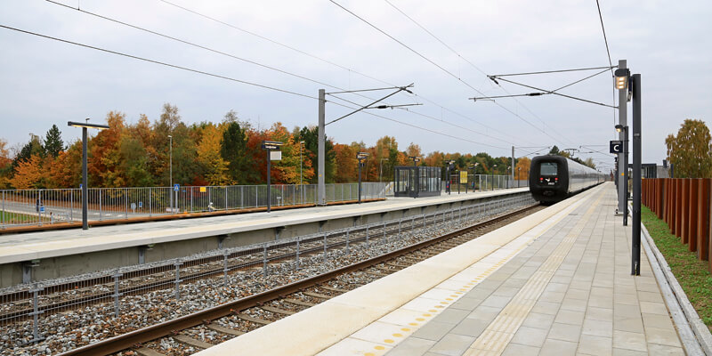
The survey work for the project, commissioned by the Danish rail authority, called for 70km of mapping including a busy 35km dual-track rail section. The 1cm specification for all observed points carried the additional challenge of precise registration to a previous survey for change detection and condition assessment to inform engineering design needs.
Time would be at a premium. The rail corridor could not practically be shut down for the weeks that a conventional survey would require – this corridor is a major artery for commerce, not only for Denmark, but also between Europe and Scandinavia. The rail project seeks to upgrade it for high-speed rail and expand the capacity of any potential bottleneck in the vital corridor.
With rail traffic through the corridor increasing every year, expanding capacity for this section became an imperative. Initially surveyed six years before, the expansion project had been delayed due to budgets – but was resurrected last year. A refresh of the survey was needed.
The time and cost benefits for mobile mapping can be substantial. Corridors mapped with conventional methods and equipment that might otherwise take days or weeks can be performed in a matter of hours. Møller’s mission became to rapidly map the corridor without putting survey crews in harm’s way. But first, he and his team needed to up their mobile mapping capacity.
LE34’s entry into mobile mapping began when they bid on a previous tender issued by the Danish government for asset mapping for the national rail system. Losing that bid to a firm with a low-precision mobile mapping system was a blessing in disguise; the experience steeled Møller’s resolve to seek a solution that could meet asset mapping needs, but also deliver engineering precisions.
Developing the process
Breaking the 1cm barrier in mobile mapping for the Odense-Nyborg project was not easy. LE34 used a combination of high-precision instruments, rigorous processing, and dense survey control to make it possible. For the data acquisition work, they selected the Trimble MX9 mobile mapping system.
LE34 developed procedures for their new system and began testing. “We first had a smaller project in Copenhagen to try out our MX9,” says Møller. “We learned that finding the right driving speed is a matter of a balance – going slow enough to get the density desired, and fast enough to minimise the time between control points.”
LE34 was uniquely poised to attempt to break the 1cm barrier for the Odense-Nyborg rail project. Six years earlier LE34 had completed a traditional survey for the line. “The original survey took several months, but in the course of the survey we had also established dense control over the entire 70km rail section,” says Møller. “There are checkbox targets, 55m apart – set with total stations and digital levels – on pairs of the pylons that support the overhead power lines for the trains. Verification to re-use the old control for the current mobile mapping survey only took a few days.”
“The control data from the old survey was still good, but the terrain, bridges and crossings data were out of date,” says Møller. “We needed to examine the entire route and identify any changes – plus add more detail in some areas.”
The new design replaces existing rails in most sections and adds new rails in others. In addition, many bridges and crossings needed to be redesigned. LE34 used this new mobile mapping project to update all 3D models of the terrain and structural features, along the route.
The mapping express
For the Odense-Nyborg rail line LE34 mounted the MX9 on a rail maintenance lorry. Møller wanted to test out different methods, with different control densities to ensure they could deliver reliable and repeatable sub-cm results.
Understanding how a high-end mobile mapping system works is key. To provide precise positioning, the MX9 includes both a GNSS receiver and inertial measurement unit. The GNSS and inertial data processed together in Applanix POSPac software can maintain high precision between control marks, but accuracy can degrade if there are lengthy GNSS outages or the control points are far apart.
Their tests showed that a speed of 45 to 50km per hour was optimal for the project.
LE34 tested different ways to process the inertial data combined with PPK (post-processed kinematic) GNSS by adjusting various parameters in the office software. It paid off. “We were very happy to see our results at 7mm,” says Møller. “We satisfied the specs for the rail project and we saved a lot of time. It took two of our surveyors one week to set it up. We performed the work safely while the trains were running. It took only a few days to verify the control – and only four hours to scan.”
The rail authority was pleased and based on the success of LE34’s work, it has approved mobile mapping as a standard method for survey of rail infrastructure. Confident in this solution, LE34 is about to embark on another rail survey, one encompassing 230km of track.
Flexibility for the future
The capability that LE34 developed with the MX9 provided the flexibility Møller was seeking. It also accommodates multiple post-processing options and standard data outputs, as deliverables requested by clients vary. “Sometimes we do extraction in TBC [Trimble Business Center],” says Møller. “But for other clients, we can customise output to go to Bentley products, TerraSolid or others.”
LE34 also has its own software team, with 24 developers. For the rail project, they were able to provide tiled, full resolution, true colour cloud access and navigation for their client with a web-based tool of their own design.
The experience of LE34 on this major rail project demonstrates clearly that if the conditions are right – dense control, rigorous processing and high-precision equipment – then sub-centimetre mobile mapping is no longer a barrier.
Jodie Hartnell (@HartnellJodie) is a freelance geographer and technology writer


