Share
3D stereoscopy is being used in Hamburg to DISCOVER where Second World War bombs might still be located on onstruction sites. Andre Gessner explains how
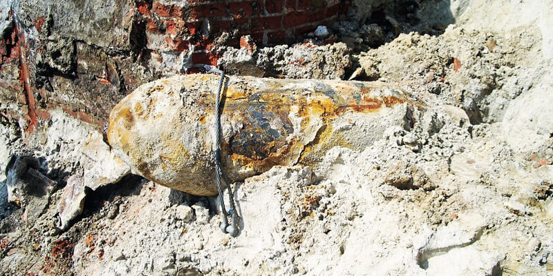
Hamburg is one of the German cities that suffered most during the Second World War. Between 18 May 1940 and 17 April 1945, a total of 213 air raids were flown against Hamburg and some 107,000 high-explosive bombs, three million incendiary bombs and 300,000 phosphorous fire-bombs were dropped.
Before any construction work begins in Hamburg, it is necessary to precisely review whether unrecovered unexploded bombs might still be buried on an intended construction site. The risk and unexploded ordnance survey (GEKV) department of the Hamburg Fire Service is responsible for categorising construction sites in the municipal area in terms of their potential risk for the presence of ordnance. Categorisation is based on the evaluation of historical aerial photographs, sourced from both Allied and German armed forces from the period between 1940 to 1946. Where available, secondary sources such as logbooks or other written records.
Every discovered impact point is precisely measured and allowance is made for the unexploded bomb’s drift. In the beginning, it was assumed that the maximum difference between the point of entry into the ground surface and the final location would be between 4m and 5m. “But today we know that it could be as much as 9m,” says Thomas Otto, the head of the department. “Last year, three unexploded bombs were found in places where during the 1990s searches were made for them in a radius of 5m around the impact point and nothing was found.”
In Hamburg, a survey must therefore also be conducted before any construction work. This requires the site owner or the party wishing to excavate the ground to submit an application to the GEKV. The applicant then receives a map section of the planned construction site containing the most precise information possible about potential dangers so that these can be investigated at as low a cost as possible. A private service provider uses this detailed information from the GEKV department to conduct an on-site search if it is suspected that unexploded ordnance might be present.
Two views
Since 2004, all analysis of wartime aerial photographs by the GEKV has been done digitally. The department interprets wartime aerial photographs to clarify whether or not there might be unexploded ordnance present. 3D stereoscopy helps to differentiate between small craters and mounds, what are suspected locations of unexploded bombs, and what are tree crowns or open manhole covers.
“A very important element of our work is spatial 3D-stereo representation, because that lets us see whether a black spot on the image is a subsidence or an elevation: A subsidence can be an indication of an unexploded bomb that entered the ground, but did not detonate,” explains Otto.
He cites another example in which overlapping two photos helps to determine a suspected case. “Stereoscopy makes it easier to see whether or not the intermediate floors were present in damaged buildings. If they were still there, that part of the site is no longer under suspicion, but if none of the floors remained, it most definitely is.”
A prerequisite for an interpretation of this type is that two photographs of the same scene taken at different times are available. A continuous series of images by reconnaissance planes was taken in most cases, with the camera being triggered at fixed intervals. However, the altitude at which the planes flew was not constant, resulting in distortions in the aerial photographs. Suitable measures enable these distortions to be almost eliminated, so that interpretation with very accurate positioning is nevertheless possible.
“When a dark spot can only be seen on one photo it’s obvious that this is an artefact, or conversely it may be the case that a black dot on the mono image reveals for example the presence of just an advertising column in the stereo image,” explains aerial photograph interpreter Matthias Otto.
The department uses Schneider Digital 3D PluraView monitors for stereoscopy. Thomas Otto asserts that “working in darkened rooms like in the 1990s is a thing of the past since the arrival of 3D PluraViews”. A system with shutter glasses had previously been used, “which put a great strain on the eyes” and the reflection from the monitors was so great that “although you could see yourself very clearly, you could only recognise the aerial images moderately”, he recalls with a grin.
The 27” and 28” stereo passive 3D monitors now used overcome these issues, offering resolutions of 4K/UHD per eye and are certified for all common 3D stereo software applications in GIS, photogrammetry and mapping. The main interpretation software used by the department is Erdas Imagine from Hexagon Geospatial and ArcGIS from Esri.
The deluge begins
Prior to digitisation, there were just over 200 applications to the department; today the number is around 11,000 per year. To keep on top of the deluge of orders and to speed up procedures, intensive efforts were made to pull out all the process automation stops. Every aerial photograph earmarked for interpretation was scanned in at high resolution. For this, it was of the utmost importance to use only raw data, because subsequent image processing can corrupt the information content.
Software was developed based on Esri’s ImageServer technology to achieve the fastest possible image retrieval. Thomas Otto adds that one major advantage of these efforts is that several staff can now work simultaneously and in parallel on the same image, something that was previously not possible on physical photographs. “That was a big step towards speeding up our procedures,” he says.
However, Otto says attempts to use artificial intelligence have not paid off: “We’ve tested and examined that very intensively. Pixel-based pattern recognition gets us nowhere, because the number of hits in automated image analysis is much too low. Just think: Only a proportion of the bombs that are actually documented in a wartime aerial photograph have been verified! That’s way too uncertain! As supporters of systematic digitisation and automation, even we have to admit defeat here. We trust digitisation and automation only where it makes sense, or more specifically where it benefits obtaining the best and most reliable result. To us that means: professional GIS software plus monitors plus a human specialist for professional analysis and the most reliable interpretation.”
Andre Gessner is head of marketing at Schneider Digital (https://www.3d-pluraview.com/en/)


