Share
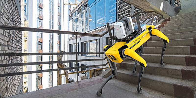
Leica Geosystems, part of Hexagon, announced a reality capture solution for a variety of industries. By combining Boston Dynamics agile mobile robot Spot with the industry-proven Leica RTC360 3D laser scanner, scanning time spent by human operators is significantly reduced by programming the devices to repeat automated scanning paths through sites. This requires minimal monitoring by the user, allowing for increased scanning efficiency, productivity, and flexibility when planning reality capture tasks. Professionals in many different industries such as construction, manufacturing, facility management, public safety, defence, media and entertainment or any other industry with autonomous scanning needs can benefit from programmed scanning tasks, especially for locations that must be repeatedly scanned for up-to-date digital twins. www.leica-geosystems.com


