Share
James Nolan drills down to reveal how varied data capture techniques and datasets are being exploited by the London Borough of Waltham Forest to optimise the use of its corporate GIS
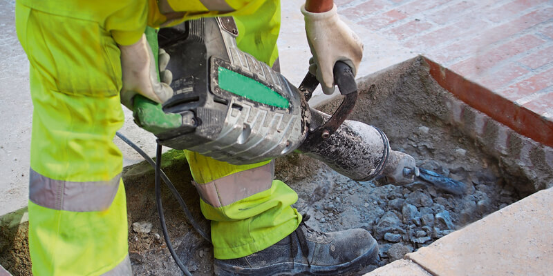
Data capture devices commonly used in civil engineering such as laser scanners, Ground Penetrating Radar (GPR) and thermal imagers, all provide data sets for Geographic Information Systems (GIS). And, as elsewhere, the Borough is using them to provide a context for future construction work and other space-related activity.
A common language
The Borough has taken part in trials of the National Underground Asset Register (NUAR) initiative1 to share location data on sub-surface utility assets that are held on a central register and displayed on a web map. This will assist strike avoidance, improve safety and provide cost efficiencies. The Borough is also working with another initiative - the Infrastructure Mapping Application or IMA (see Mapping for the future inset) - that displays planned infrastructure and development pipeline data in an online map.
These GIS resources provide precise spatial data on subsurface assets installed by utility providers and where local authorities are well placed to support the database with designation constraints and above ground information. For example, protected trees that can limit construction work are accurately captured as point assets. Similarly, lamp posts, car charging points and gullies can also act as constraints on street works. Such considerations can often stretch across Borough boundaries, and in this context, cross-border experience gained by working with neighbouring Epping Forest District Council has been very useful.
Paving the way
The Council’s GIS system has assisted its highways teams who arrange permits for utilities companies, skip and hording placement and scaffolding licenses. Other teams focus on ongoing street works, maintenance and enforcement. Data sharing helps agencies to plan works beneath the public highway with a detailed view of the position of underground cables and pipelines. Outlines of planned works in a GIS format avoid unnecessary digging and re-surfacing works by coordinating agencies working at the same site. Mapping creates a reference point of above-ground data sets overlaid with subsurface data; it also speeds up access and provides a constant view. The NUAR GIS platform focuses on precise spatial data sets, often with sub-meter accuracy.
The IMA web tool has a function which uploads specific GIS layers and overlays them with the rich data repository already in the system. Tram lines, which were set in reinforced concrete, were vectorised using historical maps and related to abandoned water mains and sewers to provide an indication of potential digging hazards. This tool generalises spatial data often captured by Ground Penetrating Radar (GPR) and is useful in assessing time series data for future projects.
Making waves
Aligning non-surveyed above ground features with underground data is particularly important when it comes to 5G communications.5G technology has a lower bandwidth spectrum and does not travel through obstructions as well as existing mobile signals. Antennae need to extend above nearby buildings to provide coverage for the residential population and commercial users. Placing masts on existing buildings no longer hold as many benefits for owners; new cell site locations are therefore sought for taller masts. A 3D building model was used so each site could be re-constructed; enhanced with a light detection and ranging (LIDAR) derived terrain model, it was viewable from the desktop. Proposed structures could be viewed to assist the planning process.
GIS databases store an increasing number of bespoke digital boundaries. These include proposed borough housing developments, children’s playgrounds and community growing areas. The vectorisation of land assets is carried out on a needs basis; once completed, it can be called on to support planning and building initiatives.
Income streams
The costs of software, data and training can be calculated; financial returns can be estimated and intangible benefits listed. In business this practice is established, and it is becoming common in the public sector.
GIS resources generate income. Charges are levied on third party operators for map production, land designation searches and for working on Council land. Other revenue opportunities include available grants, efficient billing, fee collection and measured time saved. GIS is invaluable in managing infrastructure spending on water supply, telecoms and electricity; building errors and repairs can cost millions of pounds.
The borough’s natural geography is strategically important; it is bounded by Epping Forest and by the Lee Valley reservoirs which supply 3.5 million people with water. The corporate GIS and its associated sharing partnerships provide an established way of linking activities concerning strategic assets and future development locations. The relationship between existing infrastructure providers, the Council and developers can be best be managed with geography in mind.
GIS, in the planning and policy department, supports residents with the services the council provides. With many more system users - and with external sharing initiatives - the GIS resource is increasing in efficiency with each additional user case. It is instrumental in many operational projects and in supporting vital service provision, especially in current challenging circumstances.
Keeping GIS stocked with spatial information of pin-point accuracy to provide an early warning system and a clear picture in uncertain times will show to the resident population that – wherever possible – it’s “business as usual.”
1. https://www.gov.uk/government/...;
James Nolan is the GIS Officer at the London Borough of Waltham Forest (https://www.walthamforest.gov.uk/)


