Share
A warmer world means more intense rainfall, not least in the British Isles where some five million people could be exposed to increased flooding by 2080. Tom Telford reports on a promising development that will help manage that risk
Our changing climate is, according to many experts, likely to bring an increased risk of flooding to the United Kingdom for, put simply, a warmer atmosphere can hold more moisture. This presents new challenges to those who must make long-term decisions around flood risk management. The FloodFutures suite of spatial data has been developed to meet this challenge. A collaboration between Landmark Information Group and Ambiental Risk Analytics, FloodFutures is already changing how companies such as Wales and West Utilities assess risk to their critical infrastructure.
The UK is seated on a cool temperate western margin, which means our weather is under the permanent influence of westerly winds and all the cyclonic activity that comes in off the Atlantic throughout the year. Never has this been more pronounced than the winter we experienced at the end of 2019 and early 2020.
Unprecedented events
The extent to which climate change is affecting our weather is a complex issue, but the high frequency of unprecedented events over recent years indicates that extreme weather is likely to become more common.
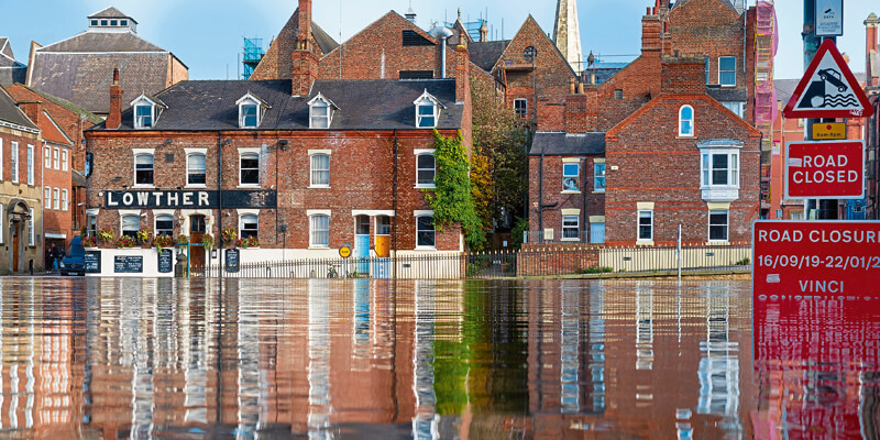
Storms Brendan, Kiera, Dennis, and Jorge all ravaged the country’s coastlines and also made a big impact inland. Swollen rivers burst their banks as many catchments struggled to cope with the amount of water entering into them. Villages like Yorkshire’s Mytholmroyd and Hebden Bridge were totally inundated and floodwaters caused extensive damage and endangered life.
Vital transport and infrastructure was also adversely affected, for example sections of the West Coast Mainline between Lancaster and Carlisle were submerged making train journeys impossible.
One of the most striking images during these events was of some new-build houses in Newport, Gwent, where the ground around them, including their gardens, were completely swept away by the Ebbw River.
Following these events, Dave Throup, the manager of the Environment Agency for Herefordshire and Worcestershire was quoted as saying “I’ve seen things today I would not have believed. This is not normal flooding. We are in uncharted territory.”
If, as a result of climate change, wetter winters are to become more common – which is what has been projected in the UKCP18 projections1 – we need to better prepared to mitigate these risks, gain a better understanding of both the current and future nature of flood risk and, ultimately, build a more resilient Britain.
Assessing the impact
For utility providers, assessing what impact climate change may have on service delivery is vital. With citizens nation-wide relying on their services, thoroughly assessing those risks and understanding the potential vulnerabilities to their infrastructure, will help them factor-in proactive measures that address such issues head-on.
This is not new to utility providers. The Climate Change Act 2008 provided Adaptation Reporting Powers that were designed to encourage and influence key organisations to report on climate change adaptation. The first round of reporting focused on organisations considered of ‘strategic importance’ to the national infrastructure, including the energy, water and transport sectors.
But how can utility providers accurately predict future climate impacts in preparing appropriate and effective mitigation plans?
A case in point
Wales & West Utilities manages the network that keep the gas flowing to 2.5 million households and businesses – serving 7.5 million people in communities across Wales and South West England.
The organisation owns and maintains more than 35,000 kilometres of gas pipes, most of which lie underground. Wales & West Utilities responds to gas emergencies and invests £2m every week connecting new homes and businesses, and upgrading old metal gas pipes to new plastic ones so the gas network is fit for a green future.
Its network stretches from Wrexham and the north Wales coast to Redruth in Cornwall. It serves a combination of cities, towns, villages and open countryside – many of which have been hit hard in recent times by extreme weather events.
Driven by the requirements of the Climate Change Act 2008 and its need to report clear Adaptation Reporting to Defra, the business was keen to identify an accurate way of modelling climate-related flood impacts across its operating area.
Two of the key risks identified were flooding and erosion, and Wales & West Utilities were finding it difficult to report effectively back to the government using UKCP09; at the time there was no way of quantifying the actual impact of risks on land where it has assets and/or provides services. As such, it was unable to quantify the related risks.
Working with Landmark Information Group and Ambiental Risk Analytics, a collaborative innovation project was launched to create Great Britain’s first national flood map … one that which incorporates both current and future predictive flood scenarios for the 2020s, 2050s and 2080s. The aim was to remove manual risk estimations and, instead, switch to modelled data analytics that could be interrogated via GIS.
Trial run
The programme to develop these mapping layers initially focused on a trial area centred on Machynlleth in mid-Wales and used Met Office climate change projections in the modelling conducted by Landmark and Ambiental.
Introducing FloodFutures: created using the latest available river flow, rainfall, sea level rise and climate change predictions, the mapped dataset depicts what a 1-in-100 year undefended event may look like, using a base layer of 2017 and applying either low, medium or high emission scenarios to present a clear insight into future hazards. By mapping the locations of Wales & West Utilities’ assets in relation to relevant river banks, transport networks and bridges, it offers the ability to view everything in topographical data layers.
Being able to model a wide variety of risks: fluvial flooding risk, pluvial flooding, tidal flooding (which also encompasses the effects of sea level change), sea level rise, sea level rise inundation areas, river bed and bank erosion potential - was all-important to Wales & West Utilities, as was an understanding of the impact on the transport infrastructure and bridge flooding heights.
The latest hydrological information on rivers and rainfall data from the Centre of Ecology and Hydrology is accessible, plus high-precision topographic data derived from the Environment Agencies’ extensive LiDAR coverage, supplemented by NEXTMap IFSAR data.
Superficial geology data has been sourced from the British Geological Survey, while detailed land use and buildings data is sourced from Ordnance Survey to determine roughness and infiltration parameterisation.
Climate predictions are derived using the UK climate projections UKCP09 – with UKCP18 to be added once fully available – for selected epochs and scenarios. Extreme rainfall events are integrated into hydrological and hydraulic modelling process. 2D shallow water modelling using Flowroute-i™, allows complex floodplain flow dynamics to be incorporated into the data analysis.
When analysing the total GB dataset for the 2080s, based on a high emissions scenario2, it shows that 29% of residential properties in the East of England will be at risk of pluvial flooding – the highest in the country. In addition, more than 1.8m residential and 439,000 commercial properties will be at risk of fluvial flooding. In all, this type of flood risk is anticipated to rise by 14% - expanding the land a risk to the equivalent of more than four million football pitches.
Managing the risk
Wales & West Utilities is able to report on notable risks, such as river bed and bank erosion, flash flooding impacting bridges, growth of floodplains, increasing flood depths, flooding of pressure reduction installations, impacts on supply chain and contaminant mobilisation and migration.
With the company maintaining approximately 1,000 river crossings on the high-pressure network, inspections are conducted using a risk-based approach. Tidal and navigable rivers are inspected annually, while minor crossings are inspected every five years.
In some cases, the pipelines come above ground at watercourses. Here, particular attention needs to be paid to the wind-waterlines and the potential for erosion of the river bank. Now, as part of the climate impact mapping, 100m segments of all relevant riverbanks can be analysed digitally.
An example is a crossing located in South Wales, where erosion of the river bank was causing an eddy current that subsequently began to erode the opposite bank. This was flagged as a potential site of high risk, leading to an interim physical inspection and the identification of a fault. Remedial work included the design of a natural barrier to reinforce the bank, and this diverted the water downstream, eliminating the eddy current.
In this example, early action avoided the potential future need to divert the crossing – with all the associated service disruption – at a cost in the region of £200,000.
Using the predictive data, Wales & West Utilities now has the ability to assess how flood risk and river erosion will vary locally and regionally at different time periods and under different emissions scenarios.
This allows the organisation to future-proof its services by investing in and protecting the network and being able to fulfil its Adaptation Reporting requirements. It also means customers are likely to face the least disruption in an uncertain era.
1. https://www.metoffice.gov.uk/binaries/content/assets/metofficegovuk/pdf/research/ukcp/ukcp18-infographic-headline-findings-land.pdf
2. Based on the comparison of a 2017 adjusted baseline 1:100 undefended flooding event and the equivalent under a high emissions UKCP09 scenario. © 2020 Landmark Information Group Ltd & © 2020 Ambiental All rights reserved.
Tom Telford is Account Director at Landmark Information Group with offices in Exeter, Reading and Brighton (https://www.landmark.co.uk)


