Share
INTERGEO’s first-ever virtual Round Table gathered experts together in June to explore industry trends. While agreeing that our world needs intensified digitalisation and networking to overcome challenges, they were equally adamant that, “Discussion doesn’t end with the Round Table – we also want to address those issues ‘live’ – at INTERGEO 2020 in Berlin!”
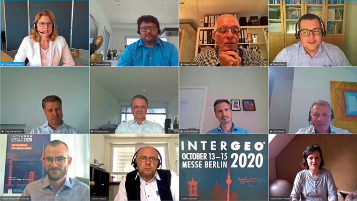
“INTERGEO 2020 is going ahead.” When INTERGEO organiser Christoph Hinte made this announcement at the start of the Round Table, participants from the worlds of business and science welcomed the news with open arms.
“Sanitising and social distancing measures for visitors will, of course, be in place, but as well as the ‘live’ event, this year’s INTERGEO conference and trade fair will be the first to offer a virtual twin.” Hinte is optimistic: “By hosting the fair in a virtual format, we expect to attract the same number of visitors as in previous years, if not more.”
Industry’s time to shine
In kick-starting the discussion, presenter Christiane Salbach from the German Society for Geodesy, Geoinformation and Land Management (DVW)* asked, “Where does the geo-IT sector stand in terms of digitalisation and networking?” Professor Jörg Blankenbach, Head of the Geodetic Institute at RWTH Aachen university, has a clear opinion on the matter: “Concepts such as GIS (Geographic Information Systems) and BIM (Building Information Modelling) that have existed independently of one another, are now merging at an increasing pace. One result of this is that georeferencing has, for the first time, been integrated into the latest version of the open BIM standard Industry Foundation Classes. It means that structural and civil engineering models are finally being docked to their geographical coordinates.”
Industry is saying the same thing. Michael Mudra from Hexagon, Ralf Mosler from Autodesk, and Janos Faust from Trimble, all stress that reality must now shift to a shared database. For them, it’s about breaking out of silos and ensuring accessible communication across different software platforms, ecosystems and, last but not least, mentalities.
Oliver Milzarek from DB Systel, the IT service provider for Deutsche Bahn AG, takes an even more pragmatic view: “Our projects now fully depend on simulation and visualisation. That’s why we need to step up to the plate. The conditions are right. Our time has come! Deutsche Bahn sees BIM as the bedrock for sustainable planning, construction and operation. Digital twins are unbeatable when it comes to transparency, too. If we network the data properly, we will reap the benefits, both now and in the years to come.”
New ways of working
Trimble’s Faust noted that attitudes to digitalisation changed overnight as the coronavirus pandemic took hold. In his view, companies are taking digital transformation much more seriously, e.g. with planning offices switching to virtual working. Hexagon’s Mudra added that anyone with instant access to automatically recorded, up-to-date and networked data that is evaluated using AI, now has a clear advantage. Mosler from Autodesk confirmed these trends and pointed out that, in the current crisis, companies are rapidly discarding traditional work models in favour of technologies that completely reconnect BIM and GIS workflows.
The theme of this year’s INTERGEO – ‘Geoinformation for a smarter world’ – reflects the role of the geo industry as a core element of the “Green Deal” … one that is expected to realise an ecological revolution. The coronavirus may well have briefly overshadowed climate change and a lack of resources, but they remain alarming issues. The Round Table agreed that geo-IT can make a significant contribution in tackling them. Indeed, in Germany alone, up to 20 percent less fuel is being used, while precision farming methods are achieving efficiency gains of 30 percent.
An appeal
As the INTERGEO Round Table 2020 concluded, participants unanimously called upon politicians to heed their cause. While the world is relying heavily on geodata in the form of dashboards to communicate and understand coronavirus, there is still too little political support for the industry’s development – despite its societal relevance now being virtually impossible to ignore.
INTERGEO 2020, with its physical and virtual incarnations, will explore these and many other issues in a responsible manner. In the words of Christoph Hinte: “As a driving force in geo-IT, we will continue to support the industry during this unusual time.”
* DVW e.V. – German Society for Geodesy, Geoinformation and Land Management e.V. is the host of INTERGEO. HINTE Expo & Conference is responsible for the management of the EXPO. Further information is available at: www.intergeo.de


