Share
Generating initial savings of more than £20k, a project designed and delivered by Morrison Water Services (MWS) for Yorkshire Water is short-listed for the Water Industry Awards 2021 thanks to its simple workflow and innovative use of geospatial technology. Lucy Hamilton explains more
MWS, a part of M Group Services, is the UK’s largest, dedicated, independent utility service provider working on behalf of regulated asset owners across the electricity, gas and water sectors.
Providing end-to-end solutions, the company is currently working with Yorkshire Water to digitally record and update attribute information on wastewater assets along thousands of metres of pipeline.
New ways of working
Although MWS was familiar with digital data capture techniques, its existing system could not deliver the precise accuracies required to capture drainage levels on the Yorkshire Water project. It meant that captured data would lack precision, resulting in disjointed information and the need for additional data checking time in the office. Additionally, MWS was aware that if real-time 1-2-centimetre accuracy was to be achieved, it could be looking at a survey grade system - a heavy investment for an application of this type.
However, through the MWS Business Improvement Platform, (a programme to spur innovation and best practice), its Northern Area team was introduced to an innovative solution that could meet the need for a simple and low-cost but accurate and integrated data capture system. This would not only fulfil needs in the field but also provide a straightforward way for storing, viewing and reporting the collected information.
Christopher Harris, MWS Regional Technical Manager, agreed to look at how this technology could potentially benefit the Yorkshire Water and similar projects, while Andrew Stephenson, MWS Design Manager, was assigned to support the technology and workflow during an initial trial.
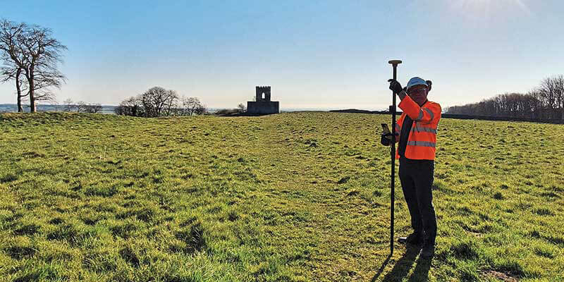
The system in question comprised Trimble’s Catalyst GNSS, KOREC Capture data collection software running on an Android phone (in this case, Trimble’s rugged TDC600), and KOREC’s secure, cloud-based portal. Lightweight and highly portable, the system would be perfect for MWS field surveyors who were traversing up to five km daily.
Innovative yet simple workflow
In order to create a workflow that exactly fitted the requirements of the project, Andrew Stephenson worked in partnership with KOREC over a test period. During the trial, customised forms for data collection were created and both parties reviewed the best way to report on and view the collected information via the portal. Once satisfied that the technology would deliver in the field and office, three systems were purchased by MWS.
A typical daily workflow sees each surveyor notified of a stretch of pipeline to be surveyed. As the survey progresses, the customised forms are populated with asset data such as its position to an accuracy of one to two centimetres; the type of asset, its depth, accessibility, and so on. A time stamped, geo-referenced photo of the asset is also added. Finally, there is a walkover to capture all the information for the ‘as built’ and Health and Safety documentation. The system then automatically generates a report for that asset in a PDF format.
Automatic report generation
The automatic generation of these complex reports is a major factor in the success of the system for MWS. All data and pictures pertaining to the asset are drawn together in a process that requires no human intervention, saving valuable time and resources which in turn, frees-up MWS staff to attend to other important business matters.
Once a capture is completed, the gathered data is automatically uploaded to the portal for checking and where anyone with permission and an internet connection can view real-time information on each asset. Data from the portal can be exported in a choice of GIS formats (including SHP, KML and CSV) to populate the client’s GIS.
An added benefit of this paperwork-free system has been to reduce travel time for resurveys … one that has also helped reduce the MWS operational carbon footprint by an estimated 1.43 tonnes. Furthermore, and due to remote working, significant savings were been achieved during the project by eliminating 60 days of travel (around 10,000 miles).
Minimal hardware investment
One of the attractions of the system is that it keeps hardware costs to a minimum on three levels:
- Trimble Catalyst – Trimble’s highly innovative GNSS is a subscription-based software receiver with cost depending on usage and accuracy. The only hardware needed is a low-cost Trimble receiver. The system supports basic Android phones and tablets.
- KOREC Capture data collection software – developed by KOREC mapping, Capture runs on a range of data loggers and phones.
- KOREC Portal – secure, cloud hosting providing fast access to information for stakeholders from anywhere with an internet connection, reducing impact on existing IT departments and avoiding the need for additional hardware.
Successful completion of Phase 1
By the end of the first phase of the project, Andrew Stephenson believes that not only have their three systems greatly improved the workflow – delivering on time and to budget – but also generated savings in excess of £20k. “To be able to capture site data at 1-2cm accuracy using just a mobile app and a Trimble Catalyst is second to none!
“The hardware used in the field makes it perfect for staff with mixed IT experience, and the ability to export data in a variety of formats widens its range of potential uses, adding even more value and driving significant efficiencies across the industry.” Phase 2 of the project with Yorkshire Water is now underway.
Lucy Hamilton is PR Manager at KOREC Group headquartered in Huntingdon, Cambridgeshire (https://www.korecgroup.com)&nb...;
Many thanks to Andrew Stephenson, Design Manger, MWS (www.morrisonws.com) for supplying the information and pictures used in this article


