Share
New cloud-based workflows are becoming vital as the marine survey industry mobilises to meet new levels of demand driven by the unprecedented growth of offshore wind projects globally. Jann Wendt and Frithjof Hennemann explain why
Led by the need for clean and renewable energy sources to help reduce greenhouse gas emissions and mitigate the impacts of climate change, the offshore wind sector has global targets to grow from 34GW of production capacity in 2020, to 330GW by 2030. Challenges persist however and the proposed tenfold expansion is not going as well as expected.
According to The Global Offshore Wind Market Report by Renewables Consulting Group (RCG) in November 2022, from the 15 countries with ambitious 2030 growth targets researched, only Vietnam, Poland, and Denmark are on the right course to achieving their goals. Political, social and commercial issues have already stalled the ambitions of the other nations, while technical challenges continue to affect wind farm development as new licences come up for tender.
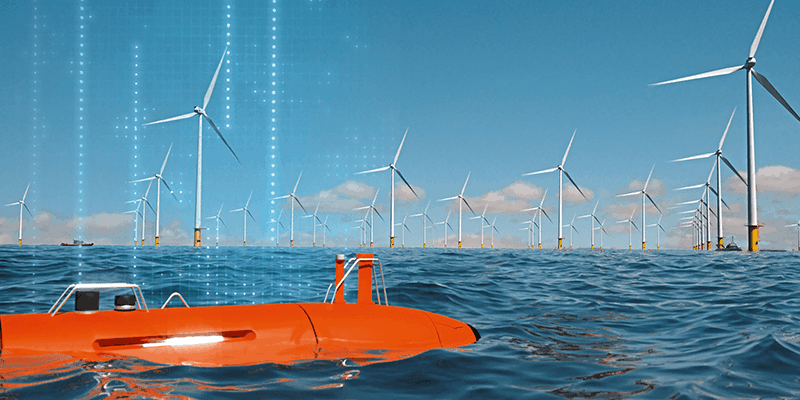
Optimising the acquisition and management of marine data is one of the more pressing technical challenges because more wind farms demand more service capacity from the survey industry. From locating new sites through planning and engineering surveys, each development stage requires significant amounts of underwater geophysical and geotechnical data to proceed. The work doesn’t stop when the wind farm is built either; regular surveys and underwater inspections are required as part of the operations and maintenance regime, to help ensure the integrity of turbines and associated infrastructure.
THE OFFSHORE WIND PRODUCTION TARGETS ARE A DOUBLE-EDGED SWORD FOR MARINE SURVEYORS
The offshore wind production targets are a double-edged sword for marine surveyors. On the one hand, the potential for business growth and sustainability is huge. On the other, companies must work to address roadblocks in the established survey process to unlock capacity and ensure they can fulfil the renewable energy industry’s demand for data.
Cloud data management
A key innovation at the data acquisition level is the use of autonomous underwater or surface vessels and more intelligent multibeam systems that can operate with less human intervention, therefore allowing more work to be carried out by the same number of surveyors. But as autonomy helps marine surveyors to collect data more efficiently, seamless transfer, storage, analysis and sharing is vital to ensure its full value can be tapped.
The cloud offers the foundation for a much-needed dataspace that can smooth out the current inefficiencies in marine survey. Cconventional methods of transferring data from survey vessels to the office, including email, FTP and sending data drives via courier are dependent on manual processes and therefore error-prone, and slow. And, especially in the context of using physical hard drives, data may be lost, stolen or damaged in transit and the cost of vessel, personnel, fuel and equipment combined can quickly run to circa €200,000 if the survey needs to be redone.
The ideal solution for data transfer is to leverage high-speed satellite networks on board survey vessels, allowing data to be automatically transmitted to the cloud in real-time. Unfortunately, satellite service capacity and cost still pose barriers to widespread implementation. The maritime satcom sector is witnessing a surge in speed and capacity however, thanks to the influx of new bandwidth from new satellite constellations. This trend is expected to continue, resulting in more cost-effective and readily available satcom connectivity in the near future.
Additionally, windfarm owners have the option of installing their own internet connectivity via fibre cables, offering high-speed Wi-Fi across the windfarm. While this service could be leased by marine survey companies, the potential for its implementation requires significant infrastructure investment.
For now, terrestrial Internet connectivity remains the most efficient option for transferring survey data to the cloud. This can be done through manual or better still, automatic transfer when connected to WiFi in port. Ideally though, data can be sent without human intervention via cellular networks when the vessel is in range, with 4G reaching up to 20 miles from shore providing a valuable head start in the process.
Digitalisation unlocks automation
It’s after data transfer that the real benefits of digitalisation start to reveal themselves. Using the TrueOcean Marine Data Platform (MDP) as an example, as soon as the data arrives the quality control process begins automatically. This provides data specialists another head start in cleaning and analysing the survey results.
Automation is key to gaining time at this stage, but in order to enable it the MDP is designed to be sensor and data format agnostic, which allows for the pre-analysis and integration of any data generated by systems from any manufacturer. This amounts to hundreds of different source formats. It’s achieved through the use of an open, non-heterogeneous format called Parquet so that users can access the data during processing without the need for expensive software licenses for handling specific or ‘one-off’ data formats.
Parquet also facilitates faster and more efficient access to marine data for third-party professionals also, enabling easier collaboration across disciplines. In comparison to the conventional data sharing methods such as email, FTP or physical delivery, the use of the cloud can revolutionise the way data is processed. By simply sharing a secure link, approved collaborators can access data instantaneously, saving time while maintaining tight version control automatically.
Further, by granting access to all relevant stakeholders, including the marine survey company team, third-party experts, the client, and the client’s engineering contractors, the traditional method of final data delivery is no longer necessary. Instead, all parties can be notified when the data reaches specific milestones, making it ready for action by specific users. This streamlined approach significantly streamlining the processing workflow.
Energy transition
Digitalising and automating marine data management brings about increased efficiency, reduced costs, tighter collaboration and improved data security, with significantly lower risk of human error. The acceleration from ‘ping to cloud’, along with the implementation of a single platform for all stakeholders won’t solve all the challenges of achieving tenfold growth in global offshore wind capacity. It will however ensure that those marine survey companies that do go digital can help to remove at least one of the many roadblocks that slows the global energy transition down.
Jann Wendt is founder of True Ocean GmbH; Frithjof Hennemann is CEO of TrueOcean GmbH


