Share
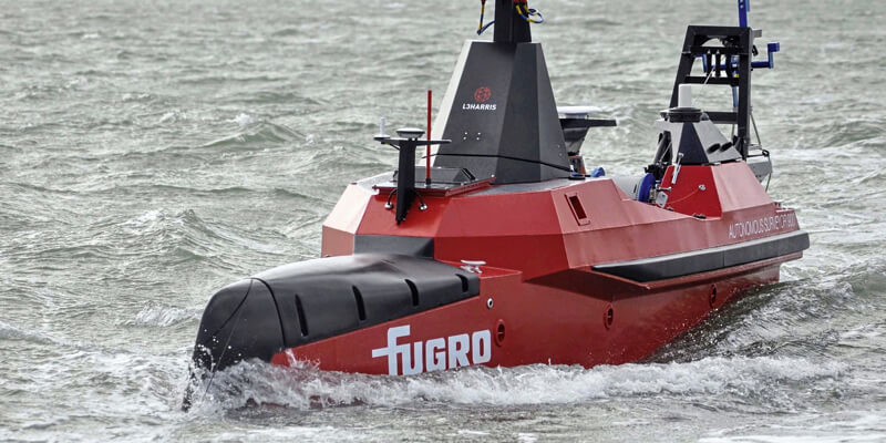
Fugro has been selected to chart the waters of South Australia’s Gulf St Vincent and Investigator Strait as part of the Australian Government’s HydroScheme Industry Partnership Program (HIPP). The 998 km2 survey will be conducted on behalf of the Australian Hydrographic Office (AHO), who will use the data to update nautical charts for safer navigation. Data will also be shared with scientific agencies, including Geoscience Australia and the national AusSeabed community. This area within Gulf St Vincent and Investigator Strait is the major waterway for the approach to Port Adelaide and features adjacent marine parks and habitat protection zones of national significance. Fugro will deploy a new uncrewed surface vessel (USV), Fugro’s Autonomous Surveyor-900 (FAS-900), to expedite data collection, the first time this technology has been deployed in Australia for the AHO and a demonstration of the innovations being developed to improve the safety and efficiency of data collection in the marine estate. www.fugro.com


