Share
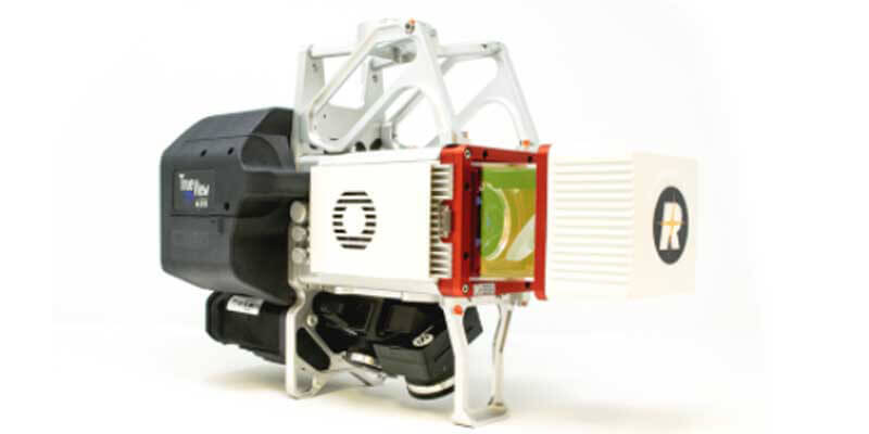
GeoCue Group has updated its Riegl-based True View 3D Imaging Systems (3DIS) with the launch of the new True View 635/640 3DIS. GeoCue’s True View 3DIS family brings a unique combination of fused LIDAR sensors and photogrammetric cameras in a fully calibrated platform, allowing direct generation of high accuracy, colorized LIDAR data in less time than is required to fly the mission. GeoCue’s first generation of Riegl miniVUX-2UAV-based 3DIS integrated systems, the True View 615 and 620, introduced compact, survey-grade 3DIS providing high network accuracy and precision (low noise). Combined with GeoCue’s integrated data processing software suite, True View EVO, all GeoCue 3DIS include the full post-processing software workflow, including direct integration with Applanix POSPac. www.geocue.com


