Share
Seppe Cassettari reflects on the need for a detailed, comprehensive national land use database, and believes the time is right to put words into action
One of the benefits of not working full time is the opportunity to revisit areas of interest and catch-up on books cast aside for ‘sometime in the future when I have the time’. I’ve recently been reading ‘The making of the English Landscape’ by W. G. Hoskins, first published in 1955 and republished in 2005. The book is about human ecology, the relationship of people to their environment. It makes the point that the UK landscape is largely a function of years of human management and that many of the patterns we find there, even if we are not really aware of them, are much older than one might at first realise.
The origins of settlements can often be traced to the Romano-British period over 2,000 years ago if not earlier, and field and parish boundaries often find their origins pre-date the Domesday book. Even our large cities contain, at their core, the old rural patterns of settlement and communication, albeit with the land no longer tilled or grazed, but infilled by the suburban sprawl that accompanied industrialisation. Quoting Jacquetta Hawkes, Hoskins characterises this as, ‘the massive ugliness of the nineteenth century and the shoddiness of the twentieth’.
The thesis here is that by understanding our current patterns of land use and how they evolved we can better plan for the future.
Extraordinary feat
Some of you will be familiar with the First Land Utilisation Survey of the 1930’s which was published as a national classification of land use and printed on the, then, one inch to the mile Ordnance Survey topographic series. This was compiled through extensive field work and the use of aerial imagery. The mapping had 15 classes and gave a good overview of the rural landscape, although there was very limited detail in the cities. It was an extraordinary feat of data collection and set a marker for future aspirations.
Unfortunately, a Second Land Utilisation Survey published in the 1960’s on 1:25,000 scale maps was never completed due to lack of funds. Today we still do not have a national land use database which is collected and maintained to the necessary level of detail to support the level of change demanded by modern society.
There have been many attempts to create a more useful land use classification. A study I conducted for a London Borough in the early 2000s attempted to draw together five different classifications it had created, collected or been gifted over a 30-year period.
Missed opportunity
This interest in creating a national land use model culminated in the development of the UK’s National Land Use Database (NLUD) Specification, with the latest version (4.4) being published in 2006. This last version embraced the idea that both land use and land cover classifications are needed. It was intended for widespread adoption as a national standard but this never materialised.
Why is all this important? For a start, property developers need a better understanding of how we currently use our environment and. in planning for the future, how change will affect it. Huge amounts of house building, often in areas subject to flood or historic mining, call for a new evidence-based approach. Again, environmentalists and farmers need accurate land use information in adapting our rural landscape to climate change. Similarly, de-industrialisation and the rise of home working all reflect changing land use imposed on existing patterns of settlement and communication.
But there can be no better example of this need to understand and better map our land use than the demands of rolling out the new 5G telecoms networks. However, the landscape classifications adopted for modelling mobile signal coverage for 3G and 4G were limited in terms of categories and level of detail.
Third time lucky?
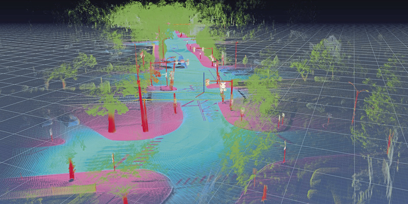
To move to a successful 5G world, the networks need to have a far greater understanding of the distribution of buildings, structures and features, their size, use and construction materials and how they impact on signal strength.
There is a need for finer resolution than hitherto envisaged and if you believe some proponents of 5G who offer the prospect of driverless cars, automated wireless production and interactive real-world gaming as some of the real benefits, it all hinges on understanding the distribution of street furniture, garden walls, ditches and hedgerows.
The telecoms database produced by Geomni UK for its 5G clients is a partial solution. But I suggest that it needs to be merged with OS MasterMap and data such as the Geomni building classifications to have real value in modelling detailed 3D land use.
Probably now, more than ever, we need a national, detailed land use database that is well maintained and accessible to all who use it. Now seems like the right time to invest in a comprehensive ‘third’ land utilisation programme based on NLUD 4.4.
Dr. Seppe Cassettari is a GIS professional, with more than 25 years’ experience in developing and applying geospatial technologies in the public, private and educational sectors. He was most recently CEO of The Geoinformation Group (now Verisk’s Geomni UK business)


