Share
We asked Spyrosoft’s Jaroslaw Marciniak to reflect on Geovation’s prestigious International Geospatial Awards and his experience in judging this year’s entries
GEO: Can you describe your experience in judging awards that help to inspire innovation across the geospatial domain, both nationally and globally?
Jaroslaw Marciniak (JM): I had the option to choose which category of the competition to judge and decided on Land, Sea and Air because of my familiarity with clients and projects in this category. Entries for this category were invited from start-ups offering new products and services, as well as those pursuing innovative research and novel data capture methods.
GEO: What does this competition mean for the industry and what impact does it have?
JM: One of the main goals of this competition is to promote innovative solutions in the geospatial sector. For that reason alone, I believe it plays an important role, pushing it forward and allowing it to continuously develop.
This is confirmed by the fact that the Awards have become more international in the past few years and now attract entries from across the world. This emphasises the growing importance of the competition and its ability to offer insight into some of the fascinating developments that are taking place at home and abroad.
GEO: On what did the judges focus when evaluating entries?
JM: In the Land, Sea and Air category, we focused on four main criteria. The first was innovation in the use of geospatial data to solve specific problems and challenges. The second was the application of different technologies to bring ideas to life and solve stated issues. The third was related to the first, as it also referred to innovation. However, here we looked at it from the standpoint of the idea itself and the project as a whole. The last criteria was the openness and accessibility of the solution created and which enabled other people to use it or contribute to its further evolution.
GEO: What were your expectations regarding the competition and the entries submitted?
JM: I was particularly intrigued by project entries that translated innovative ideas into commercial products rather than those that were focussed solely on research. I expected to see more entries from smaller businesses and start-ups that would utilise and present diverse data sources in new ways. For this reason, I was quite surprised to find that large, well-known companies or entire national-level organisations were also submitting entries.
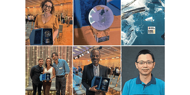
One of the latter entries involved collaboration between a government-affiliated organisation in one of the
Caribbean countries and a major corporation. It involved mapping marine life in the Caribbean Sea basin using innovative methods, including attaching cameras to animals such as sharks. In doing so, the project participants were able to gain a new perspective on undersea activity.
GEO: What aspects of the various entries were most significant and intriguing to you?
JM: My main area of focus was, of course, on innovation. And in this I mean innovations that aim to benefit end users, communities and businesses – as well as the innovators.
It is important to say that innovation is not just about new ideas – it also requires funding and the ability to make money for itself. For me, it is about introducing novelty and unique value that can be applied for a specific purpose and on which further solutions can be built. Those were the aspects to which I paid most attention when evaluating entries.
GEO: What innovations and technologies do you think played the most prominent role in this year’s entries?
JM: I was the most impressed with and gave the highest grades to proposals that merged various technologies. As usual, one of the essential elements of the competition was that of data acquisition, with an emphasis on large-scale data capture. The growing popularity of drone and satellite-acquired imagery was a case in point and, here, entries were judged from the viewpoint of potential end users, both in terms of ease of access to the solution and also the appropriate use of geospatial data visualisation.
This year was particularly notable for submissions that emphasised the growing popularity and application of Artificial Intelligence, e.g., in helping extract more information from collected data, provide more in-depth analyses, or create automated summaries. However, what surprised me in terms of utilised technologies was the very limited use of Mixed Reality or Augmented Reality in the Land, Sea and Air category – quite contrary to my expectations. So, there is still potential here for the future.
GEO: Were there any particular good practices relating to technology and innovation that appeared in the competition entries?
JM: Good practices relating to accessibility to solutions were a feature of many entries. This was evident on two levels. The first was the possibility of integrating data or the entire solution with others on the market. The second was accessibility in terms of use through various media, e.g., desktop or mobile. It is great to see this approach in projects because it shows that solutions are less often closed and available only to the entity that invented them. Instead, we now see more willingness to share knowledge and ideas, make APIs available, and follow open data standards.
What’s more, a significant number of those initiatives make use of open-source tools. The Open Geospatial Consortium (OGC) toolset was particularly popular. Of course, some submissions employed solutions from major players such as Esri. These left their imprint, especially in the realm of data processing. Nevertheless, many of the entries were tailored solutions that utilised OGC group features and combined them with additional cloud or AI technology.
GEO: What technology trends emerged during the competition? And what impact might they have on the future of the geospatial sector?
JM: As I have mentioned, Artificial
Intelligence stood out, though it’s not necessarily a new trend. I have been seeing interesting applications of AI solutions in many geospatial areas for quite a while now. Some of them focus on extracting detailed information from spatial data, others on helping to analyse and make decisions based on various data sources. Nevertheless, the popularity of the technology in this year’s competition was striking.
Another noticeable trend was the industry’s emphasis on interoperability.
Many projects focussed on providing data
and solutions that could work within a broader ecosystem. I think this approach
is relatively new in the geospatial sector. It is an excellent sign, demonstrating that companies are not locking themselves
into one solution but working with a
point-to-point perspective.
GEO: What was your favourite competition entry, and why?
JM: I granted the highest scores to a project that integrates satellite data with AI-based solutions. This approach helped enhance data quality and automatically form correlations between different data sets. It was a very clever use of these technologies.
The project’s key feature was the open sharing and analysis of time-series agricultural crop data on a global scale and in very high target resolutions. This platform aggregates data, performs analyses, and then allows the results to be used in other systems.
Another thing I really liked about this project was the ‘API first’ approach. The premise of its creators was that they are the source or intermediary of the data, and others can create further solutions based on them. This project clearly demonstrated the growing importance of sharing data and open solutions, which is why I rated it highly.
For me, the most important aspects were globalisation, accessibility, and the use of innovative technologies and solutions that permit data sharing with various parties. These were the areas to which I devoted most of my attention when evaluating project entries.
Drawn from nearly 100 entries from 26 countries, full details of the winners and those highly commended in the four categories of this year’s competition can be found at https://geovation.uk/insights/...;
Jarek Marciniak is the Geospatial Business Unit Director at Spyrosoft (https://spyro-soft.com), one of Europe’s fastest growing IT companies, with over 1500 experts, delivering complete digital transformation services from concept, through delivery, to maintenance. He can be found on LinkedIn at https://www.linkedin.com/in/ja...;


