Share
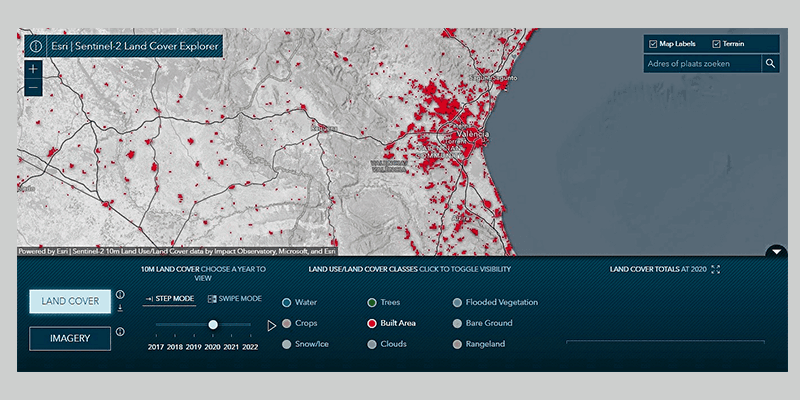
Esri, the global provider of mapping and location intelligence, has released a new online application, Sentinel-2 Land Cover Explorer. The app is structured around a web-based version of its own high-resolution global land-cover map, derived from European Space Agency (ESA) Sentinel-2 satellite imagery. The app is easy to access and leverages the same geographic information system (GIS) technology behind the land-cover map. The app, map, and source Sentinel-2 imagery are all part of the company’s ArcGIS Living Atlas of the World. Change analysis is fundamental to a deeper understanding of LULC maps, and Sentinel-2 Land Cover Explorer provides various ways of detecting and reporting changes, including visual change analysis; statistical change analysis; visual change validation; and dynamic charts for percentage changes and trends over time. www.esri.com


