Share
Mark Poveda says taking a fresh look at your workflow can do wonders to improve your effectiveness and counter the shortage of geospatial skills
There’s no hiding from the fact that, like the construction industry, the geospatial community is suffering a debilitating shortage of labour. Recently, I’ve talked to a number of KOREC customers with a worrying complaint: they have far more work than they can handle and the order book is full, but delivering within a 10-day service agreement places a tremendous pressure on both field and office staff and, because of this, some businesses are even losing money.
In the long term, the solution is to entice a new generation of tech savvy, motivated surveyors to the industry, but from a day-to-day business point of view, this is out of our control.
So what can we do right now that is within our control?
If I could give one bit of advice, it would be to digitise aspects of your workflow or, for even bigger results, establish a complete end-to-end digital workflow. Here at KOREC, without a doubt, our most successful customers have done just that. Technology has evolved dramatically within the last decade and has become far more accessible, and while establishing a complete end-to-end workflow takes time and planning, we’ve also worked on many projects over the years that have reaped excellent benefits from a smaller scale approach. Here’s how:
Digitising your workflow
A company responsible for manhole surveys asked us to replace its pen and paper manhole cards with a digital solution. By using a handheld mapping GNSS and field data capture software with built-in templates, it was able to improve data quality and cut office time by 70%.
In another project, a utilities services company needed to collect assets with 1-2 cm accuracy along with complex attribute information. Using field data capture software with compulsory fields to fill in, the completed asset information is then automatically sent to their KOREC portal for checking. This new methodology increased accuracy, reduced fieldwork and cut out paperwork and processing through an automated reporting function. The company saved over £20k in just the first phase of this project.
Improved productivity was the goal of an HS2 contractor that needed to undertake a topo survey on a site filled with ditches and tree canopy. By switching its standard GNSS for a Trimble GNSS with TIP Tilt technology and ability to handle tough GNSS conditions, field productivity was improved by 30%. The contractor is also using Trimble Active Sync technology so that data can be speedily exchanged between the site and the office.
Building an end-to-end digital workflow
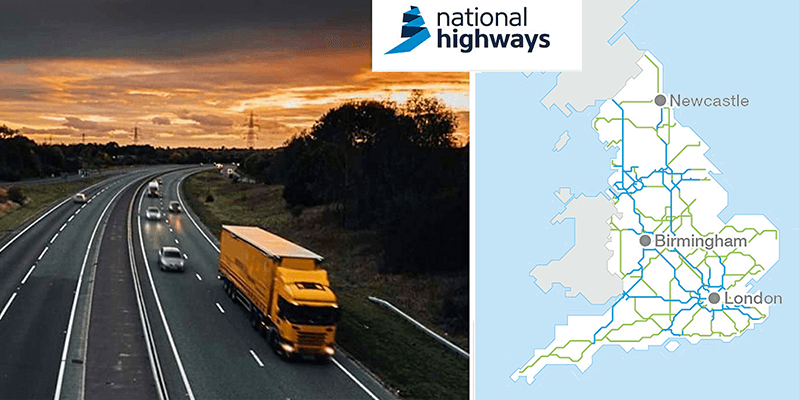
A great example of this is National Highways and its digital transformation strategy for the concrete roads programme. The full story can be found at korec.group/nationalhighways and whilst I appreciate that this is large project, their principles are entirely scalable:
National Highways is investing £27.4 billion in the strategic road network (SRN) between 2020 and 2025. Digital data and technology are critical to its main objective: providing safer, smoother and more reliable journeys for its customers.
The aim of National Highways was to tackle some of the broader issues. For example, defects were recorded by chainage using only pen and paper and therefore lacked an accurate position and visual detail; there was an information lag between the information being collected, transcribed, and reports being prepared and shared with different stakeholders; collected data was effectively siloed with no single source that could be referenced by the different stakeholders. Because of this, once surveyed, the works management process was disjointed.
On the right road
To handle these issues, National Highways adopted a number of new digital technologies including mobile mapping, Machine Learning, digital field data capture, and a centralised and secure cloud-based portal where all the information held can be accessed.
The end result is a two-way data flow between the field and office that vastly increases the efficiency of operation, speeds up processes and saves money as the same amount of work can be handled in just one shift, with estimate savings of around £20k on each 5km stretch of highway.
The labour shortage in the geospatial industry poses challenges, but technology and automated workflows offer effective solutions. By embracing automation, enhancing data processing capabilities, enabling remote working, integrating AI and ML, and working collaboratively, businesses can mitigate the impact of the labour shortage. It all goes to maintain growth and ensures that the geospatial industry continues to play a vital role in shaping our world.
Mark Poveda is Group Commercial Director of KOREC Group (www.korecgroup.com)


