Share
A new framework to help government create better, more appropriate maps is in the offing. Seppe Cassettari explains why and what it means in practice
The British Cartographic Society (of which I’m proud to be the current president) has just signed a Memorandum of Understanding with the Government Geography Profession (GGP). It covers a framework whereby the Society can provide guidance and support to those working in all parts of government to help them create better, more appropriate maps. This is the first of what we understand will be several MoUs with organisations that comprise the wider geospatial community, but the BCS is chuffed to be the first.
But why are such agreements necessary? All members of the GGP could, if they so wished, join the BCS or any other learned, professional or trade body and get the same support and advice.
The reason is more to do with the way geospatial has become a ubiquitous resource we have all embraced as part of our everyday lives. Making maps is now not solely the purview of specialists, well trained and highly skilled as they are. It is now something anyone can attempt. The tools are readily available at little or no cost, and people working in many other specialisms can generate their own maps. And many do, across government and beyond.
Not fit for purpose
The problem is that so many of these maps are just not fit for purpose. They do not communicate the essential geographic message the author is trying to convey in a way that is easy to understand.
There are, of course, standard map layouts for colour schemes, text formatting, symbology and marginalia that can be applied to the standard maps datasets with which we are all familiar. These are fine, but often limited in their scope. Those who step outside the comfort of using a standard template need to have some knowledge of map design and how maps work at the user level. This is where support materials, short training sessions and ‘how to’ advice become so important.
As part of its initiative with the GGP, the BCS has also relaunched a programme it ran for a number years under the title Better Mapping. It included many face-to-face events to show map users how they could improve what they do and thereby increase the impact of the message they want the map to convey.
So this begs the question ‘Is the demise of the cartographer imminent?’. As you would expect, all those in the BCS believe wholeheartedly that the answer is a resounding No.

Underlying reality
But there is an underlying reality that everyone using geospatial data faces. As a subject, it is underpinned by basic principles that have not changed for decades, but the technology is constantly re-inventing itself. Which means we create new terms, labels and names for much the same thing that existed at the start of the GIS revolution.
A GIS Technician of the 1990s is now more likely to be a Geospatial Data Analyst, or some such. The word cartography is dated in many people’s eyes. It implies traditional map making, old-fashioned styles, historic records ...
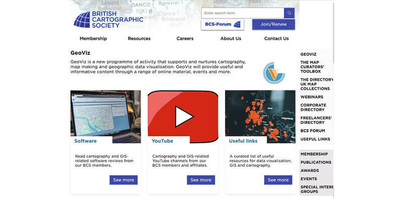
But the principles of cartography have not gone away. If anything, they are now more important than ever. We just call it something else – Data Vizualisation seems to be the current buzz phrase. So the BCS has called its new programme to promote better mapping GeoViz (short for geospatial vizualisation). It seems to capture the current view that the technology allows us to be much more creative in the way we design maps. They can be dynamic, interactive, multi-dimensional. In fact, they can embrace all sorts of new and exciting formats and media.
The BCS runs awards each year for the best examples of maps from around the world. There are still many traditional map styles, which when brilliantly executed, can absolutely blow you away. But there are also many people working on great new ideas about how maps could and should look in the future. A new generation of cartographic designers (sorry, data visualization experts!).
Rise of the amateur cartographer
It is important that good practice underpins maps that are created both by mapping professionals and by those who are not trained in the subject. The rise of the ‘amateur cartographer’ has to be supported by sound advice and support.
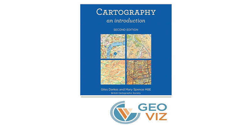
The BCS published a book on the principles of Cartography back in 2017. It is used the world over as an introduction to the subject of how maps should be designed and is used as part of the GeoViz programme as the basis of support materials available through its various partnerships.
So, to paraphrase Mark Twain, the report of the death of the cartographer is much exaggerated. Whatever label we want to hang round our necks as a way to show off our skills, the underlying knowledge we need to make good, effective maps that communicate well with the intended user, is critical.
Cartography, again sorry, Geo Vizualisation, is not dead. It is, in fact, burgeoning as a skill set that more people want - and need - to embrace.
Dr. Seppe Cassettari is a GIS professional, with more than 25 years’ experience in developing and applying geospatial technologies in the public, private and educational sectors. He was most recently CEO of The Geoinformation Group (now Verisk’s Geomni UK business)


