Share
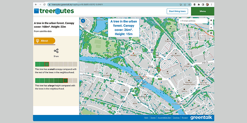
Greentalk, a London-based ecotech start-up, is offering a map of trees from Bluesky International within its online urban forest engagement platform. Incorporating Bluesky’s National Tree Map data, Greentalk will be able to provide accurate height, location and canopy coverage data for trees three meters and taller across the UK. Greentalk’s platform has already been deployed by London’s Hounslow Council and is designed to encourage greater interaction with the outdoors. It can also support corporate wellness programs, assist social prescribing initiatives, help identify new tree planting locations and facilitate climate action plans. Bluesky’s National Tree Map data sits within a Mapbox environment, which includes base mapping of the urban landscape providing context for all the green and blue data presented by the Greentalk platform. www.bluesky-world.com


