Share
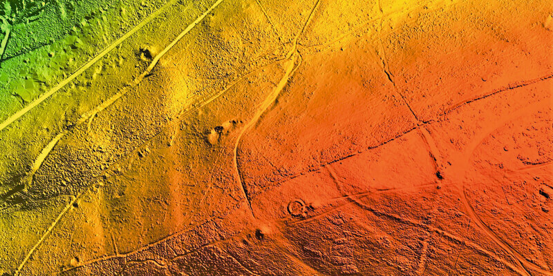
A high precision terrain mapping project has revealed more than 400 ‘new’ archaeological sites in England’s first Area of Outstanding Natural Beauty (AONB). Commissioned by the Quantock Landscape Partnership Scheme (QLPS) and undertaken using the world’s first hybrid airborne sensor by Bluesky, the survey has also helped identify a rare early example of a nationally important monument. The QLPS is a £2.6 million National Lottery Heritage Fund (NLHF), 5-year project, created to address changing pressures on the Quantock Hills AONB and the surrounding parishes in Somerset. The scheme comprises 23 individual projects spanning natural and historic heritage, community engagement and education. Each project is intended to contribute to the long-term future of the hills by protecting, restoring and increasing understanding of the distinctive features of the Quantock landscape. www.bluesky-world.com


