Share
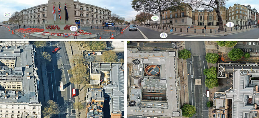
Aerial mapping company Bluesky International is working with the Dutch mobile mapping specialist Cyclomedia to bring together imagery and height data, captured from the air and at street level, to fuel a growing demand for virtual city applications in the UK. Cyclomedia currently captures and processes around 375,000 miles of 360-degree panoramic street level images and LiDAR data worldwide – the equivalent to 30 million recordings a year. Enhanced by powerful Artificial Intelligence powered analytics, this data provides large scale systematic visualisations of physical environments, using specialised technology, from moving vehicles. Using its hybrid airborne sensors, Bluesky has already flown many UK cities. www.bluesky-world.com


