Share
Edward Peveler & Wendy Morrison describe how archaeology, LiDAR, and Citizen Science are shedding new light on Bronze and Iron Age history in the Chiltern Hills
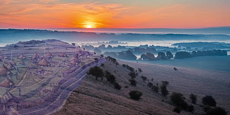
Beacons of the Past (BotP), a project initiated by the Chilterns Conservation Board (CCB), has been investigating the archaeology of the Chiltern Hills in Southern Britain1. It is a landscape that has a pivotal role in our understanding of the human colonisation of upland spaces in post-glacial Britain, as well as the development of farming on marginal soils, and the evolution of power and regional tensions in the later prehistoric period.
The Chilterns Area of Outstanding Natural Beauty (AONB) provides an ideal test case for a landscape-scale, high resolution archaeological LiDAR study. The key reason for this is the Chiltern woods. Over 22 % of the 833 km2 AONB is today covered by woodland (more than double the average for England), and about 60 % of this has been found to be “Ancient Woodland,” i.e., continuously wooded since before AD 1600.
Environment Agency (EA) LiDAR data has wide, and growing coverage of the UK. In the Chilterns, large areas are still yet to be surveyed by EA, with completion planned by 2021. The EA data which does exist for the region has often been flown at one metre resolution, at which many archaeological features are indistinct or unidentifiable. This is particularly exacerbated under tree cover, where ground point densities are inevitably lower than for open ground.
Bespoke LiDAR survey
A bespoke LiDAR dataset was therefore viewed as being of great benefit for enriching our understanding of this landscape. With funding from the National Lottery Heritage Fund and other partners, the UK’s largest bespoke high-resolution archaeological LiDAR survey was commissioned and undertaken between December 2018 and April 2019.
Encompassing 1400 km2 (Fig. 1) and flown at a minimum ground point resolution of 16ppm utilising the Riegl LMS-Q1560 LiDAR sensor, the survey offers not only the potential to reveal thousands of new archaeological sites, but also in keeping with the mission of the CCB, point cloud data can be used to record and monitor tree canopy and hedgerow health.
Airborne LiDAR has for some years now been recognised as an excellent method for identifying and mapping extant archaeological earthworks. The precision of the technique, and the use of specialist visualisation methods, allows even subtle, heavily eroded archaeological features to be identified.
The technique is particularly powerful in wooded landscapes and where traditional approaches to archaeological survey are made more difficult for several reasons:
- Aerial photography for cropmarks or parchmarks (variations in crops and soils where underlying archaeology shows though to the surface) is of no use
- Earthworks are more difficult to spot among undergrowth
- There is no ploughing to bring artefacts to the surface, and
- GPS and Total Station surveying is made difficult by the trees.
Ancient Woodland, however, provides an excellent opportunity for archaeologists: the ground beneath these trees has lain undisturbed for at least 400 years, protected from the damage caused by ploughing or development. The high proportion of Ancient Woodland in the Chilterns, combined with the development protections of its status as an AONB confers two further advantages: it is both a landscape that has been relatively difficult to study hitherto; it is also a landscape with exceptional preservation of archaeological features (Fig. 2).
Citizen Science
Faced with the prospect of dealing with a massive amount of new data in a short period of time (funding for the project terminates at the end of 2021), BotP turned to the idea of embracing Citizen Science for analysing the data for archaeological sites.
With the help of our developer, Steve Smith of Go Studio, we designed and built our own bespoke platform, the Beacons of the Past LiDAR Survey Portal1 (Fig.3) that gives the public immediate access to multiple visualisations of the LiDAR-derived Digital Terrain Model, along with historic and contemporary base maps and satellite imagery.
Users are provided with the tools for navigating the maps, exploring sites of interest, and recording their thoughts on what the earthwork features might represent. Tutorials available on the website explain how the dataset was captured and processed and how to interpret it for archaeological sites.
A second tier of more experienced volunteers work in our “Review portal,” assessing the submitted Citizen Science records and deciding whether to add them to the master database of archaeological sites. The platform also has a social element in the form of a forum, where volunteers can talk among themselves and share their ideas and discoveries.
Launched on 12 August 2019, the Portal has at the time of writing nearly 4,000 registered users, with more than 500 spending considerable time on the site. More than 10,000 records have been created, and over 4,000 records have so far been vetted through the Review Portal to be incorporated into regional and national level Historic Environment databases.
Global reach
When designing and implementing this method of engaging the public with LiDAR data, we could not have known what was in store; however, the onset of the global pandemic and restricted socialisation really accelerated the way in which people began to embrace online activities as a way of staying engaged in the wider world during lockdown periods.
Not only has the Portal allowed people from all over the world (Figure 4) to engage with a new technology and with the concepts of remote archaeology, but the social aspects such as the Forum and the frequent online ‘mapathons’ - virtual teamwork led by the Project’s Landscape Heritage Officer – have helped keep isolated people in touch with a wider community.
Conclusion
Beacons of the Past is shedding light on the previously hidden landscapes of the Chiltern Hills, revealing thousands of previously undiscovered archaeological sites, and allowing new and detailed histories to be told of this landscape.
The Citizen Science approach has not only had the benefit of assisting the Project with interpreting and mapping archaeology over the large survey area, but it has also engaged a large and diverse community with a subject which might otherwise have been inaccessible to them. Harnessing this power through a user friendly and well-supported online platform has maximised both the number of features identified and dramatically enhanced the outreach of the project.
Reference
1 https://chilternsbeacons.org&n...;
Edward Peveler is Landscape Heritage Officer and Dr. Wendy Morrison, Project Manager, both with the Chilterns Conservation Board (https://www.chilternsaonb.org/...;


